Overslaan en naar de inhoud gaan

page search

Displaying 1849 - 1860 of 3109

Water-use accounts in CPWF basins: Simple water-use accounting of the Indus Basin

Reports & Research
december, 2010
India
Asia

This paper applies the principles of water-use accounts, developed in the first of the

series, to the Indus River basin in South Asia. The Indus Basin covers 3 countries, rises

in the Tibetan plateau in the vicinity of Lake Mansarovar in China. Irrigated agriculture

in the Basin is extensive with the construction of dams, barrages, and link canals to

distribute water, with modern engineering to support irrigation starting as early as the

mid 1800s.

Net runoff is about 10% of total precipitation. Irrigated agriculture covers 20% of

Water-use accounts in CPWF basins: Simple water-use accounting of the Karkheh Basin

Reports & Research
december, 2010
Iran
Western Asia

This paper applies the principles of water-use accounts, to the Karkheh River basin in Iran.

The northern part of the Basin where the Karkheh and its tributaries rise is mountainous, cooler, and wetter. The River spills out on to the hotter, lower semi-arid plains at its southern end. Precipitation, mainly in winter, varies from 400-500 mm in the upper part of the Basin falling to about 230 mm in the lower reaches.

Water-use accounts in CPWF basins: Simple water-use accounting of the Mekong Basin

Reports & Research
december, 2010
Vietnam
Cambodia
Laos
Thailand
South-Eastern Asia

This paper applies the principles of water-use accounts, developed in the first of the series, to the Mekong River basin in Southeast Asia. The Mekong Basin covers six

countries, the River rises in China, but there are substantial downstream tributaries

from Thailand, Laos, Cambodia, and Vietnam, and from a small area in Myanmar. A

unique feature is the reverse flow from the Mekong to the Tonle Sap via the Tonle Sap

River at the height of the wet season flow and its ebb as the river levels fall.

Water-use accounts in CPWF basins: Simple water-use accounting of the Niger Basin

Reports & Research
december, 2010
Niger
Nigeria
Western Africa

This paper applies the principles of water-use accounts, developed in the first of the

series, to the Niger River basin in West Africa. The Niger Basin covers 10 countries, and

rises in the highlands of southern Guinea near the border with Sierra Leone just 240

km inland from the Atlantic Ocean, but there are substantial downstream tributaries

from Cameroon and Nigeria. A unique feature is the inland delta which forms where its

gradient suddenly decreases.

Net runoff is about 12% of total precipitation. Grassland is the most extensive

Water-use accounts in CPWF basins: Simple water-use accounting of the Nile Basin

Reports & Research
december, 2010
Kenya
Ethiopia
Eastern Africa

This paper applies the principles of water-use accounts, developed in the first of

the series, to the Nile River basin in Northeast Africa. The Nile and its tributaries

flow though nine countries. The White Nile flows though Uganda, Sudan, and Egypt.

The Blue Nile starts in Ethiopia. Zaire, Kenya, Tanzanian, Rwanda, and Burundi all

have tributaries, which flow into the Nile or into Lake Victoria. Unique features are

Lake Victoria and the Sudd wetland where White Nile loses about half of its flow by

Water-use accounts in CPWF basins: Simple water-use accounting of the São Francisco Basin

Reports & Research
december, 2010
Brazil
South America

This paper applies the principles of water-use accounts, developed in the first of the

series, to the São Francisco basin in South America. The São Francisco Basin lies wholly

within Brazil. There are several major dams and wetlands in the Basin.

Net runoff is about 16% of total precipitation. Grassland is the most extensive land use,

covering 59% of the Basin and uses 48% of the water. Rainfed agriculture covers 23%

of the basin, but uses 14% of the water in the Basin. Forest and woodland cover 16% of

Water-use accounts in CPWF basins: Simple water-use accounting of the Volta Basin

Reports & Research
december, 2010
Burkina Faso
Ghana
Western Africa

This paper apples the principle of west –use accounts, developed in the first of the series, to the Volta River in West Africa. The Volta Basin covers six countries, with 85% of its area in Ghana and Burkina Faso.

Runoff in all three tributaries increases from 2-7% in the drier north to 12-26 % in the higher – rainfall south. Grassland is the dominant land use throughout Basin ranging from 76% of the Delta catchment in the south to 98% of the Arly catchment with corresponding water use of 55% and 92% of water used in each.

Water-use accounts in CPWF basins: Simple water-use accounting of the Yellow River Basin

Reports & Research
december, 2010
China
Asia

This paper applies the principles of water-use accounts, developed in the first of the

series, to the Yellow River basin in China. The Yellow River rises in the Bayan Har

Mountains in Qinghai Province in western China, and empties into the Bohai Sea. A

unique feature of the river is the large amount of silt it carries.

Net runoff is about 14% of total precipitation. Forest and woodland cover 9% of the

basin and use about 15% of the precipitation. Grassland covers much of the upper part

Wetlands and agriculture: a case for integrated water resource management in Sri Lanka

Conference Papers & Reports
december, 2010
Sri Lanka
South-Eastern Asia

Wetlands are habitats with temporary or permanent accumulation of water. The degradation and loss of wetlands is more rapid than that for other ecosystems, and wetland-dependent biodiversity in many parts of the world is in continuing and accelerating decline. They have been confirmed to deliver a wide range of critical and important services vital for human well-being.

Steekmuggen in de waterbergingsgebieden Peize en Roden : monitoring 2009

Reports & Research
december, 2010
Netherlands

In de periode mei-augustus 2009 zijn steekmuggen gemonitord in de waterbergingsgebieden Peize en Roden-Norg; larven en poppen op 40 locaties en volwassen steekmuggen op acht locaties. Beide levensstadia zijn gemonitord volgens een gestandaardiseerde methode. De monitoring liet zien dat er momenteel geen sprake is van het optreden van eventuele overlast van steekmuggen. Larven en poppen van huissteekmuggen (Culex) zijn in plas-dras situaties aangetroffen.

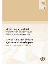
Suivi de l’utilisation de l’eau agricole au niveau des pays

Journal Articles & Books
december, 2010
Ethiopia
Italy
Benin
Madagascar
Sri Lanka

As water becomes scarcer in many countries, governments increasingly have to deal with the considerable challenges of water management. Sound information on water vailability and use is key to shaping water policies that aim to provide equitable and sustainable use of increasingly scarce water resources. Accurate information on agricultural water withdrawal is particularly important to planners and decision-makers involved in water management, as agriculture represents the largest water us er in many countries, representing about 70 percent of total withdrawal worldwide.

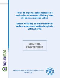
Taller de expertos sobre métodos de evaluación de recursos hídricos y usos del agua en América Latina -

Journal Articles & Books
december, 2010
Chile
Peru
Uruguay
Ecuador
Colombia
Brazil
Bolivia
Italy
Mexico
Panama

Information on water use is required for political, economic and academic decision making on issues affecting everyone?s life. Owing to fi nancial constraints, it is diffi cult to have complete and comprehensive information on everything related to water. Techniques and methodologies are, therefore, used to affordably maximize control. To improve understanding of the different techniques and methodologies used to generate information, the AQUASTAT team sent thematic questionnaires to approximately 170 countries in April 2009.