Overslaan en naar de inhoud gaan

page search

Displaying 25 - 36 of 342

Integrating local knowledge and remote sensing for eco-type classification map in the Barotse Floodplain, Zambia

Journal Articles & Books
december, 2018
Zambia
Southern Africa

This eco-type map presents land units with distinct vegetation and exposure to floods (or droughts) in three villages in the Barotseland, Zambia. The knowledge and eco-types descriptions were collected from participatory mapping and focus group discussions with 77 participants from Mapungu, Lealui, and Nalitoya. We used two Landsat 8 Enhanced Thematic Mapper (TM) images taken in March 24th and July 14th, 2014 (path 175, row 71) to calculate water level and vegetation type which are the two main criteria used by Lozi People for differentiating eco-types.

Improving the accuracy of remotely sensed irrigated areas using post-classification enhancement through UAV [Unmanned Aerial Vehicle] capability

Journal Articles & Books
december, 2018
South Africa

Although advances in remote sensing have enhanced mapping and monitoring of irrigated areas, producing accurate cropping information through satellite image classification remains elusive due to the complexity of landscapes, changes in reflectance of different land-covers, the remote sensing data selected, and image processing methods used, among others. This study extracted agricultural fields in the former homelands of Venda and Gazankulu in Limpopo Province, South Africa.

Trend Analysis of Las Vegas Land Cover and Temperature Using Remote Sensing

Peer-reviewed publication
december, 2018
Global

The Las Vegas urban area expanded rapidly during the last two decades. In order to understand the impacts on the environment, it is imperative that the rate and type of urban expansion is determined. Remote sensing is an efficient and effective way to study spatial change in urban areas and Spectral Mixture Analysis (SMA) is a valuable technique to retrieve subpixel landcover information from remote sensing images.

Analyses of land cover change trajectories leading to tropical forest loss : Illustrated for the West Kutai and MahakamUlu Districts, East Kalimantan, Indonesia

Journal Articles & Books
december, 2018
Indonesia

In Indonesia, land cover change for agriculture and mining is threatening tropical forests, biodiversity and ecosystem services. However, land cover change is highly dynamic and complex and varies over time and space. In this study, we combined Landsat-based land cover (change) mapping, pixel-to-pixel cross tabulations and expert knowledge to analyze land cover change and forest loss in the West Kutai and Mahakam Ulu districts in East Kalimantan from 1990-2009.

Identifying hotspots in land use land cover change and the drivers in a semi-arid region of India

Journal Articles & Books
december, 2018
India

The study examines long-term land use/land cover change (LUCC) at a finer scale in a semi-arid region of India. The objectives were to study and quantify the spatiotemporal LUCC and uncover the major drivers causing the change in the Mula Pravara river basin, which is located in a semi-arid region of Maharashtra state, India.

Analyses of Land Cover Change Trajectories Leading to Tropical Forest Loss: Illustrated for the West Kutai and Mahakam Ulu Districts, East Kalimantan, Indonesia

Peer-reviewed publication
september, 2018
Indonesia

In Indonesia, land cover change for agriculture and mining is threatening tropical forests, biodiversity and ecosystem services. However, land cover change is highly dynamic and complex and varies over time and space. In this study, we combined Landsat-based land cover (change) mapping, pixel-to-pixel cross tabulations and expert knowledge to analyze land cover change and forest loss in the West Kutai and Mahakam Ulu districts in East Kalimantan from 1990–2009.

Analyses of Land Cover Change Trajectories Leading to Tropical Forest Loss: Illustrated for the West Kutai and Mahakam Ulu Districts, East Kalimantan, Indonesia

Journal Articles & Books
september, 2018
Indonesia

In Indonesia, land cover change for agriculture and mining is threatening tropical forests, biodiversity and ecosystem services. However, land cover change is highly dynamic and complex and varies over time and space. In this study, we combined Landsat-based land cover (change) mapping, pixel-to-pixel cross tabulations and expert knowledge to analyze land cover change and forest loss in the West Kutai and Mahakam Ulu districts in East Kalimantan from 1990-2009.

South Sudan Land cover mapping

Institutional & promotional materials
augustus, 2018
Kenya
South Sudan
Sudan
Ethiopia
Uganda

The new land cover dataset will allow mapping of natural resources, human settlements and human activities in South Sudan and within neighboring countries. It will represent the most innovative and updated dataset developed for South Sudan, integrating high-resolution multi-temporal imagery, object-based image analysis

and machine-learning algorithms and LCML to support the Natural Resource Management strategy and land use planning.

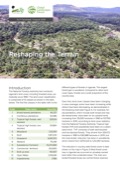
Reshaping the terrain: Forest landscape restoration in Uganda

Reports & Research
juli, 2018
Uganda

The National Forestry Authority has monitored Uganda’s land cover, including forested areas, periodically since 1990. The land cover classification is comprised of 13 classes as shown in the table below. The first five classes in the table refer to the different types of forests in Uganda. The largest forest type is woodland. Compared to other landcover types, forests are a small proportion of the country area.

Time-series cloud noise mapping and reduction algorithm for improved vegetation and drought monitoring

Journal Articles & Books
december, 2017
Sri Lanka

Moderate Resolution Imaging Spectro-radiometer (MODIS) time-series Normalized Differential Vegetation Index (NDVI) products are regularly used for vegetation monitoring missions and climate change analysis. However, satellite observation is affected by the atmospheric condition, cloud state and shadows introducing noise in the data. MODIS state flag helps in understanding pixel quality but overestimates the noise and hence its usability requires further scrutiny. This study has analyzed MODIS MOD09A1 annual data set over Sri Lanka.