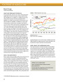
Cropping intensity
LandLibrary Resource
Peer-reviewed publication
december, 2014
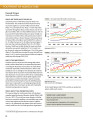
Eastern Africa
Western Africa
Southern Africa
Sub-Saharan Africa
Africa