Перейти к основному содержанию

page search

Displaying 121 - 132 of 187

Classification of hazelnut cultuvation areas for agricultural suitability in the eastern Black sea region, case study; Unye-Tekkiraz district

Policy Papers & Briefs
декабря, 2009
Turkey

The aim of this research was to determine physical land evaluation of hazelnut areas of Ordu-Unye and its vicinity. The study area, is located between west of Ordu and south of Samsun provinces, at coordinates 4542500-4537500 km N and 342500-347500 km E (UTM), covers approximately 31.5 km2. The study area consists of various topographic features such as, hilly and rolling physiographic units commonly. Elevation varies from 200 m to 600 m above sea level. Average annual precipitation and temperature are 1162.4 mm and 14.2ºC, respectively.

GIS-integrated fuzzy rule-based inference system for land suitability evaluation in agricultural watersheds

Journal Articles & Books
декабря, 2009
India

Land suitability evaluation in water scarce agricultural watersheds consists of assessment of land potential for various crops as well as surface water potential to identify the scope for supplementary irrigation. A large amount of information related to the crop land suitability can be conveyed through linguistic terms. Capability of fuzzy sets in modeling involving uncertainty and vagueness is made use of in fuzzy rule-based systems, where various decision making criteria in linguistic terms are expressed as fuzzy rules.

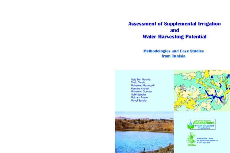
Assessment of Supplemental Irrigation and Water Harvesting Potential: Methodologies and Case Studies from Tunisia

Reports & Research
ноября, 2009
Tunisia
Northern Africa

An innovative, low-cost methodology was developed to assess the potential of sites in Tunisia for supplemental irrigation and water harvesting. The methodology, which uses commonly available technologies and information such as remote sensing and a Digital Elevation Model (DEM), was developed and tested using newly constructed hill reservoirs (used to capture surface runoff) and traditional water harvesting systems.

KENYA LAND POLICY: ANALYSIS AND RECOMMENDATIONS

Journal Articles & Books
мая, 2009
Kenya

This analysis and recommendations stem from USAID/Kenya’s request for an assessment of Kenya’s draft National Land Policy (dNLP).4 It was conducted under the global task order: Property Rights and Resource Governance Program, a mechanism designed and supervised by USAID-EGAT’s Land Resources Management Team under the Office of Natural Resources Management.

[Soil fertility at the Yaritagua experimental station and its use to guide fertilizers recommendations for sugarcane]

Journal Articles & Books
апреля, 2009

Documento digital estructurado con una 'Introducción'; en donde se expone el contexto geográfico de donde se halla localizada la Estación Local Yaritagua: ELY, en el estado Yaracuy, destacándose que por años ha estado dedicada a llevar a cabo investigaciones en caña de azúcar. Bajo el encabezamiento de: 'Área bajo estudio';, se presenta una descripción de los suelos predominantes en el Campo Experimental de esa estación, particularmente los de la serie Uribeque perteneciente al orden Alfisoles.

Fuzzy-logic modeling of land suitability for hybrid poplar across the Prairie Provinces of Canada

Journal Articles & Books
декабря, 2008
Canada

Determining the feasibility of a large-scale afforestation program is one approach being investigated by the Government of Canada to increase Canada's potential to sequester carbon from the atmosphere. Large-scale afforestation, however, requires knowledge of where it is suitable to establish and grow trees. Spatial models based on Boolean logic and/or statistical models within a geographic information system may be used for this purpose, but empirical environmental data are often lacking, and the association of these data to land suitability is most often a subjective process.

Comparison between land suitability and actual crop distribution in an irrigation district of the Ebro valley (Spain)

Policy Papers & Briefs
декабря, 2008
Spain

The present research aims to obtain a better insight into the agreement between land evaluation results and actual crop spatial distribution by comparing biophysical land suitability with different crop frequency parameters and with crop rotations derived from multi-year crop maps. The research was carried out in the Flumen district (33,000 ha), which is located in the Ebro Valley (Northeast Spain). Land evaluation was based on a 1:100,000 soil survey according to the FAO framework for the main crops in the study area (alfalfa, winter cereals, maize, rice and sunflower).

Determination and mapping of land suitability classes for agricultural utilization in Ankara Imrahor Valley and its vicinity

Policy Papers & Briefs
декабря, 2008
Turkey

That was to perform a determination of land suitability classes for agricultural land uses in Ankara Imrahor valley and vicinity with this study. First of all detailed survey and mapping of research area was performed with aid of satellite data and topographic maps then four different soil serials and their fourteen different mapping units were described. For this units, 38 different land uses were describe as their soil and meterological properties and calculated their suitability for this region and determined and mapping their land suitability classes for agricultural purposes.

Determination the asppropriateness of Tokat Kazova lands to peach cultivation using geographic information system

Policy Papers & Briefs
декабря, 2008
Turkey

The aims of this study are to determine the appropriate peach orchard locations among Tokat Kazova lands and to classify the lands according to the suitability for peach cultivation by means of Geographic Information System (GIS). The distances and elevation differences of possible orchard locations to/from the available water resources, soil profile depth, soil profile texture, frost risk, land aspect, and land slope were considered as criterions to classify the lands of Tokat Kazova to determine appropriate lands for peach cultivation under Tokat Kazova conditions.

Comparison between land suitability and actual crop distribution in an irrigation district of the Ebro valley (Spain)

ноября, 2008
Spain

El objetivo de la presente investigación fue analizar la correspondencia entre los resultados de una evaluación de tierras con la distribución real de los cultivos. Para ello la aptitud biofísica de las tierras se comparó con diferentes tipologías de frecuencia de ocurrencia de los cultivos y rotaciones derivadas de mapas de cultivos multitemporales. La investigación fue llevada a cabo en el distrito de riego de Flumen (33.000 ha), localizado en el valle del Ebro (NE España).

A study on determination of agricultural use suitability of agricultural lands

Policy Papers & Briefs
декабря, 2007
Turkey

In this study, by using cellular analyze method according to ecological criteria, the determination of agricultural land suitability of Research and Practice Farm of Ankara University Agrucultural Faculty Farm and Haymana Research Farm of Central Research Institute for Field Crops lands, which are in Ankara province and Haymana district, was aimed. For this aim, by using Geographical Information Systems(GIS) techniques, the data layers such as some soil properties, topography and irrigation was examined for each land criterion to determine the weighted scale.