Overslaan en naar de inhoud gaan

page search

Displaying 397 - 408 of 925

Strategic Environmental Assessment of the Kenya Forests Act 2005

maart, 2013

Forest in Kenya is an important source
of livelihood, environmental services, and economic growth.
In November of 2005 the Government of Kenya (GOK) ratified a
new Forests Act. The act contains many innovative provisions
to correct previous shortcomings, including a strong
emphasis on partnerships, the engagement of local
communities, and promotion of private investment. The
purpose of the Strategic Environmental Assessment (SEA) is

Uganda : Country Environmental Analysis

februari, 2013

A Country Environmental Analysis (CEA)
is a World Bank analytical tool used to integrate
environmental issues into development assistance strategies,
programs, and projects. To that end, the CEA synthesizes
environmental issues, highlights the environmental and
economic implications of development policies, and evaluates
the country's environmental management capacity. It is
composed of three analytical building blocks: the

Vyāghranomics in Space and Time : Estimating Habitat Threats for Bengal, Indochinese, Malayan and Sumatran Tigers

januari, 2013

As the wild tiger population in tropical
Asia dropped from about 100,000 to 3,500 in the last
century, the need to conserve tiger habitats poses a
challenge for the Global Tiger Recovery Program. This paper
develops and uses a high-resolution monthly forest clearing
database for 74 tiger habitat areas in ten countries to
investigate habitat threats for Bengal, Indochinese, Malayan
and Sumatran tigers. The econometric model links forest

Ecosystem Services and Green Growth

januari, 2013

"Ecosystem services" has
become a catch-phrase for the complex connections between
the natural environment and human well-being. This paper
considers the impact of changes in the supply of ecosystem
services, and programs to increase their supply, on
near-term growth of gross domestic product. It focuses on
the relationship between locally generated versus
transboundary services and growth in developing countries,

Payment for ecosystem services, sustained behavioural change, and adaptive management: peasant perspectives in the Colombian Andes

Journal Articles & Books
december, 2012
Colombia
Central America
South America

Payment for ecosystem services (PES) has been widely promoted as an effective and efficient model for conservation; however, few studies have empirically examined how the market-based approach interacts with farmer's decision-making processes and their abilities to sustain new conservation practices. This paper examines the sustainability of a PES silvopastoral programme in Colombia from peasant farmers’ perspectives.

Influence of carbon mapping and land change modelling on the prediction of carbon emissions from deforestation

Journal Articles & Books
december, 2012

The implementation of an international programme for reducing carbon emissions from deforestation and degradation (REDD) can help to mitigate climate change and bring numerous benefits to environmental conservation. Information on land change modelling and carbon mapping can contribute to quantify future carbon emissions from deforestation. However limitations in data availability and technical capabilities may constitute an obstacle for countries interested in participating in the REDD programme.

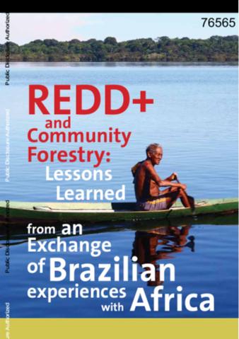
REDD+ and Community Forestry

Reports & Research
Policy Papers & Briefs
december, 2012
Brazil
Africa
Latin America and the Caribbean

This publication is the result of an initiative to promote an exchange between Brazil and African countries on lessons learned about the role of community forestry as a strategic option to achieve the goals of Reducing Emissions from Deforestation and Forest Degradation (REDD+). The initiative was supported by the World Bank with funding from the Global Environment Facility (GEF), and coordinated by the Amazonas Sustainable Foundation (FAS) with support from the National Forestry Agency International (ONFI).

Landuse planning for conservation of forest resources in Phitsanulok province 2560 b.e.

Conference Papers & Reports
december, 2012
Thailand

Objective of study were to simulate size area of land use change in Phitsanulok province from 2552 to 2560 B.E., and decided agriculture area and forest area, and to be use as a guideline map for formulating the land use and forest conservation, In Phitsanulok province. Geographic Information System couples with CLUE-S model by Logistic Regression and Markov chain model were used to predict of future land use in Phitsanulok province.

Monitoring the Voluntary Guidelines on the Responsible Governance of Tenure of Land, Fisheries and Forests in the Context of National Food Security: A Civil Society Perspective

Reports & Research
november, 2012
Uganda
Cameroon
Democratic Republic of the Congo
South Africa
Ghana
Liberia
Guatemala
Bolivia
Brazil
Colombia
Ecuador
Peru
Cambodia
Indonesia
Philippines
Bangladesh
India
Nepal
Pakistan
Belgium
France

This study is intended to contribute to the effective implementation of the Voluntary Guidelines by exploring ways of monitoring the governance of tenure of land, fisheries and forests and providing a civil society perspective on monitoring in the context of the Guidelines. It provides an overview of existing and commonly used monitoring systems and practices in relation with tenure of land, fisheries and forests by civil society organisations and institutions. In order to do so, it will propose a schematic categorization of monitoring in the context of land, fisheries and forests.

Preparing for Myamar's Environment-Friendly Reform

Policy Papers & Briefs
november, 2012
Myanmar

... Myanmar is a predominantly agricultural country in Mekong River Basin, also known as Burma, the second largest country in mainland South-East Asia, known as the ‘‘Asia’s Barn’’ in the past years, once the world’s largest exporter of rice. Myanmar is a resource-rich country that has abundant arable land, timber, mineral resources, natural gas and oil, which made it one of the best developing countries in South-East Asia until the early 1960s. Myanmar’s total area is 676 578 km2.