Overslaan en naar de inhoud gaan

page search

Displaying 6313 - 6324 of 17904

Land Use Changes in Iberian Peninsula 1990–2012

Peer-reviewed publication
september, 2018
Portugal
Spain

This work aims to provide a comprehensive, wall-to-wall analysis of land use/cover changes in the continental areas of Portugal and Spain between 1990 and 2012. This overall objective is developed into two main research questions: (1) Whether differences between the extent and prevalence of changes exist between both countries and (2) which are the hotspots of change (areas where a given land use/cover transition dominates the landscape) in each country.

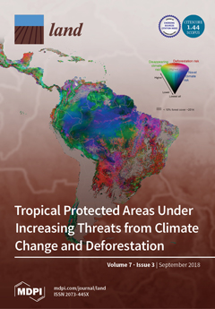
Tropical Protected Areas Under Increasing Threats from Climate Change and Deforestation

Peer-reviewed publication
september, 2018
Africa
Global
Asia
South America

Identifying protected areas most susceptible to climate change and deforestation represents critical information for determining conservation investments. Development of effective landscape interventions is required to ensure the preservation and protection of these areas essential to ecosystem service provision, provide high biodiversity value, and serve a critical habitat connectivity role.

Fairness and Transparency Are Required for the Inclusion of Privately Protected Areas in Publicly Accessible Conservation Databases

Peer-reviewed publication
september, 2018
South Africa
Australia
United States of America
Southern Africa

There is a growing recognition of the contribution that privately-owned land makes to conservation efforts, and governments are increasingly counting privately protected areas (PPAs) towards their international conservation commitments. The public availability of spatial data on countries’ conservation estates is important for broad-scale conservation planning and monitoring and for evaluating progress towards targets.

Criteria to Confirm Models that Simulate Deforestation and Carbon Disturbance

Peer-reviewed publication
september, 2018
Bolivia

The Verified Carbon Standard (VCS) recommends the Figure of Merit (FOM) as a possible metric to confirm models that simulate deforestation baselines for Reducing Emissions from Deforestation and forest Degradation (REDD). The FOM ranges from 0% to 100%, where larger FOMs indicate more-accurate simulations. VCS requires that simulation models achieve a FOM greater than or equal to the percentage deforestation during the calibration period.

The Usage and Perception of Pedestrian and Cycling Streets on Residents’ Well-being in Kalamaria, Greece

Peer-reviewed publication
september, 2018
Greece

Pedestrian zones are public spaces intended for the continued and safe mobility of pedestrians and people with disabilities, and they provide multiple benefits to urban areas. They counterbalance the densely built-up areas, decrease atmospheric pollution, increase available green or social space, increase walking and cycling rates, and facilitate active play for children. Done properly, pedestrianization may also increase local business sales. Greece boasts open public spaces and the pedestrianization of common roads.

A Differentiated Spatial Assessment of Urban Ecosystem Services Based on Land Use Data in Halle, Germany

Peer-reviewed publication
september, 2018
Germany

Urban ecosystem services (ES) contribute to the compensation of negative effects caused by cities by means of, for example, reducing air pollution and providing cooling effects during the summer time. In this study, an approach is described that combines the regional biotope and land use data set, hemeroby and the accessibility of open space in order to assess the provision of urban ES. Hemeroby expresses the degree of naturalness of land use types and, therefore, provides a differentiated assessment of urban ES.

Analyses of Land Cover Change Trajectories Leading to Tropical Forest Loss: Illustrated for the West Kutai and Mahakam Ulu Districts, East Kalimantan, Indonesia

Peer-reviewed publication
september, 2018
Indonesia

In Indonesia, land cover change for agriculture and mining is threatening tropical forests, biodiversity and ecosystem services. However, land cover change is highly dynamic and complex and varies over time and space. In this study, we combined Landsat-based land cover (change) mapping, pixel-to-pixel cross tabulations and expert knowledge to analyze land cover change and forest loss in the West Kutai and Mahakam Ulu districts in East Kalimantan from 1990–2009.

The Role of Tourism in the Ecosystem Services Framework

Peer-reviewed publication
september, 2018
Global

The Ecosystem Services Framework (ESF) is a powerful tool for understanding the relationship between nature and society, and tourism is an important expression of this. However, the scientific literature focusing on the relationship between tourism and the ESF is limited. Hence, there is a need to bring the tourism research community and the ESF together, not only as a cultural service but as an economic sector that consumes natural resources. This paper aims to do this by analyzing discourse on tourism in institutional reports produced by the ESF.

Livelihoods on the Edge without a Safety Net: The Case of Smallholder Crop Farming in North-Central Namibia

Peer-reviewed publication
september, 2018
Namibia

Semi-arid Namibia is marginal for agricultural production. Low soil fertility combined with low and variable rainfall restrict the livelihoods of smallholder farmers who often struggle to produce enough food. Although historically, communities have adopted a number of coping mechanisms, climate change threatens to further reduce agricultural production. There are many additional options available to smallholder farmers to adapt to climate change, but they are not necessarily adopting these measures despite having noticed increasing temperatures and declining rainfall.

Analyses of Land Cover Change Trajectories Leading to Tropical Forest Loss: Illustrated for the West Kutai and Mahakam Ulu Districts, East Kalimantan, Indonesia

Journal Articles & Books
september, 2018
Indonesia

In Indonesia, land cover change for agriculture and mining is threatening tropical forests, biodiversity and ecosystem services. However, land cover change is highly dynamic and complex and varies over time and space. In this study, we combined Landsat-based land cover (change) mapping, pixel-to-pixel cross tabulations and expert knowledge to analyze land cover change and forest loss in the West Kutai and Mahakam Ulu districts in East Kalimantan from 1990-2009.

Meeting global land restoration and protection targets: What would the world look like in 2050?

Journal Articles & Books
september, 2018

Land restoration has received increased attention recently as a tool to counteract negative externalities of unsustainable land management on human well-being. This is reflected in targets of the Sustainable Development Goals (SDGs), the Convention on Biological Diversity (CBD), the United Nations Framework of the Convention on Climate Change (UNFCCC) and the United Nations Convention to Combat Desertification (UNCCD). However, the implications of these targets for land use, especially considering their potential conflict with growing food production demands, are largely unexplored.