Location
The International Center for Agricultural Research in the Dry Areas (ICARDA) was established in 1977. It is one of 15 such centers supported by the CGIAR. ICARDA’s founding mandate to promote agricultural development in the dry areas of developing countries remains highly relevant today.
ICARDA works with a tight focus on the problem-solving needs of resource-poor farmers, achieving this through the in-field delivery of its research outputs. Although global food production has increased by 20 per cent in the past decade, food insecurity and poverty remain widespread, while the natural resource base continues to decline.
International research centers such as ICARDA, which have helped drive previous improvements, continue to deliver new technologies to support sustainable growth in agriculture, and crucially, to work with a wide range of partners to accelerate the dissemination of these technologies.
ICARDA’s biggest strength is its staff – 600 highly skilled men and women from 32 countries. Our research and training activities cover crop improvement, water and land management, integrated crop-livestock-rangeland management, and climate change adaptation.
Other interventions include:
- Water harvesting - supplemental irrigation and water-saving irrigation techniques
- Conservation agriculture methods to reduce production costs and improve sustainability
- Diversification of production systems to high-value crops – horticulture, herbal and medicinal plants
- Integrated crop/rangeland/livestock production systems including non-traditional sources of livestock feed
- Empowerment of rural women – support and training for value-added products.
The ICARDA genebank holds over 135,000 accessions from over 110 countries: traditional varieties, improved germplasm, and a unique set of wild crop relatives. These include wheat, barley, oats and other cereals; food legumes such as faba bean, chickpea, lentil and field pea; forage crops, rangeland plants, and wild relatives of each of these species.
ICARDA’s research portfolio is part of a long-term strategic plan covering 2007 to 2016, focused on improving productivity, incomes and livelihoods among resource-poor households.
The strategy combines continuity with change – addressing current problems while expanding the focus to emerging challenges such as climate change and desertification.
We work closely with national agricultural research systems and government ministries. Over the years the Center has built a network of strong partnerships with national, regional and international institutions, universities, non-governmental organizations and ministries in the developing world and in industrialized countries with advanced research institutes.
THE ‘DRY AREAS’
Research and training activities cover the non-tropical dry areas globally, using West Asia, North Africa, Central Asia and the Caucasus as research platforms to develop, test, and scale-out new innovations and policy options.
Dry areas cover 41 per cent of the world’s land area and are home to one-third of the global population. About 16 per cent of this population lives in chronic poverty, particularly in marginal rainfed areas. The dry areas are challenged by rapid population growth, frequent droughts, high climatic variability, land degradation and desertification, and widespread poverty. The complex of relationships between these challenges has created a "Poverty Trap."
Members:
Resources
Displaying 261 - 265 of 431Object-based agricultural land use map of Khorezm
In recent decades, multi-spectral and hyper-spectral remotely sensed imageries with high and modern spatial resolutions at sufficient time-series interval have been developed. This allows for detecting crop types and its distribution over large areas and at short time intervals. Among the advantages of remote sensing technologies are its cost effective evaluation over extensive areas and the ability to provide reliable information on land surface conditions. This is useful also for areas with sporadic information on the spatial extent of croplands effected by for instance water scarcity.
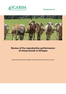
Review of the reproductive performances of sheep breeds in Ethiopia: Documenting existing knowledge and identifying priority research needs
Mapping Flooded Rice Paddies Using Time Series of MODIS Imagery in the Krishna River Basin, India
Rice is one of the major crops cultivated predominantly in flooded paddies, thus
a large amount of water is consumed during its growing season. Accurate paddy rice maps
are therefore important inputs for improved estimates of actual evapotranspiration in the
agricultural landscape. The main objective of this study was to obtain flooded paddy rice
maps using multi-temporal images of Moderate Resolution Imaging Spectroradiometer
(MODIS) in the Krishna River Basin, India. First, ground-based spectral samples collected
Introduction of Cactus (Opuntia ficus-indica) as a multi-purpose crop under intensive production system
In Pakistan, rangelands are the major source of feed for about 167.5 million heads of livestock. At present rangelands are being grazed by all kinds of livestock. About 40 percent of feed requirements for horses, donkeys and camels, 60 percent of the goats and sheep are met from rangelands whereas only 5-10 percent of the population of cattle and buffaloes graze in the rangelands despite they are heavily overgrazed, and has reduced the carrying capacity by 30 to 50 percent of their potential.
Effects of land use changes and soil conservation intervention on soil properties as indicators for land degradation under a Mediterranean climate
Land degradation resulting from improper land use and management is a major cause of declined productivity
in the arid environment. The objectives of this study were to examine the effects of a sequence of land use changes,
soil conservation measures, and the time since their implementation on the degradation of selected soil properties.
The climate for the selected 105 km2 watershed varies from semi-arid sub-tropical to Mediterranean sub-humid. Land


