Sistemas de explotación
AGROVOC URI:
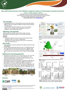
Modeling and scenarios of ecosystem services in the Volta Basin: Tradeoffs and plausible interventions to enhance resilience
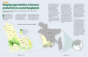
Mapping Opportunities to Increase Productivity in Coastal Bangladesh
The Ganges Basin Development Challenge (GBDC) Program of the CGIAR Challenge Program for Water and Food is focusing on improving livelihoods and increasing productivity sustainably in the coastal polder zone, and has developed and tested innovative cropping systems and water management practices suited to the local conditions.Before a new cropping system can be recommended, it is important to identify its “extrapolation domain,” which determines where it could be successful.
Managing water and land resources for sustainable livelihoods at the interface between fresh and saline water environments in Vietnam and Bangladesh
Managing water: Water resource management options for smallholder farming systems in sub-Saharan Africa
Mapping adaptive capacity and smallholder agriculture: applying expert knowledge at the landscape scale
The impacts of climate change exacerbate the myriad challenges faced by smallholder farmers in the Tropics. In many of these same regions, there is a lack of current, consistent, and spatially-explicit data, which severely limits the ability to locate smallholder communities, map their adaptive capacity, and target adaptation measures to these communities.
Livestock development in the peasant sector of highland Ethiopia: Some policy issues and implications
Generally discusses policy and institutional issues related to the topic in post-revolution Ethiopia. The first part of the paper summarizes the physical resource base and the farming systems of the central highlands. Part two highlights the performance of the livestock sector and provides a very brief picture of the institutions involved in livestock development in these institutions with particular reference to the dairy sector. The third part surveys livestock investments made available by government, non-government organizations and formal credit institutions.
Legume-based cropping. A possible remedy to land tenure constraint to ruminant production in the subhumid zone of central Nigeria
Length of Growing Period over Africa: Variability and Trends from 30 Years of NDVI Time Series
The spatial distribution of crops and farming systems in Africa is determined by the duration of the period during which crop and livestock water requirements are met. The length of growing period (LGP) is normally assessed from weather station data—scarce in large parts of Africa—or coarse-resolution rainfall estimates derived from weather satellites. In this study, we analyzed LGP and its variability based on the 1981–2011 GIMMS NDVI3g dataset. We applied a variable threshold method in combination with a searching algorithm to determine start- and end-of-season.

