Pasar al contenido principal

page search

Displaying 2005 - 2016 of 2218

Mongolia

Reports & Research
Training Resources & Tools
Policy Papers & Briefs
Agosto, 2010
Mongolia
Asia oriental
Oceanía

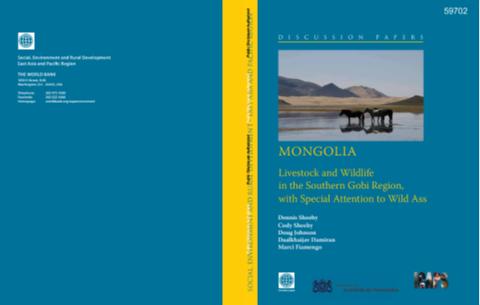
The purpose of this report is to examine development trends in the Southern Gobi Region (SGR) as they affect livestock and wildlife. It provides an overview of the environment and natural resources of the region, discusses existing relationships and interactions among humans, livestock, large herbivore wildlife, and the natural resources on which they are dependent. It then explores the impact that economic development of the region is likely to have if that development does not consider the needs of the current users.

An svm multiclassifier approach to land cover mapping

Reports & Research
Julio, 2010
United States of America

From the advent of the application of satellite imagery to land cover mapping, one of the growing areas of research interest has been in the area of image classification. Image classifiers are algorithms used to extract land cover information from satellite imagery. Most of the initial research has focussed on the development and application of algorithms to better existing and emerging classifiers. In this paper, a paradigm shift is proposed whereby a committee of classifiers is used to determine the final classification output.

Water and Climate Change

Reports & Research
Policy Papers & Briefs
Junio, 2010

Adaptation to climate impacts on groundwater resources in developed and developing countries has not received adequate attention. This reflects the often poorly understood impacts of climate change, the hidden nature of groundwater and the general neglect of groundwater management. Many developing countries are highly reliant on groundwater. Given expectations of reduced supply in many regions and growing demand, pressure on groundwater resources is set to escalate. This is a crucial problem and demands urgent action.

Land in the Proposed Constitution of Kenya: What does it mean?

Reports & Research
Mayo, 2010
Kenya
África

Covers what is ‘land’ and what ‘property’ in the proposed Constitution?; where is land covered; common questions…with some answers; what does the proposed Constitution actually say and not say about land?; so what is the verdict? Concludes that it opens the door to significant reforms and failure to perform could be a matter of challenge in the courts. Ordinary Kenyans will need to hold the State to account in devising appropriate legislation and programmes swiftly and with the maximum of public participation.

Valuing the role of living aquatic resources to rural livelihoods in multiple-use, seasonally-inundated wetlands in the Yellow River Basin of China, for improved governance

Reports & Research
Abril, 2010
China
Asia

Supported by the CPWF, this two-year project titled “Valuing the role of living aquatic

resources to rural livelihoods in multiple-use, seasonally-inundated wetlands in the

Yellow River Basin of China, for improved governance” focused on linking the use of

wetlands resources by local communities and value of wetlands ecosystem services with

management implications for the riverine and coastal wetlands in Henan and Shandong

provinces. A study on this Chinese situation of pursuing a rapid development agenda

Wetlands-based livelihoods in the Limpopo basin: Balancing social welfare and environmental security

Reports & Research
Marzo, 2010
Sudáfrica
África austral

This report is a synthesis of research implemented for the project on Wetlands-based livelihoods in the Limpopo basin: balancing social welfare and environmental security. The research was motivated by the dependency of many people on wetlands for their livelihoods. It was therefore founded on the basis that the potential of wetlands to contribute to livelihoods is closely related to their ability to maintain ecosytem functions (such as regulating river flows), which is a consequence of their unique hydrological characteristics.

Mongolia

Reports & Research
Training Resources & Tools
Enero, 2010
Mongolia
Asia oriental
Oceanía

The primary objective of the Southern Gobi Regional Environmental Assessment (REA) is to provide guidance for sustainable management of environmental resources in the future development of the Southern Gobi Region (SGR), development that will be led by rapid expansion of mining.

The impact of urbanization on the monthly averaged diurnal cycle in October 2004 in the Pearl River Delta region

Journal Articles & Books
Diciembre, 2009
Estados Unidos de América
China

The Pearl River Delta (PRD) region in southern China has experienced rapid urbanization and dramatic economic growth in last 25 years. Using identical observed meteorology for lateral boundary conditions, two one-month simulations were conducted: one using the original United States Geological Survey (USGS) 24-category land cover data (namely NU) and the other using the urban land cover data from 2004 Moderate Resolution Imaging Spectroradiometer (MODIS) satellite images (namely HU) as lower boundary conditions in a mesoscale model.

Landscape Planning for Agricultural Nonpoint Source Pollution Reduction III: Assessing Phosphorus and Sediment Reduction Potential

Journal Articles & Books
Diciembre, 2009

Riparian buffers have the potential to improve stream water quality in agricultural landscapes. This potential may vary in response to landscape characteristics such as soils, topography, land use, and human activities, including legacies of historical land management. We built a predictive model to estimate the sediment and phosphorus load reduction that should be achievable following the implementation of riparian buffers; then we estimated load reduction potential for a set of 1598 watersheds (average 54 km²) in Wisconsin.

classificatory approach integrating fuzzy set theory and permutation techniques for land cover analysis: a case study on a degrading area of the Rift Valley (Ethiopia)

Journal Articles & Books
Diciembre, 2009
Etiopía

We suggest a classificatory approach for land cover analysis that integrates fuzzy set theory with permutation techniques. It represents a non parametric alternative and/or a complement of traditional multivariate statistics when data are scarce, missing, burdened with high degree of uncertainty and originated from different sources and/or times. According to this approach, the Operational Geographic Units (OGUs) in which landscape is subdivided and sampled are classified with hierarchical clustering methods.

Future of Tropical Species on a Warmer Planet

Journal Articles & Books
Diciembre, 2009
África occidental

Modern global temperature and land cover and projected future temperatures suggest that tropical forest species will be particularly sensitive to global warming. Given a moderate greenhouse gas emissions scenario, fully 75% of the tropical forests present in 2000 will experience mean annual temperatures in 2100 that are greater than the highest mean annual temperature that supports closed-canopy forest today. Temperature-sensitive species might extend their ranges to cool refuges, defined here as areas where temperatures projected for 2100 match 1960s temperatures in the modern range.

Risk assessment of water soil erosion in upper basin of Miyun Reservoir, Beijing, China

Journal Articles & Books
Diciembre, 2009
China

This research selected water soil erosion indicators (land cover, vegetation cover, slope) to assess the risk of soil erosion, ARCMAP GIS ver.9.0 environments and ERDAS ver.9.0 were used to manage and process satellite images and thematic tabular data. Landsat TM images in 2003 were used to produce land/cover maps of the study area based on visual interpreting method and derived vegetation cover maps, and the relief map at the scale of 1:50,000 to calculate the slope gradient maps.