Pasar al contenido principal

page search

Displaying 3769 - 3780 of 17898

Expériences du quota et de l'accès collectif dans le delta de la vallée du fleuve Sénégal

Reports & Research
Febrero, 2021
Sénégal

Le phénomène d’ATGE gagne l’ensemble du Sénégal, privant les communautés de leurs droits fonciers, des principaux moyens d’existance. L’IPAR, en partenariat avec le CNCR et aGter, a bénéficié d’un appui financier du CRDI pour exécuter ce projet de recherche- action participative et collaborative.

Ce projet évalue des initiatives mises en œuvre et analyse du contexte global de trois communes, situées dans trois zones agro-écologiques : bassin arachidier, Niayes et vallée du fleuve Sénégal, afin de :


Analyse des dynamiques de deux régimes fonciers distincts Cas de la ville de Touba et Ziguinchor (Sénégal)

Peer-reviewed publication
Febrero, 2021
Sénégal

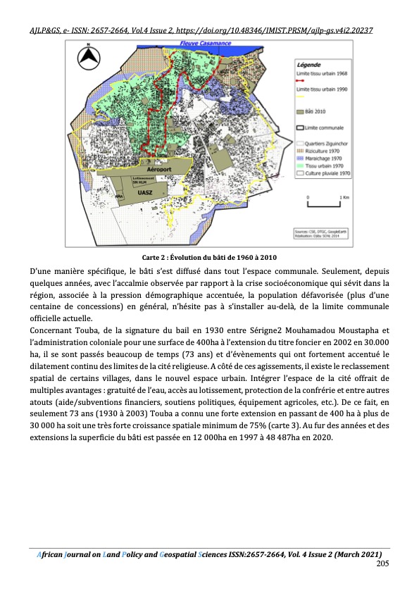
L’originalité de la structure urbaine de Touba réside tout d’abord sur sa gestion dirigée par le Khalif général et son statut particulier d’un titre foncier qui s’adosse sur une forte démographie incontrôlée conjuguée à un fort étalement mal maitrisé. La politique d'urbanisme de Touba semble se résumer à la création de parcelles d'habitation et au libre choix laissé au khalife pour les sites d'implantation d'équipements ou d'infrastructures, et la destination des réserves.

Faire la paix avec la nature

Reports & Research
Febrero, 2021
Afrique
Amériques
Asie
Europe
Océanie

La synthèse qui en résulte indique la manière dont le changement climatique, la perte de biodiversité et la pollution peuvent être abordés conjointement dans le cadre des objectifs de développement durable. Le rapport a pour but de traduire l'état actuel des connaissances scientifiques en messages factuels clairs et digestes auxquels le monde peut se référer et comprendre.

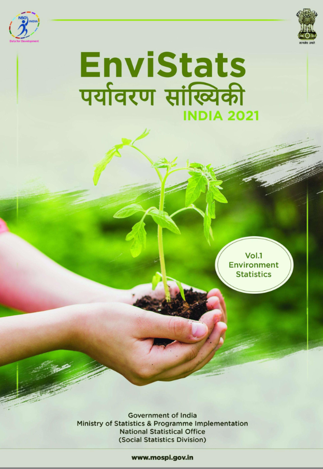
EnviStats India 2021

Reports & Research
Febrero, 2021
India

Environment statistics enumerate various aspects of the environment and human interactions with it. The scope of environment statistics encompasses all dimensions of the environment, be it Earth, Water or Air, the biotic and abiotiv matter found within the natural environment, and various concerns arising out of impacts of human footprints on it. The objective of environment statistics is to provide information about the environment, its changes over time and across locations, and the main factors that influence them.

Forest and Arborescent Scrub Habitats of Special Interest for SCIs in Central Spain

Peer-reviewed publication
Febrero, 2021
Australia
Belgium
Canada
Spain
United States of America

The habitat of the several territories in Ciudad Real (Castilla-La Mancha, Spain) are studued through the and mapping (scale 1:10.000) and vegetation analysis. The distribution and surface of the habitat presents in the Sites of Community Interest (SCIs), as well as pressures, threats, trends, and state of conservation are described. These site contributes significantly to the maintenance or restoration at a favourable conservation status of a natural habitat type or of a species of community intesess.These specially protected areas are part of the Natura 2000 network.

Water-Facing Distribution and Suitability Space for Rural Mountain Settlements Based on Fractal Theory, South-Western China

Peer-reviewed publication
Febrero, 2021
China
Russia
United States of America

The establishment of rural settlements in the topographically complex mountainous area of South-Western China is restricted by various geographical features. The fractal characteristics and water-facing distribution of rural mountain settlements and the suitability of spaces for rural mountain settlements were analyzed for a greater scientific understanding of what factors would facilitate a more appropriate selection of residential sites.

A Preliminary Study on the Impact of Landscape Pattern Changes Due to Urbanization: Case Study of Jakarta, Indonesia

Peer-reviewed publication
Febrero, 2021
Indonesia

Urbanization is changing land use–land cover (LULC) transforming green spaces (GS) and bodies of water into built-up areas. LULC change is affecting ecosystem services (ES) in urban areas, such as by decreasing of the water retention capacity, the urban temperature regulation capacity and the carbon sequestration. The relation between LULC change and ES is still poorly examined and quantified using actual field data. In most ES studies, GS is perceived as lumped areas instead of distributed areas, implicitly ignoring landscape patterns (LP), such as connectivity and aggregation.

Mediterranean Landscape Re-Greening at the Expense of South American Agricultural Expansion

Peer-reviewed publication
Febrero, 2021
Argentina
French Southern and Antarctic Lands
Brazil
Canada
Spain
Paraguay
United States of America
South America

The stabling of livestock farming implies changes in both local ecosystems (regeneration of forest stands via reduced grazing) and those located thousands of kilometers away (deforestation to produce grain for feeding livestock). Despite their importance, these externalities are poorly known. Here we evaluated how the intensification and confinement of livestock in Spain has affected forest surface changes there and in South America, the largest provider of soybeans for animal feed to the European Union.

Land–Lake Linkage and Remote Sensing Application in Water Quality Monitoring in Lake Okeechobee, Florida, USA

Peer-reviewed publication
Febrero, 2021
Argentina
Puerto Rico
Uruguay
United States of America

The state of water quality of lakes is highly related to watershed processes which will be responsible for the delivery of sediment, nutrients, and other pollutants to receiving water bodies. The spatiotemporal variability of water quality parameters along with the seasonal changes were studied for Lake Okeechobee, South Florida. The dynamics of selected four water quality parameters: total phosphate (TP), total Kjeldahl nitrogen (TKN), total suspended solid (TSS), and chlorophyll-a (chl-a) were analyzed using data from satellites and water quality monitoring stations.

Implications of Bioenergy Cropping for Soil: Remote Sensing Identification of Silage Maize Cultivation and Risk Assessment Concerning Soil Erosion and Compaction

Peer-reviewed publication
Febrero, 2021
Germany

Energy transition strategies in Germany have led to an expansion of energy crop cultivation in landscape, with silage maize as most valuable feedstock. The changes in the traditional cropping systems, with increasing shares of maize, raised concerns about the sustainability of agricultural feedstock production regarding threats to soil health. However, spatially explicit data about silage maize cultivation are missing; thus, implications for soil cannot be estimated in a precise way. With this study, we firstly aimed to track the fields cultivated with maize based on remote sensing data.

How Climate Change and Land Use/Land Cover Change Affect Domestic Water Vulnerability in Yangambi Watersheds (D. R. Congo)

Peer-reviewed publication
Febrero, 2021
Democratic Republic of the Congo
Global

In the tropics, the domestic water supply depends principally on ecosystem services, including the regulation and purification of water by humid, dense tropical forests. The Yangambi Biosphere Reserve (YBR) landscape is situated within such forests in the Democratic Republic of Congo (DRC). Surprisingly, given its proximity to the Congo River, the YBR is confronted with water issues. As part of its ecosystem function, the landscape is expected to reduce deterioration of water quality.