Land fragmentation is a factor that limits the development of the agricultural and forestry sector, as well as the ability of operators to reach a profitable economic dimension. This phenomenon also influences the creation of activities and incomes in a negative way in marginal areas. In this…

Many land use systems in Mediterranean sloping areas risk abandonment because of nonprofitability, while their hydro-geological stability depends on an appropriate management. However, who are the land managers? What are their practices? Our research on the traditional olive groves of the Monte…
The purpose of this work is to synthesize, for an international audience, certain fundamental elements that characterize the Italian peninsular territory, through the use of a biogeographical model known as the “peninsula effect” (PE). Just as biodiversity in peninsulas tends to change,…

Mediterranean regions have experienced a shift from accelerated urban growth typical of a post-industrial phase to a more recent spatial delocalization of population and economic activities reflecting discontinuous settlement expansion, land take, and the abandonment of cultivated areas around…


This paper is presenting research on with possibilities and benefit of applying a customer-oriented approach in public cadastral procedures. Public service providers have raised awareness towards customer-oriented approaches in their procedures during recent decades. This study discusses the…
Deforestation and forest degradation driven by Agriculture, Forestry and Other Land Use (AFOLU) are important sources of carbon emissions. Market globalization and trade liberalization policies reinforce this trend and risk deforestation to be embedded in global value chains. Due to the…
Diversification has been increasingly recognized as a rewarding farm strategy through which farmers produce on-farm non-agricultural goods and services. In doing so, farmers employ farm inputs (capital, labor, and land) in products other than agricultural goods, with the aim to sell them in the…
The present paper focuses on an integrated evaluation methodology aimed at measuring the attractiveness of rural landscapes. The landscapes under observation are two exceptional contexts in Piedmont (Italy): The Moraine Amphitheatre of Ivrea and the vineyard landscape of Langhe, Roero and…
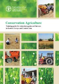
Agriculture in Eastern Europe and Central Asia is diverse, and has great potential to revitalize the economy of the countries in the region via improved productivity (efficiency) and higher total yield for food, fodder and fibre crops. Conservation agriculture can rise to the major challenge of…
This evaluation assessed strategic positioning of the first phase of the FAO-Turkey programme, its results and contributions, sustainability, as well as coherence and catalytic effects. It noted that the programme facilitated a beneficial collaboration between the Turkish Government and regional…