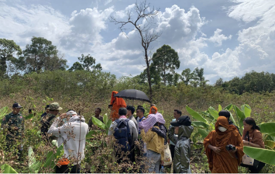
Preav Hun cultivated bananas and mangos in the Areng valley of the Cardamom mountains for more than 25 years, but for the past six months Ministry of Environment officials have banned him and his indigenous Chorng neighbors from farming as the government rezones the protected area.
“They won’t let us do it [farming],” Hun said. “I’m not sure why they keep it as barren land. The plantation land has now been abandoned because we do not dare do it if it is banned.”
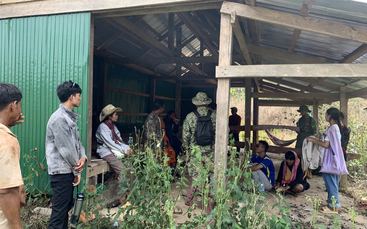
Hun, 55, lives in Chumnap village of Thmar Bang district’s Chumnap commune at Central Cardamom Mountain National Parks, currently undergoing a hazy government land zoning and titling initiative known as Sub-Decree 30.
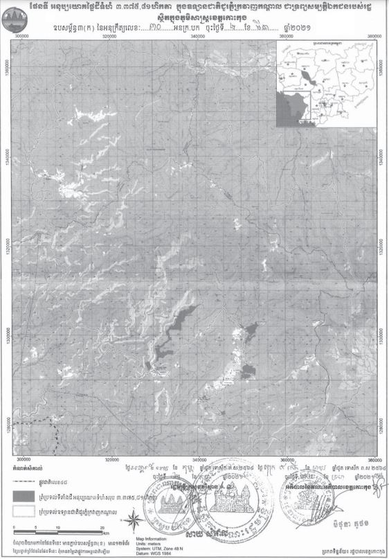
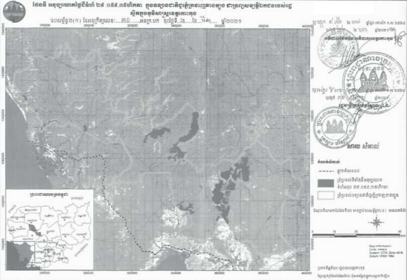
The sub-decree, signed by Prime Minister Hun Sen in March 2021, allows for the privatization of land inside the national park and seven other protected areas encompassing 126,928 hectares in Koh Kong province.
Koh Kong has since been afflicted with widespread land-grabbing by elites, though the sub-decree was technically intended to issue land titles and land use rights in the form of community zones for long-term residents living or farming inside protected areas — people like Hun and his neighbors. But now their livelihoods have been indefinitely disrupted as they wait to receive clear instructions about new zoning.
“People are suffering because the land that used to be farmed for a living is not allowed to be used like before,” said Hun, who estimates he has two hectares of farmland. Officials have allowed him to keep farming a half hectare. “There is no clear demarcation yet, and those lands are under the control of the communes and provinces, so if we still do something on them we will face legal action.”
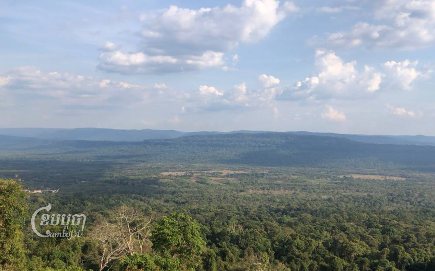
Hun’s farm is also near the site of a registered REDD+ project (Reducing Emissions from Deforestation and forest Degradation) run by NGO Wildlife Alliance and the MoE and inside one of the areas appearing targeted by a prospective REDD+ project managed by the NGO Conservation International.
Hun and his neighbors placed complaints in drop-boxes set up around Chumnap commune by Conservation International and the MoE, which appeared to be part of their Central Cardamom REDD+ project.
Sony Oum, country director of Conservation International (CI) did not respond to CamboJA’s requests for comment about why farmers who appeared to live within the NGO’s REDD+ site and partner communities were being banned from farming.
“The suspension [of farming] is related to Sub-Decree 30, not because of the REDD+ project,” said Khim Sothon, Managing Director of Central Cardamom National Park.
He claimed that the Ministry of Environment (MoE) is still preparing the new protected area boundaries under the sub-decree.
The protected area overlaps with parts of Chumnap commune, particularly farmland areas but officials remained unsure where exactly, Sothon said.
“We do not allow people to continue because they have to wait for the zoning to be cleared to know where the land can be farmed,” Sothon said, confirming the ban had been in place for around six months. “We informed people to stop farming because we suspect it is in a protected area.”
Claire Baker-Munton, a spokesperson for Wildlife Alliance, which runs a nearby registered REDD+ site, declined to comment.
“We have no comment on this subject since Sub-Decree 30 is under the management of Provincial Administration,” she said.
The Chorng community in the area lack nationally hard land titles for their farms but will seek a community land title to safeguard their lands once the sub-decree zoning process is resolved, said Ven Vorn, a former community representative.
Chumnap commune chief Sok Voeun said residents were instructed to contact commune authorities with concerns and these would be passed on to the MoE. He claimed to have received no complaints so far, but confirmed the ban on farming.
But Chorng community members in Chumnap commune, assisted by social justice group Khmer Thavarak, petitioned the Koh Kong provincial department of Environment in November 2022 to quickly issue clear maps for farmers so they understand where they can cultivate land in protected areas.
Khmer Thavarak member Svay Samnang said his organization traveled again to Areng in the first week of February to request MoE officials share the sub-decree map. He said the revised map could cause farmers in the area to lose income if their old plantation sites are not zoned to allow for farming in the future.
The department of Environment in Koh Kong, which could not be reached for comment,
in response, said that they would review the land’s location and send it to a higher level so that expert officials could visit and measure the location of the area, according to Samnang.
“For me, it is still unclear,” he said. “We still urge the government and the ministry to show a clear map so that the minority can know which areas are protected and which areas they can cultivate.”
Ngeth Sinap, Koh Kong coordinating officer for human rights NGO Adhoc, said the government should provide assistance to farmers during the period when their livelihoods were disrupted.
“The people are the children of the government, so when people are in trouble, the government must help them,” Sinap said. “When there is a problem, it really affects the interests of the people, so the authorities should expedite this work as quickly as possible.”
Copyright © Fuente (mencionado anteriormente). Todos los derechos reservados. El Land Portal distribuye materiales sin el permiso del propietario de los derechos de autor basado en la doctrina del "uso justo" de los derechos de autor, lo que significa que publicamos artículos de noticias con fines informativos y no comerciales. Si usted es el propietario del artículo o informe y desea que se elimine, contáctenos a hello@landportal.info y eliminaremos la publicación de inmediato.
Varias noticias relacionadas con la gobernanza de la tierra se publican en el Land Portal cada día por los usuarios del Land Portal, de diversas fuentes, como organizaciones de noticias y otras instituciones e individuos, que representan una diversidad de posiciones en cada tema. El derecho de autor reside en la fuente del artículo; La Fundación Land Portal no tiene el derecho legal de editar o corregir el artículo, y la Fundación tampoco espalda sus contenidos. Para hacer correcciones o pedir permiso para volver a publicar u otro uso autorizado de este material, por favor comuníquese con el propietario de los derechos de autor.