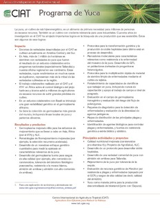
Síntesis de los programas de investigación del CIAT: area de investigación en agrobiodiversidad
Reports & Research
Dezembro, 2012
Synthesis reports on CIAT's investigations in the area of agrobiodiversity.
AGROVOC URI:
Synthesis reports on CIAT's investigations in the area of agrobiodiversity.
In the West African drylands, SOC sequestration is seen as one of the prominent strategies to both enhance the resilience of agro-ecosystems and mitigate global greenhouse effects. However, there is a dearth of baseline data that impede the design of site-appropriate recommended management practices (RMPs) to improve and sustain SOC accrual.

Intensive farming and grazing on Oxisols of the Brazilian savannas (also known as the Cerrados) are leading to loss of soil organic matter (SOM) and consequently to a decline in fertility and sustainability of the soils. Alternative land-use systems such as the introduction of legumes in pastures and the use of no-tillage systems can reverse this process.
Spatially explicit models are becoming increasingly important tools for simulating land-use change. In this study, we formulated and tested models that incorporated spatial correlates of agricultural expansion and used them to predict local- and landscape-scale patterns of agricultural land-use change and its implications in the Maasai-Steppe of Northern Tanzania. We evaluated the relationship between agricultural land-use and its spatial correlates using Multiple Logistic Regression on data derived from satellite imageries for the year 2000.
In the mountainous regions of northern Laos, shifting cultivation, or slash-and-burn agriculture, is widely practiced. However, the crop–fallow rotation cycle is becoming shorter owing to forest conservation policies and population pressure, causing loss of productivity that deleteriously affects farmers’ livelihoods in the region. To investigate regional land use conditions, we have developed a method of identifying the crop–fallow rotation cycle from Landsat Thematic Mapper (TM) and Enhanced Thematic Mapper+ (ETM+) data.
The objective of this work was to assess the effects of integrated crop-livestock systems, associated
with two tillage and two fertilization regimes, on the abundance and diversity of the soil macrofauna. Four
different management systems were studied: continuous pasture (mixed grass); continuous crop; two croplivestock
rotations (crop/pasture and pasture/crop); and native Cerrado as a control. Macrofauna was sampled
using a modified Tropical Soil Biology and Fertility method, and all individuals were counted and identified at