GeOC Installation Guide

Manuals & Guidelines
Outubro, 2017
Global
The purpose of this document is to outline the technical design of WebGIS, and provide a step-by-step guidance to build and deploy WebGIS tool.
The purpose of this document is to outline the technical design of WebGIS, and provide a step-by-step guidance to build and deploy WebGIS tool.
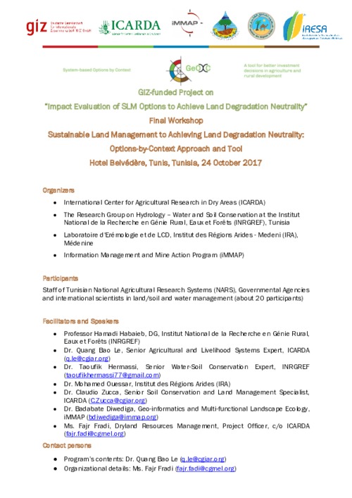
This is the program of the closure workshop "Sustainable Land Management to Achieve Land Degradation Neutrality: Options-by-Context Approach and Tools" of the project "Impact Evaluation of SLM Options to Achieve Land Degradation Neutrality".

This is the presentation of Dr. Quang Bao Le during the workshop "Sustainable Land Management to Achieving Land Degradation Neutrality: Options-by-Context Approach and Tool", final workshop for the project "Impact Evaluation of SLM Options to Achieve Land Degradation Neutrality", held in Tunis on the 24th October 2017. This presentation highlights the progress of the project.
This is the presentation of Dr. Badabate Diwediga during the workshop "Sustainable Land Management to Achieving Land Degradation Neutrality: Options-by-Context Approach and Tool", final workshop for the project "Impact Evaluation of SLM Options to Achieve Land Degradation Neutrality", held in Tunis on the 24th October 2017. This presentation is a landscape dynamics analysis in Tunisia.
This is the presentation of Dr. Taoufik Hermassi during the workshop "Sustainable Land Management to Achieving Land Degradation Neutrality: Options-by-Context Approach and Tool", final workshop for the project "Impact Evaluation of SLM Options to Achieve Land Degradation Neutrality", held in Tunis on the 24th October 2017. This presentation highlights the SLM techniques documented by the team in Zaghouan governorate.

Presentation of the project (East Africa and Sahel) for the Annual meeting (2017) organized in Niger (ICRISAT)
The document present the contribution of local knowledge in context-Specific Land Restoration Technologies.
It is no doubt that water resource is considered as main determining factor for agriculture and the adoption of modern irrigation technique would preserve this important resource. The shortage of rain in middle and southern Iraq pushes farmers to depend on irrigated agriculture especially from its main resource Euphrates and Tigris and their tributaries.
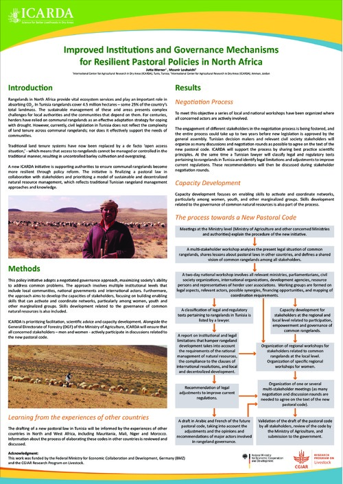
Rangelands in North Africa provide vital ecosystem services and play an important role in absorbing CO2. In Tunisia rangelands cover 4.5 million hectares – some 25% of the country’s total landmass. The sustainable management of these arid areas presents complex challenges for local authorities and the communities that depend on them. For centuries, herders have relied on communal rangelands as an effective adaptation strategy for coping with drought.

The global food market makes international players intrinsically connected through the flow of commodities, demand, production, and consumption. Local decisions, such as new economic policies or dietary shifts, can foster changes in coupled human–natural systems across long distances. Understanding the causes and effects of these changes is essential for agricultural-export countries, such as Brazil. Since 2000, Brazil has led the expansion of soybean planted area—19 million hectares, or 47.5% of the world’s increase. Soybean is among the major crop commodities traded globally.
Landscape Character Assessment (LCA) has been introduced into Jordan through the MEDSCAPES project. The purpose of this project was to streamline landscape studies and integrate them into the land use planning practices in Jordan. Two areas within the Mediterranean and arid climatic zones of the country were chosen as test areas for the methodology. These were the Yarmouk River drainage basin in the northwest of the country and the Mujib River area in the west of Jordan within the Dead Sea basin.
This paper presents an evaluation of the multi-source satellite datasets such as Sentinel-2, Landsat-8, and Moderate Resolution Imaging Spectroradiometer (MODIS) with different spatial and temporal resolutions for nationwide vegetation mapping. The random forests based machine learning and cross-validation approach was applied for evaluating the performance of different datasets.