Passar para o conteúdo principal

page search

Displaying 325 - 336 of 586

ICARDA Annual Report 2010

Reports & Research
Março, 2011
Global

Global food production has increased by 20% in the past decade – but food insecurity and poverty remain widespread , while the natural resource base continues to decline. International research centers, which have helped drive previous improvements, must continue to deliver new technologies to support sustainable growth in agriculture; and to work with other partners to accelerate the dissemination of these technologies.

An assessment of the accuracy of volunteered road map production in Western Kenya

Journal Articles & Books
Fevereiro, 2011
Quênia
África
África Oriental

The introduction of web based mapping facilities that use satellite imagery, offers local people the possibility to map their environment. However, maps need to be accurate, which is the reason why map making is assigned to professionals. In this paper, we investigated the classification accuracy of road infrastructure from high resolution satellite imagery of an urban area in western Kenya achieved by surveyors and non-surveyors alike, with and without local knowledge. Those with local knowledge classified roads with over 92% accuracy on average, irrespective of surveying background.

Assessment of topography effects on identification of hazelnut orchards in Giresun province by remote sensing and determination of suitability for alternative crops

Policy Papers & Briefs
Dezembro, 2010

In the frame of Agricultural Reform Implementation Project (ARIP) financed by World Bank, a regulation numbered 5495 and concerning the planning of the hazelnut production and determining of planting areas and supporting the farmers who make a choice of alternative crop farming instead of hazelnut farming was put in to practice in 2003.

Understanding regional dynamics of mixed crop-livestock agricultural systems to support rural development in South-western France uplands

Journal Articles & Books
Dezembro, 2010
França
Europa

The Coteaux de Gascogne region, an upland area in south-western France, is a site where studies related to the future of landscapes and the sustainability of natural resource management are well documented. The local agricultural system is induced by a “house centred” society with the particularity of passing on the inheritance and farm estate identically from one generation to the next. This system generates a mosaic landscape made up of field crops, grasslands and woodlots.

Evaluating the ecological suitability of the vineyards, by using geographic information systems (GIS)

Journal Articles & Books
Dezembro, 2010
Romênia

In this scientific paper are presented the preliminary results of the research having as goal to establish a methodology for the determination of the oenoclimatic potential and its spatial distribution in the viticultural areas. Data were obtained by means of GIS technology and disclosed a new, original model for analysing the viticultural ecoclimate.

Comprendre la dynamique régionale des exploitations de polyculture élevage pour accompagner le développement rural dans les Coteaux de Gascogne

Journal Articles & Books
Dezembro, 2010
França
Europa

The Coteaux de Gascogne region, an upland area in south-western France, is a site where studies related to the future of landscapes and the sustainability of natural resource management are well documented. The local agricultural system is induced by a “house centred” society with the particularity of passing on the inheritance and farm estate identically from one generation to the next. This system generates a mosaic landscape made up of field crops, grasslands and woodlots.

Surface runoff estimation over heterogeneous canal commands applying medium resolution remote sensing data with the SCS-CN method

Conference Papers & Reports
Dezembro, 2010

The precise estimation of surface runoff from rainfall is critical for water resource management. In the recent past, remote sensing and Geographic Information System (GIS) technologies have been widely used in the estimation of surface runoff from watersheds, and from agricultural fields in particular. This is due to the inherent ability of remote sensing to capture spatial heterogeneity of surface parameters such as land use and land cover. This could lead to better performances of surface runoff simulation models.

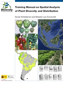
Training manual on spatial analysis of plant diversity and distribution

Training Resources & Tools
Dezembro, 2010

This training manual is intended for scientists and students who work with biodiversity data and are interested in developing skills to effectively carry out spatial analysis based on (free) GIS applications with a focus on diversity and ecological analyses.

These analyses offer a better understanding of spatial patterns of plant diversity and distribution, helping to improve conservation efforts. The training manual focuses on plants of interest for improving livelihoods (e.g. crops, trees and crop wild relatives) and/or those which are endangered.

Groundwater management in land administration: A spatio-temporal perspective

Conference Papers & Reports
Dezembro, 2010

Although the use of land and water is intertwined, specifics for groundwater management are not effectively dealt with in the laws and other institutional mechanisms related to land. Provisions for groundwater aspects in land management are there, but with a focus on the land itself. Land rights and restrictions are more or less static, lacking enough flexibility to incorporate the relatively short interval spatio-temporal dynamics of groundwater resources in the land management and regulation mechanisms. This leads to a gap between the scientific inputs and policy-decision making.

Landelijk Grondgebruiksbestand Nederland versie 6 (LGN6) : vervaardiging, nauwkeurigheid en gebruik

Reports & Research
Dezembro, 2010
Netherlands

De snelle veranderingen die zich in Nederland voordoen met betrekking tot het gebruik van ruimte en de conflicterende belangen van veel gebruikers van deze ruimte, zorgen voor een voortdurende behoefte aan actuele geografische bestanden. Eén van deze bestanden is het Landelijke Grondgebruiksbestand Nederland (LGN). Sinds 1986 wordt met een periodiciteit van 3-5 jaar het LGN-bestand geproduceerd. Het LGN6-bestand is een rasterbestand met een resolutie van 25*25 m. Het bestand geeft het Nederlandse landgebruik voor de jaren 2007/2008 weer.