Passar para o conteúdo principal

page search

Displaying 5893 - 5904 of 17898

Données d’observations de la terre et outils cartographiques libres à la caractérisation de la dynamique foncière face à l’accaparement des terres à grande échelle au sud-ouest Cameroun.

Peer-reviewed publication
Abril, 2019
Camarões

Situé en plein cœur de la forêt équatoriale dans le bassin du Congo, la région du Sud-ouest est sans doute l’une des plus riches du Cameroun. Elle comporte une biodiversité des plus diversifiées avec une importance significative des espèces endogènes ainsi que des espèces commerciales. Les conditions pédologiques, hydrographiques et orographiques sont favorables à l’agriculture, ce qui a amené les allemands dès leurs arrivées au Cameroun à s’y implanter.

Climate, Land Use Change and Local Adaptation Strategies in Ecological Areas. Case of Miwaleni River Valley

Peer-reviewed publication
Abril, 2019
África

Climate change issues are contemporary global phenomena which affect the largest part of the world in different ways. This paper explores how local communities living in sensitive ecological areas, particularly in river valleys, respond to and adapt to climate change. By employing a qualitative research approach, findings have indicated that heavy rainfall and prolonged droughts coupled with population increase have led to land use changes and loss of biodiversity in the river valley.

The role of institutional actors and their interactions in the land use policy making process in Ethiopia

Journal Articles & Books
Abril, 2019

This study investigates the role of the different institutional actors involved in the development and implementation of land use policies in the Ethiopian Rift Valley. The work is based on interviews with key informants from different administrative levels and these results are compared to the relevant policy documents. While the constitution prescribes a participatory policy development process, our results show that in reality policies are made at the highest level and implemented in a top-down approach from the higher to the lower administrative levels.

The Global Symposium on Soil Erosion (GSER19)

Reports & Research
Abril, 2019
Global

The Global Symposium on Soil Erosion (GSER19) represented a critical step towards the implementation of the Voluntary Guidelines for Sustainable Soil Management (VGSSM) in terms of minimizing the risk of soil erosion. GSER 19 identified effective and ineffective Sustainable Soil Management (SSM) practices, techniques, instruments and mechanisms which shed light on where the gaps and challenges are in terms of science, technology and legislation.

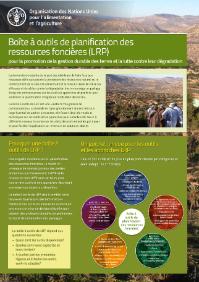
Boîte à outils de planification des ressources foncières (LRP)

Institutional & promotional materials
Abril, 2019

La boîte à outils de LRP est une source en ligne librement accessible pour un éventail de parties prenantes et fournit des informations techniques sur les outils et les approches pour aider les decideurs politiques à différents niveaux pour surmonter les obstacles au niveau politique et faciliter la mise en place de solutions viables sur le terrain.

Modelling Development of Riparian Ranchlands Using Ecosystem Services at the Aravaipa Watershed, SE Arizona

Peer-reviewed publication
Abril, 2019
México

This paper describes how subdivision and development of rangelands within a remote and celebrated semi-arid watershed near the US–Mexico border might affect multiple ecohydrological services provided, such as recharge of the aquifer, water and sediment yield, water quality, flow rates and downstream cultural and natural resources. Specifically, we apply an uncalibrated watershed model and land-change forecasting scenario to consider the potential effects of converting rangelands to housing developments and document potential changes in hydrological ecosystem services.

Evaluation of Resource and Environmental Carrying Capacity of China’s Rapid-Urbanization Areas—A Case Study of Xinbei District, Changzhou

Peer-reviewed publication
Abril, 2019
China

The evaluation of resource and environmental carrying capacity (RECC) is the foundation for the rationale behind the arrangement of land spaces for production, living, and ecological uses. In this study, based on various natural, economic, and social factors, an integrated Multi-Factor assessment model was developed to evaluate the RECC of Xinbei district of Changzhou. Meanwhile, we also calculated the population carrying capacity estimation model restricted by food security.

Göbekli Tepe: A Brief Description of the Environmental Development in the Surroundings of the UNESCO World Heritage Site

Peer-reviewed publication
Abril, 2019
Global

This contribution provides a first characterization of the environmental development for the surroundings of the UNESCO World Heritage site of Göbekli Tepe. We base our analyses on a literature review that covers the environmental components of prevailing bedrock and soils, model- and proxy-based climatic development, and vegetation. The spatio-temporal scales that are covered are mainly the Eastern Mediterranean region and the Late Quaternary—whereby special attention is given to available data from the close vicinity of Göbekli Tepe.

Implementing Green Infrastructure in Spatial Planning in Europe

Peer-reviewed publication
Abril, 2019
Europa

Interest in green infrastructure (GI) has grown in research, policy and planning in recent decades. The central idea behind GI is the understanding of the physical non-built-up environment as an infrastructure capable of delivering a wide variety of benefits to society, including the ability to preserve biodiversity; to provide food, feed, fuel and fibre; to adapt to and mitigate climate change and to contribute to enhanced human health and quality of life.

Future governance options for large-scale land acquisition in Cambodia: Impacts on tree cover and tiger landscapes

Journal Articles & Books
Abril, 2019
Cambodia

This paper investigates how large-scale land acquisitions (LSLAs) can be governed to avoid underuse and thereby spare room for other land claims, specifically nature conservation. LSLA underuse occurs when land in LSLAs is not converted to its intended use. Taking Cambodia as a case, we map converted and unconverted areas within LSLAs using remote sensing. We develop three scenarios of alternative LSLA policies until 2040, and use a land system change model to evaluate how governing the underuse of LSLAs affects overall land use.

Adoption of improved amaranth varieties and good agricultural practices in East Africa

Peer-reviewed publication
Março, 2019
Quênia
Tanzania

This study quantifies the adoption of improved amaranth varieties in Kenya and Tanzania, and the extent to which these result from international vegetable breeding research conducted by the World Vegetable Center (WorldVeg) and partners. The study used expert elicitation and a questionnaire survey among vegetable seed producers. Nine expert panels were conducted involving 123 local experts. The results show that improved amaranth varieties were planted on 51% of the planted area in Kenya and 70% in Tanzania.

Survey methodologies of urban land uses: An oddment of the past, or a gap in contemporary planning theory?

Peer-reviewed publication
Março, 2019
Global

The primary objective of this article is to review the evolution of urban land-use survey methodologies during the last century, with a special focus on the methodologies concerning field surveys that are conducted for urban planning purposes. Our review reveals, on the one hand, that there has been a steep decrease of interest in the further development of these methodologies over the last 50 years, and, on the other, that they have been seriously trivialized, as shown by the simplistic and empirical approach to land-use survey methodology in contemporary textbooks.