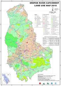
Srepok River Catchment Land Use Map 2010
Resource information
Date of publication
Dezembro 2010
Resource Language
ISBN / Resource ID
handle:10568/34373
License of the resource
Map shows detail for 50 categories of land use with a summary of main land uses.
