Resources
Displaying 1626 - 1630 of 2258Coupling Coordinated Development and Exploring Its Influencing Factors in Nanchang, China: From the Perspectives of Land Urbanization and Population Urbanization
The coordination relationship between land urbanization and population urbanization is crucial for achieving sustainable development under economic transition. Moreover, the balance between land urbanization and population urbanization is essential to guarantee the urbanization process of an entire city. This paper empirically analyzes the interaction between land urbanization and population urbanization in Nanchang from 2002 to 2017 based on the coupling coordination model (CCM).
Towards Responsible Consolidation of Customary Lands: A Research Synthesis
The use of land consolidation on customary lands has been limited, though land fragmentation persists. Land fragmentation on customary lands has two main causes—the nature of the customary land tenure system, and the somewhat linked agricultural system. Since attempts to increase food productivity on customary lands have involved fertilisation and mechanisation on the small and scattered farmlands, these approaches have fallen short of increasing food productivity.
How Much is Enough? Improving Participatory Mapping Using Area Rarefaction Curves
Participatory mapping is a valuable approach for documenting the influence of human activities on species, ecosystems, and ecosystem services, as well as the variability of human activities over space and time. This method is particularly valuable in data-poor systems; however, there has never been a systematic approach for identifying the total number of respondents necessary to map the entire spatial extent of a particular human activity. Here, we develop a new technique for identifying sufficient respondent sample sizes for participatory mapping by adapting species rarefaction curves.
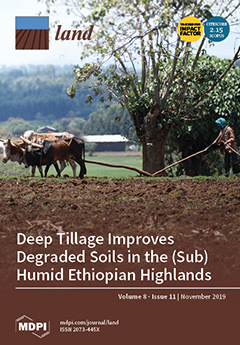
Deep Tillage Improves Degraded Soils in the (Sub) Humid Ethiopian Highlands
Intensification of rainfed agriculture in the Ethiopian highlands has resulted in soil degradation and hardpan formation, which has reduced rooting depth, decreased deep percolation, and increased direct runoff and sediment transport. The main objective of this study was to assess the potential impact of subsoiling on surface runoff, sediment loss, soil water content, infiltration rate, and maize yield.
Law, Violence, and Property Expropriation in Syria: Impediments to Restitution and Return
After eight years of civil war, parts of Syria are now free from conflict. In recognition of the return to peace, the government officially welcomes back all who fled the country to escape violence. Yet, a pattern of property expropriation supported by the government during the war limits the ability of some to return and reclaim their homes and businesses.


