Resources
Displaying 1761 - 1765 of 2258Land Use Evaluation over the Jema Watershed, in the Upper Blue Nile River Basin, Northwestern Highlands of Ethiopia
Generating land capability class guidelines at a watershed scale has become a priority in sustainable agricultural land use. This study analyzed the area of cultivated land use situated on the non-arable land-capability class in the Jema watershed in the Upper Blue Nile River Basin. Soil surveys, meteorological ground observations, a digital elevation model (DEM) at 30 m, Meteosat at 10 km × 10 km and Landsat at 30 m were used to generate the sample soil texture class, average annual total rainfall (ATRF in mm), terrain, slope (%), elevation (m a.s.l) and land-use land cover (%).
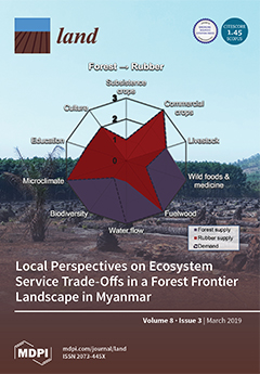
Local Perspectives on Ecosystem Service Trade-Offs in a Forest Frontier Landscape in Myanmar
Extensive land use changes in forest frontier landscapes are leading to trade-offs in the supply of ecosystem services (ES) with, in many cases, as yet unknown effects on human well-being. In the Tanintharyi Region of Myanmar, a forest frontier landscape facing oil palm and rubber expansion, little is known about local perspectives on ES and the direct impact of trade-offs from land use change. This study assessed the trade-offs experienced with respect to 10 locally important ES from land user perspectives using social valuation techniques.
Ecosystem Productivity and Water Stress in Tropical East Africa: A Case Study of the 2010–2011 Drought
Characterizing the spatiotemporal patterns of ecosystem responses to drought is important in understanding the impact of water stress on tropical ecosystems and projecting future land cover transitions in the East African tropics. Through the analysis of satellite measurements of solar-induced chlorophyll fluorescence (SIF) and the normalized difference vegetation index (NDVI), soil moisture, rainfall, and reanalysis data, here we characterize the 2010–2011 drought in tropical East Africa.
Classifying and Mapping Periurban Areas of Rapidly Growing Medium-Sized Sub-Saharan African Cities: A Multi-Method Approach Applied to Tamale, Ghana
Periurban areas of growing cities in developing countries have been conceptualised as highly dynamic landscapes characterised by a mixture of socioeconomic structures, land uses and functions. While the body of conceptual literature on periurban areas has significantly increased over the past two decades, methods for operationalising these multi-dimensional concepts are rather limited. Yet, information about the location and areal extent of periurban areas is needed for integrated planning in the urban–rural interface.
Monitoring Effects of Land Cover Change on Biophysical Drivers in Rangelands Using Albedo

This paper explores the relationship between land cover change and albedo, recognized as a regulating ecosystems service. Trends and relationships between land cover change and surface albedo were quantified to characterise catchment water and carbon fluxes, through respectively evapotranspiration (ET) and net primary production (NPP). Moderate resolution imaging spectroradiometer (MODIS) and Landsat satellite data were used to describe trends at catchment and land cover change trajectory level. Peak season albedo was computed to reduce seasonal effects.