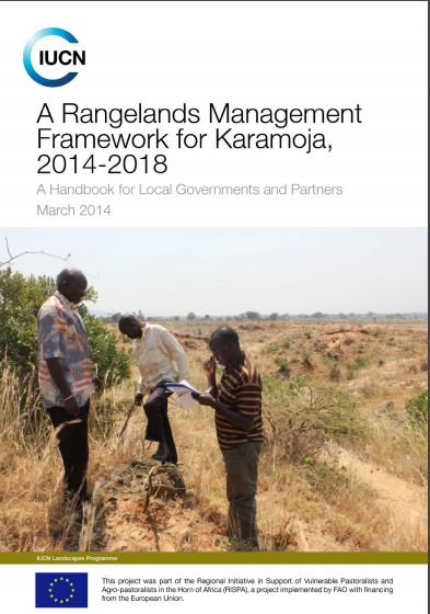
A Rangeland Management Framework for Karamoja, 2014-2018
This rangelands management framework is a product of a rapid pastoralist-led rangeland health assessment that was conducted in three sampled districts of Karamoja; Moroto, Napak and Kotido.
AGROVOC URI:
This rangelands management framework is a product of a rapid pastoralist-led rangeland health assessment that was conducted in three sampled districts of Karamoja; Moroto, Napak and Kotido.
The technical guide on improving the governance of pastoral lands is designed for several audiences including government and non-government actors. It covers specific challenges of pastoral tenure that are unique to pastoralism and considers how these different facets of pastoralist tenure (issues of the commons; free, prior and informed consent (FPIC); gender etc.) can be combined in a coherent approach to securing pastoral lands.
Pastoralism is a livelihood strategy and a system of mobile livestock production that makes wide-ranging use of grazing lands in arid and semi-arid environment that doesn’t uphold sustainable crop cultivation. The freedom of mobility over outsized land for seasonal pastures is indispensable to pastoralist production primarily in order to convert the pastures residues into human food. The people and livestock in pastoral communities may move to avoid various natural and/or social hazards, to avert competition with others, or to seek more favourable conditions.
The goal of the Rangelands Initiative is increased tenure security of local rangeland users through improved implementation of enabling policy and legislation. By connecting, mobilising and influencing, the Initiative strengthens ILC members’ activities in-country and across its continental platforms.
Extensive grazing is the predominant form of land use on at least a quarter of the world’s land surface, in which livestock are raised on food that comes mainly from rangelands. The term livestock includes both domesticated animals such as cattle, sheep, goats, camels, horses, llamas and alpacas, and a broad range of wild animals kept for meat or game viewing. It is estimated that tropical grasslands alone cover 18 million square kilometres, where the natural vegetation is used by mobile animals requiring forage and water throughout the year.
Participatory digital mapping using satellite imagery and digital earth and other open source Geographic Information Systems (GIS) is a practical tool bridging the knowledge and communication gap between pastoral communities and county government planners. It is offering an effective option for participatory planning and decision-making in support of climate change adaptation in the drylands of Kenya.
Informed livestock sector policy development and priority setting is heavily dependent on a good understanding of livestock production systems. In a collaborative effort between the Food and Agriculture Organization and the International Livestock Research Institute, stock has been taken of where we have come from in agricultural systems classification and mapping; the current state of the art; and the directions in which research and data collection efforts need to take in the future.
In most cases, the establishment of protected areas (PAs) goes hand-in-hand with an increase in conservation costs to communities living adjacent to these PAs. This paper draws insights from gender theories in particular feminist political ecology approach to unravel the impact of PAs on men and women around the Kilimanjaro National Park (NP) and the Enduimet Wildlife Management Area (WMA) in Tanzania. Specifically, it investigates how the creation and expansion of two PAs in Tanzania have impacted men and women in different ways.
‘This study is in-depth, up-to-date and the first of its kind on a massive infrastructure development project in the region, examining its history, politics, evolution, the emergence of actors and interests and effects on the poor and marginalized. It presents the ambitions and ambiguities of a megaproject never seen in the development history of the region. The report is a comprehensive analysis of the hopes and fears emanating from a megaproject in the region and provides invaluable data on which future studies will certainly have to rely.’
Kenya is the most recent African state to acknowledge customary tenure as producing lawful property rights, not merely rights of occupation and use on government or public lands. This paper researches this new legal environment. This promises land security for 6 to 10 million Kenyans, most of who are members of pastoral or other poorer rural communities. Analysis is prefaced with substantial background on legal trends continentally, but the focus is on Kenya’s Community Land Act, 2016, as the framework through which customary holdings are to be identified and registered.
Introduction: Water as a range management tool The pastoral system - the inter-relationship between livestock, natural resources and people / institutions - has evolved to function effectively and efficiently in areas of low and unpredictable rainfall, using mobility as one of the key adaptation strategies. Although having undergone changes over the years, the pastoralist system comprises fundamental elements which have allowed it to persist for millennia.