Pasar al contenido principal

page search

IssuesInvestigaciónLandLibrary Resource
There are 4, 053 content items of different types and languages related to Investigación on the Land Portal.

Investigación

AGROVOC URI:

Displaying 1117 - 1128 of 1392

REDD+ Implementation in Community-Based Muyong Forest Management in Ifugao, Philippines

Peer-reviewed publication
Noviembre, 2019
Filipinas

Ifugao province of the Philippines has a traditional muyong forest system that supplies water and prevents soil erosion of the world-famous Ifugao rice terraces. The socio-political structure of Ifugao has been the key to the maintenance and communal use of land, as well as the muyong forest, without causing excessive damage to the land. Recently, the Ifugao is facing various challenges viz. deforestation, slash-and-burn, introduction of commercial rice, and climate change.

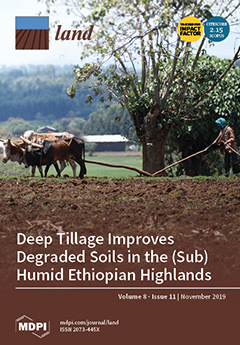
Deep Tillage Improves Degraded Soils in the (Sub) Humid Ethiopian Highlands

Peer-reviewed publication
Noviembre, 2019
Global

Intensification of rainfed agriculture in the Ethiopian highlands has resulted in soil degradation and hardpan formation, which has reduced rooting depth, decreased deep percolation, and increased direct runoff and sediment transport. The main objective of this study was to assess the potential impact of subsoiling on surface runoff, sediment loss, soil water content, infiltration rate, and maize yield.

Transition of Collective Land in Modernistic Residential Settings in New Belgrade, Serbia

Peer-reviewed publication
Noviembre, 2019
Serbia

Turbulent periods of transition from socialism to neoliberal capitalism, which have affected the relationships between holders of power and governing structures in Serbia, have left a lasting impact on the urban spaces of Belgrade’s cityscape. The typical assumption is that the transformation of the urban form in the post-socialist transition is induced by planning interventions which serve to legitimize these neoliberal aspirations.

The Ecosystem Effects of Sand-Binding Shrub Hippophae rhamnoides in Alpine Semi-Arid Desert in the Northeastern Qinghai–Tibet Plateau

Peer-reviewed publication
Diciembre, 2019
Global

The planting of sand-binding vegetation in the Qinghai Lake watershed at the northeastern edge of the Qinghai–Tibet Plateau began in 1980. For this paper, we took the desert on the eastern shore of Qinghai Lake as the study area. We analyzed a variety of aged Hippophae rhamnoides communities and aeolian activities, and we discuss the relationship between them. The main conclusions are as follows: (1) With an increasing number of binding years, the species composition became more abundant, natural vegetation began to recover, and biodiversity increased year by year.

Riparian Zones in Nairobi City

Journal Articles & Books
Diciembre, 2012
Kenya

This article is a contribution to the current debate on the concepts of land use planning and riparian zone
conservation. It discusses some of the major theoretical and conceptual issues that impact on the
practice of planning and conservation of riparian zones within the City of Nairobi. A conceptualization of
planning and conservation of riparian zone as well as the linkage between the two is discussed as the
paper critically seeks to identify some of the planning and conservation strategies in place, policy, legal

The Use of Sociological Methods to Assess Land-use Change: A Case Study of Lambwe Valley, Kenya

Journal Articles & Books
Diciembre, 2003
Kenya

Land-use history, not readily available
for most places, remains the weakest link in nearly all
studies of historic vegetation change, in Africa as well
as other places in the world. Notwithstanding,
communities hold a great wealth of knowledge on the
processes and events influencing change on the land
they occupy. The Lambwe Valley, southwestern Kenya,
has a multi-ethnic population of settlers from the early
1950s. These people have seen the transformation of
an initially forested area with diverse challenges to

Soil indicators to assess the effectiveness of restoration strategies in dryland ecosystems

Journal Articles & Books
Marzo, 2016
Global

Soil indicators may be used for assessing both land
suitability for restoration and the effectiveness of restoration
strategies in restoring ecosystem functioning and services. In
this review paper, several soil indicators, which can be used
to assess the effectiveness of ecological restoration strategies
in dryland ecosystems at different spatial and temporal
scales, are discussed. The selected indicators represent the
different viewpoints of pedology, ecology, hydrology, and
land management. Two overall outcomes stem from the review.

Detection of City Integration Processes in Rapidly Urbanizing Areas Based on Remote Sensing Imagery

Peer-reviewed publication
Septiembre, 2020
China

Since China’s reform and development commenced, in the context of rapid urbanization and coordinated regional development, Chinese cities with a close geographic proximity and social ties have gradually formed an integrated city development model. As a new phenomenon in China’s urbanization process, existing research on China’s integrated cities mainly focuses on typical case studies, and most research has been limited to literature reviews and theoretical analyses.

Spatial Structure of a Potential Ecological Network in Nanping, China, Based on Ecosystem Service Functions

Peer-reviewed publication
Septiembre, 2020
Estados Unidos de América
China
Rusia

The increasing scale of urbanization and human activities has resulted in the fragmentation of natural habitats, leading to the reduction of ecological landscape connectivity and biodiversity. Taking Nanping as the study area, the core areas with good connectivity were extracted as ecological sources using a morphological spatial pattern analysis (MSPA) and landscape connectivity index. Then the ecosystem service functions of the ecological sources were evaluated based on the InVEST model.

Inventory and Distribution of Rock Glaciers in Northeastern Yakutia

Peer-reviewed publication
Septiembre, 2020
Estados Unidos de América
Reino Unido

Rock glaciers are common forms of relief of the periglacial belt of many mountain structures in the world. They are potential sources of water in arid and semi-arid regions, and therefore their analysis is important in assessing water reserves. Mountain structures in the north-east of Yakutia have optimal conditions for the formation of rock glaciers, but they have not yet been studied in this regard. In this article, for the first time, we present a detailed list of rock glaciers in this region.

The Grain for Green Project May Enrich the Mercury Concentration in a Small Karst Catchment, Southwest China

Peer-reviewed publication
Septiembre, 2020
Estados Unidos de América
China
Rusia

The Chinese project, better known as the Grain for Green Project (GGP), has changed the land-use type in the karst area of Puding county, Guizhou province, southwest China, and this study is aimed at evaluating the Hg distribution and determining factors in soils after the land-use change. A total of ten soil profiles were selected in the typical karst region, and the land-use types were divided into native vegetation land (NVL), farmland (FL), and abandoned farmland (AFL).

Uncovering Ecosystem Services of Expropriated Land: The Case of Urban Expansion in Bahir Dar, Northwest Ethiopia

Peer-reviewed publication
Septiembre, 2020
Etiopía

In Ethiopia, urban expansion happens at high rates and results in land expropriations often at the cost of agriculture and forests. The process of urban expansion does not include assessment of ecosystem services (ES). This has been causing unintended environmental problems. This study aims to uncover ES of three most important land use types (cropland, agroforestry, and grassland) that are threatened by land expropriation for urban expansion in Bahir Dar City. The study applied a participatory approach using community perception and expert judgments (N = 108).