geómetra related Blog post | Land Portal
Hay 1,388 elementos de contenido relacionados con geómetra en Land Portal.

geómetra

Geómetra, se califica como tal al ingeniero competente en las materias de topografía, derecho inmobiliario y administración de bienes raíces. Identifica los límites de la propiedad y hace el amojonamiento recurriendo a la fotogrametría, GPS e informática, elaborando para tal efecto los SIG. Individualmente o en equipo pluridisciplinario participa en la elaboración de proyectos de urbanismo e ingeniería civil o de reagrupamiento de predios. En los dominios de la topografía general, el geómetra por el conocimiento que tiene del derecho civil y de los bienes raíces, es frecuentemente consejero de las partes en materia de bienes raíces y autor de informes de peritaje hechos a los inmuebles construidos o sin construcción.

Mostrando 1 - 2 de 2
blockchain, land, survey
16 Julio 2019
Authors: 
Mr. John Dean Markunas
Global

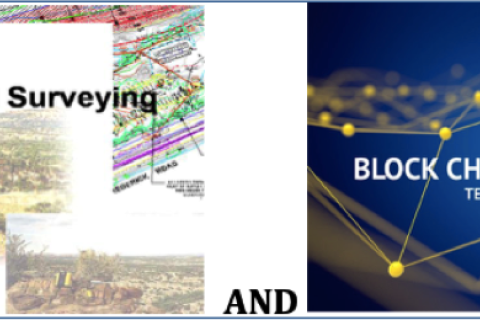
UNLIKELY PARTNERS: BLOCKCHAIN & LAND SURVEYING INDUSTRY

OUTLINE

I. Introduction to Blockchain Technology

II. Overview of the Surveying Industry

III. Surveying and Blockchain

IV. Types of Blockchains  

V. The Case for Blockchain in the Real Estate Industry

VI. Blockchain, Surveying, Land Registry and Cadastre 

VII. Blockchain Registry Integration Levels

VIII. The Future of Blockchain for Real Estate

IX. Conclusion

APPENDIX 

Glossary — Blockchain Terminology

Flickr Thailand agriculture
29 Mayo 2018
Asia

The Second Regional Land Forum kicked off in Bangkok, Thailand in the early morning of May 28th and the opening session was certainly one to remember! Live drones, talk of big data and using NASA related technology to propel land rights forward, were but a few of the impressive topics on the table. Participants gathered to hear a variety of ‘flash talks’, quick yet effective pitches about notable initiatives relating to data, technology and land rights.

Organizaciones

The-Arab-Union-of-Surveyors-AUS-logo.jpg

The Arab Union of Surveyors aims to promote cooperation, coordination and communication among surveyors in the Arab countries.

Geomatics, Landmanagement and Landscape

By the decision of the authorities of the Department of Environmental Engineering and Geodesy at the University of Agriculture in Krakow of 17 October 2012 a scientific quarterly magazine named Geomatics, Landmanagement and Landscape (GLL) was created.

The purpose of the quarterly magazine are presentations, discussions and exchange of scientific thoughts in the field of broadly understood planning, shaping and protection of the environment and landscapes; modern geoinformatic techniques, surveying, rural areas development and property management.

Mission


To facilitate efficient land administration and management, acess to adequate and affordable housing, social and physical infrastructure for national development


Vision


To be a globally competitive organization in sustainable management of Land and built environment

Norwegian Mapping Authority logo

The Norwegian Mapping Authority (NMA) is Norway's national mapping agency, dealing with land surveying, geodesy, hydrographic surveying, cadastre and cartography. Its headquarters are in Hønefoss and it is a public agency under the Ministry of Local Government and Modernisation. NMA was founded in 1773.


Source: Wikipedia (consulted d.d. February 18th, 2020)

Palestine Land Authority logo

The PLA established by presidential Decree No.10 of 2002 as a legal entity with its own budget , subordinate to the Council of Ministers , with the responsibility for both the Survey and Registration Departments.


Mandate:


  • Surveying department responsible for examining maps and plans prepared in connection with land adjudication process, partition, subdivision, first registration and other transaction;
Survey Review

Survey Review (ISSN -0039-6265 (print); ISSN 1752-2706 (online) is an international journal which has been published since 1931, and in recent years under the auspices of the Commonwealth Association of Surveying and Land Economy (CASLE). It has been published continuously as a quarterly journal, bringing together a wide range of papers on research, theory, practice and management in land and engineering surveying. All papers are independently assessed by two referees and come from government, private industry and academic organisations world-wide.

Universiti Teknologi Malaysia
PHILOSOPHY

The divine law of Allah is the foundation of knowledge. In line with His Will, UTM strives with total commitment to attain excellence in science, technology and engineering for the well-being and prosperity of mankind.

Hukum Allah adalah dasar kepada ilmu. Sejajar dengan kehendak-Nya, UTM komited secara menyeluruh dan bersepadu demi mencapai kecemerlangan dalam sains, teknologi dan kejuruteraan untuk kemakmuran dan kesejahteraan sejagat.

Comparta esta página