surveyors related Blog post | Land Portal
There are 1,388 content items of different types and languages related to surveyors on the Land Portal.

surveyors

A surveyor is a professional person with the academic qualifications and technical expertise to practise the science of measurement; to assemble and assess land and geographic related information.

Displaying 1 - 7 of 7
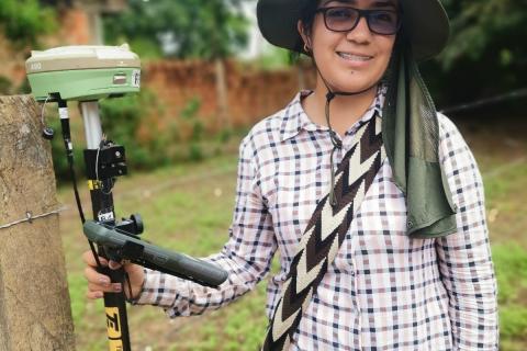
Woman topographer proves land surveyors are not limited to men.
18 October 2023
Authors: 
Nicholas Parkinson
Latin America and the Caribbean
South America
Colombia

How a land surveyor in a rural Land Office in Colombia has overcome challenges to find herself in a career dominated by men.

Real Estate Regulation and Development (RERA)
29 November 2022
Authors: 
Deepak Sanan
India

The Real Estate (Regulation and Development) Act 2016 which seeks to create a more professional real estate sector and create a level playing field in transactions between developers and homebuyers, has the potential to assist in reducing property related disputes.

16 September 2022
Authors: 
Ms. Laura Meggiolaro
Mr. Charl-Thom Bayer
Madagascar
Senegal
Global

An important precondition for good land governance is to have good land data that can be used to make informed decisions, formulate policies, and develop plans and strategies for the public good.

blockchain, land, survey
16 July 2019
Authors: 
Mr. John Dean Markunas
Global

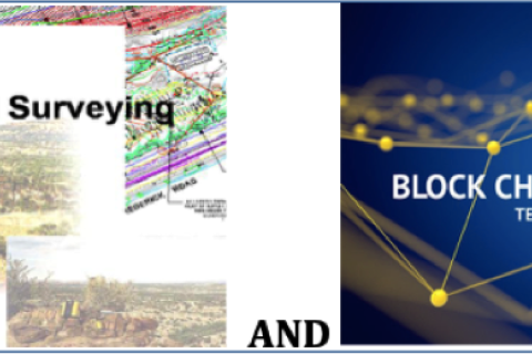
UNLIKELY PARTNERS: BLOCKCHAIN & LAND SURVEYING INDUSTRY

OUTLINE

I. Introduction to Blockchain Technology

II. Overview of the Surveying Industry

III. Surveying and Blockchain

IV. Types of Blockchains  

V. The Case for Blockchain in the Real Estate Industry

VI. Blockchain, Surveying, Land Registry and Cadastre 

VII. Blockchain Registry Integration Levels

VIII. The Future of Blockchain for Real Estate

IX. Conclusion

APPENDIX 

Glossary — Blockchain Terminology

13 August 2018
Authors: 
Ms. Laura Meggiolaro
Global

Dear Land Portal users,

First and foremost, on behalf of the Land Portal team, I would like to thank those of you for taking the time out of your very busy schedules to complete our user survey. We are continuously trying to improve our services, and unlike many other websites, the Land Portal is a community in which dialogue and exchange of ideas are the cornerstone of what we do every day. Your feedback on our services is therefore crucial and invaluable to us!

Flickr Thailand agriculture
29 May 2018
Asia

The Second Regional Land Forum kicked off in Bangkok, Thailand in the early morning of May 28th and the opening session was certainly one to remember! Live drones, talk of big data and using NASA related technology to propel land rights forward, were but a few of the impressive topics on the table. Participants gathered to hear a variety of ‘flash talks’, quick yet effective pitches about notable initiatives relating to data, technology and land rights.

Organizations

The-Arab-Union-of-Surveyors-AUS-logo.jpg

The Arab Union of Surveyors aims to promote cooperation, coordination and communication among surveyors in the Arab countries.

Geomatics, Landmanagement and Landscape

By the decision of the authorities of the Department of Environmental Engineering and Geodesy at the University of Agriculture in Krakow of 17 October 2012 a scientific quarterly magazine named Geomatics, Landmanagement and Landscape (GLL) was created.

The purpose of the quarterly magazine are presentations, discussions and exchange of scientific thoughts in the field of broadly understood planning, shaping and protection of the environment and landscapes; modern geoinformatic techniques, surveying, rural areas development and property management.

FIG is the premier international organization representing the interests of surveyors worldwide. It is a federation of the national member associations and covers the whole range of professional fields within the global surveying community. It provides an international forum for discussion and development aiming to promote professional practice and standards.

The Netherlands’ Cadastre, Land Registry and Mapping Agency – in short Kadaster – collects and registers administrative and spatial data on property and the rights involved. This also goes for ships, aircraft and telecom networks. Doing so, Kadaster protects legal certainty. We are also responsible for national mapping and maintenance of the national reference coordinate system. Furthermore, we are an advisory body for land-use issues and national spatial data infrastructures.

Land Journal RICS (Land Journal RICS)

The Land Journal is published six times a year for members of the Rural, Geomatics, Minerals & Waste Management, Environment, and Planning & Development professional groups.


The journal emphasises the crossovers in these practice areas and their global nature, with articles contributed by experts from all over the world.


Mission


To facilitate efficient land administration and management, acess to adequate and affordable housing, social and physical infrastructure for national development


Vision


To be a globally competitive organization in sustainable management of Land and built environment

Norwegian Mapping Authority logo

The Norwegian Mapping Authority (NMA) is Norway's national mapping agency, dealing with land surveying, geodesy, hydrographic surveying, cadastre and cartography. Its headquarters are in Hønefoss and it is a public agency under the Ministry of Local Government and Modernisation. NMA was founded in 1773.


Source: Wikipedia (consulted d.d. February 18th, 2020)

Palestine Land Authority logo

The PLA established by presidential Decree No.10 of 2002 as a legal entity with its own budget , subordinate to the Council of Ministers , with the responsibility for both the Survey and Registration Departments.


Mandate:


  • Surveying department responsible for examining maps and plans prepared in connection with land adjudication process, partition, subdivision, first registration and other transaction;
Survey Review

Survey Review (ISSN -0039-6265 (print); ISSN 1752-2706 (online) is an international journal which has been published since 1931, and in recent years under the auspices of the Commonwealth Association of Surveying and Land Economy (CASLE). It has been published continuously as a quarterly journal, bringing together a wide range of papers on research, theory, practice and management in land and engineering surveying. All papers are independently assessed by two referees and come from government, private industry and academic organisations world-wide.

Universiti Teknologi Malaysia
PHILOSOPHY

The divine law of Allah is the foundation of knowledge. In line with His Will, UTM strives with total commitment to attain excellence in science, technology and engineering for the well-being and prosperity of mankind.

Hukum Allah adalah dasar kepada ilmu. Sejajar dengan kehendak-Nya, UTM komited secara menyeluruh dan bersepadu demi mencapai kecemerlangan dalam sains, teknologi dan kejuruteraan untuk kemakmuran dan kesejahteraan sejagat.

Share this page