Focal point
Location
FIG is the premier international organization representing the interests of surveyors worldwide. It is a federation of the national member associations and covers the whole range of professional fields within the global surveying community. It provides an international forum for discussion and development aiming to promote professional practice and standards.
FIG was founded in 1878 in Paris and was known as the Fédération Internationale des Géomètres. This has become anglicized to the International Federation of Surveyors. It is a UN-recognized non-government organization (NGO), representing more than 120 countries throughout the world, and its aim is to ensure that the disciplines of surveying and all who practise them meet the needs of the markets and communities that they serve.
The FIG vision
A modern and sustainable surveying profession in support of society, environment and economy by providing innovative, reliable and best practice solutions to our rapidly changing and complex world, acting with integrity and confidence about the usefulness of surveying, and translating these words into action.
The role of FIG
FIG’s activities are governed by a work plan, which is approved by the General Assembly and reviewed by Council as its tenure progresses. The current work plan with the motto “Ensuring the Rapid Response to Change Ensuring the Surveyor of Tomorrow” guides Council, Commissions, Networks and Task Force in their activities.
FIG supports the role of a prosperous and sustainable profession of surveyors to provide solution functionality, reliably, affordably for a complex and rapidly changing world that cannot wait, and to translate a sustainable development agenda into action. FIG supports international collaboration among its members for the progress of surveying in all its fields and applications. FIG has a close cooperation with United Nations relevant bodies, World Bank, and its sister associations and has been globally recognized as the leading international non-governmental organization on geospatial information and the management of “land”, the “sea” and the “built” environment. It is within the surveyors’ task to determine the size and shape of the earth, to map its surface and to manage it in a sustainable way.
Members:

Resources
Displaying 1 - 5 of 49Valuation of Unregistered Land – A Practice Manual
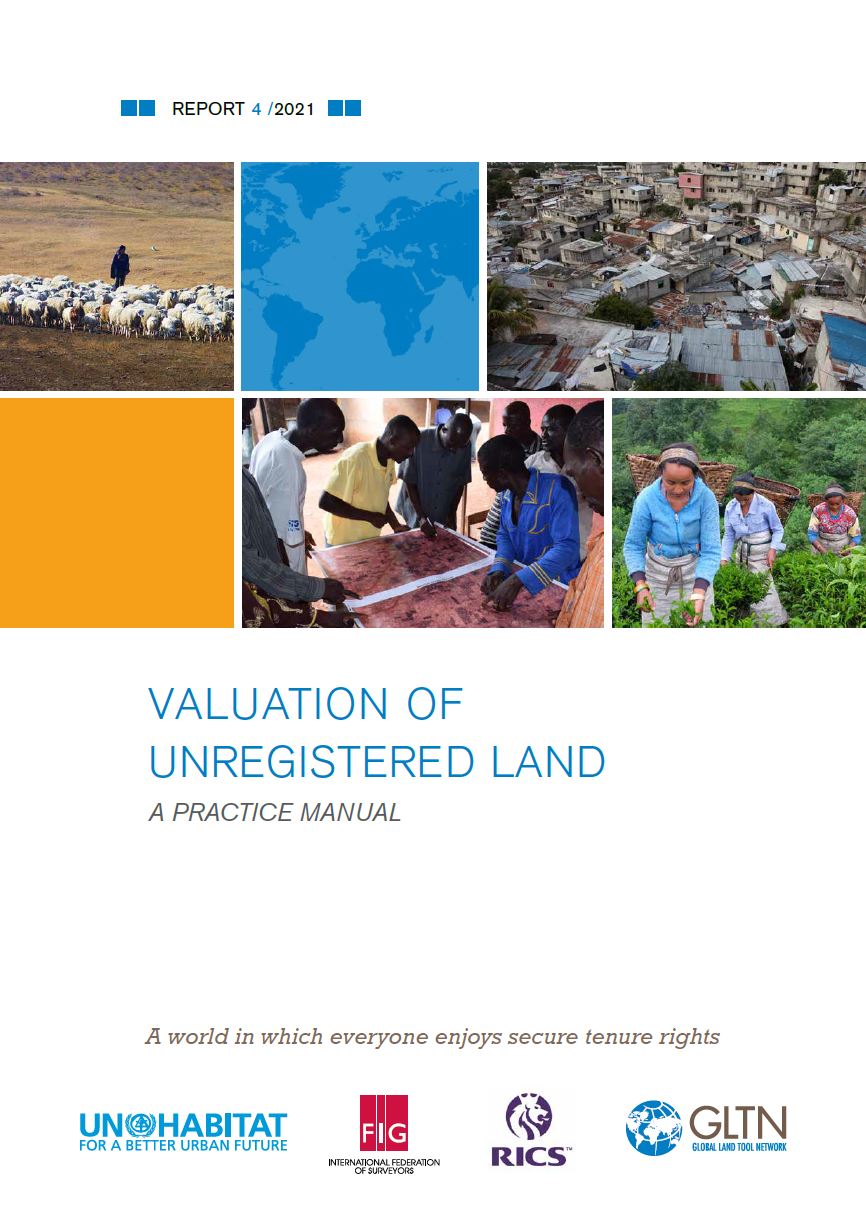
Value, and its attribution to unregistered land, is important information for effective land acquisition, taxation and transfer processes and a key component of land administration systems.
Where Bottom-Up and Top-Down Meet: Challenges in Shaping Sustainable & Scalable Land Interventions
LAND-at-scale is a land governance support program for developing countries from the Ministry of Foreign Affairs of the Netherlands, which was launched in 2019. The aim of the program is to directly strengthen essential land governance components for men, women and youth that have the potential to contribute to structural, just, sustainable and inclusive change at scale in lower- and middle-income countries/regions/landscapes. The program is designed to scale successful land governance initiatives and to generate and disseminate lessons learned to facilitate further scaling.
Webinar Report: Land Consolidation Legislation
Land consolidation is a well-proven land management instrument, which has traditionally been used for agricultural development with a main objective of reducing land fragmentation and increasing holding and farm sizes. Some European countries have a land consolidation tradition that goes back a hundred years or more. It is also widespread in particular in countries in Asia but also in Africa.
Land Tenure Security: An Essential Component of Responsible Land Administration
In many countries around the world, the land administration system deals only with formal land rights, often subject to legislation passed during the colonial period. Formal or statutory tenure is where a landholder’s rights are specified in the law. This enables the owner(s) or rightholder(s) to rely on the law to defend his or her rights. But the poor often hold their land through customary or informal tenure systems which are often not recognized in law or in practice and therefore they lack the tenure security provided by the law.
Land Governance Lost in Translation - Exploring Semantic Technologies to Increase Discoverability of New Technologies & Data

Language and technology barriers are a very serious constraint to effectively exchange and learn from land data, information and technologies across the globe. We would like to explore whether we can gain inspiration from how semantic web technologies have overcome knowledge-sharing challenges in other sectors, such as the agriculture sector. With emerging technologies, new tools and ever-growing amounts of land data, we face a very real risk of losing the overview. Without this overview, data is much less likely to be used and thus be useful.