The Netherlands’ Cadastre, Land Registry and Mapping Agency – in short Kadaster – collects and registers administrative and spatial data on property and the rights involved. This also goes for ships, aircraft and telecom networks. Doing so, Kadaster protects legal certainty. We are also responsible for national mapping and maintenance of the national reference coordinate system. Furthermore, we are an advisory body for land-use issues and national spatial data infrastructures.
Our information is available predominantly through online web services, including information on energy labels of houses and underground cables and pipelines. Our main customer groups are civil-law notaries, local authorities, businesses, financial institutions and private individuals. Kadaster maintains the Key Registers Cadastre and Topography.
Kadaster performs its public tasks in service of society. This is reflected in the way we are organised and the ways in which we publicly account for how we work.
Members:
Resources
Displaying 1 - 5 of 15Global Scaling up of Women’s Land Rights

A discussion paper attempting to take stock of what works and does not work in interventions seeking to promote and enhance women’s land rights. Looks at both individual and community land tenure, rural and urban land, arable and forest land. Describes a variety of interventions in as much detail as possible to understand why the intervention worked or not. Makes recommendations for scaling up women’s land rights.
Fit-For-Purpose Land Administration
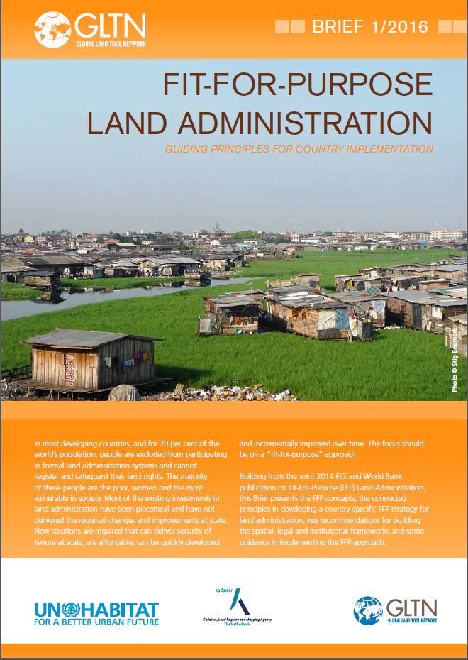
The FFP approach provides a new, innovative and pragmatic solution to land administration focused on developing countries, where current land administration solutions are not delivering.
Fit-For-Purpose Land Administration
The FFP approach provides a new, innovative and pragmatic solution to land administration focused on developing countries, where current land administration solutions are not delivering.
Fit-For-Purpose Land Administration
The FFP approach provides a new, innovative and pragmatic solution to land administration focused on developing countries, where current land administration solutions are not delivering.
Fit-For-Purpose Land Administration
The FFP approach provides a new, innovative and pragmatic solution to land administration focused on developing countries, where current land administration solutions are not delivering.