Mapeo, análisis y monitoreo participativos de los recursos naturales en una microcuenca

Journal Articles & Books
Diciembre, 1999
AGROVOC URI:
The transmission of malaria in Sri Lanka is unstable; its incidence greatly fluctuates from year to year and exhibits important variations within a year. Identification of the underlying risk factors of malaria is important to target the limited resources for the most-effective control of the disease. This report presents the first results of a project on malaria risk mapping to investigate whether this tool could be utilized to forecast malaria epidemics.
The purpose of this study was to identify risk areas in Thailand where insecticide resistance in malaria mosquitoes might develop as a consequence of crop protection activities in agriculture. The study provides guidelines on how to delineate risk areas. A review of insecticide resistance in disease vectors and the potential role of agricultural insecticides is presented.
Proceedings of a workshop held in Embilipitiya, Sri Lanka, 29th March 2001. Presents preliminary findings on malaria patterns and possible risk factors and describes the progress of IWMI research towards developing a risk map for Sri Lanka. It also contains presentations by Regional Malaria Officers, and other officials involved in malaria control, on areas of high malaria risk within their districts.

OBJETIVO: Identificar zonas geográficas de América Latina y el Caribe para la biofortificación de cultivos básicos como frijol, maíz, arroz, yuca y batata, contribuyendo así a reducir las deficiencias nutricionales en la Región.
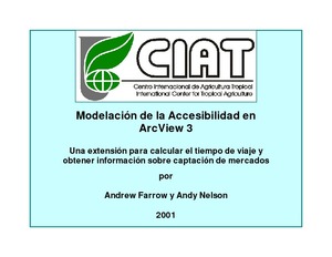
CIAT programmed this simple and flexible GIS tool to automate the creation of accessibility surfaces. Previously, these surfaces were laboriously created, step-by-step, using ArcINFO software from the Environmental Systems Research Institute (ESRI). You can install the Accessibility Analyst if you have the ESRI ArcView 3 software and its ArcView Spatial Analyst. From this page, you can download the extension and documentation, see case studies of the extension at work, and follow up links with other people working in the same field.
The world is facing severe and growing challenges in maintaining water quality and meeting the rapidly growing demand for water resources. In addition, water used for irrigation, the largest use of water in most developing countries, will likely have to be diverted increasingly to meet the needs of urban areas and industry whilst remaining a prime engine of agricultural growth. Finally, environmental and other in-stream water demands become more important as economies develop.