There are 1, 167 content items of different types and languages related to Sistemas de información geográfica on the Land Portal.
Sistemas de información geográfica
AGROVOC URI:
Spatial analysis of wild peanut distributions and the implications for plant genetic resources conservation

Journal Articles & Books
Diciembre, 2002
Paraguay
Bolivia
América central
América del Sur
Spatial analysis to support geographic targeting of genotypes to environments
Journal Articles & Books
Diciembre, 2013
Spatial analysis of 'food poverty' in Ecuador
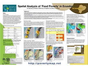
Diciembre, 2004
Ecuador
América central
América del Sur
Spatial decision support for selecting tropical crops and forages in uncertain environments.Thesis (Ph.D.)
Journal Articles & Books
Diciembre, 2004
América central
América del Sur
Spatial analysis of intraspecific diversity: a point-centred approach
Reports & Research
Diciembre, 1997
Suivi par teledetection des cultures de decrue dans la vallee du fleuve Senegal en saison froide 2000/2001. In FrenchEstimating crop yield in flood recession agriculture in the Senegal River Valley using remote sensing
Reports & Research
Diciembre, 2001
Senegal
África occidental
In the Senegal river floodplain, irrigated agriculture and traditional flood recession crops (mainly sorghum) coexist. The latter depends upon the extent of the annual flood, which is partly a function of the amount of water released from the upstream Manantali reservoir. Even though recession sorghum yield is clearly smaller than that of irrigated rice, this production system, because it covers a large area, is a major contributor to total food production in Podor and Matam departments. It is therefore important to quantify areas and yields.
Summaries of papers presented at the IRMU seminar series
Journal Articles & Books
Diciembre, 1996
Sri Lanka
Canadá
Indonesia
Surface runoff estimation over heterogeneous canal commands applying medium resolution remote sensing data with the SCS-CN method
Conference Papers & Reports
Diciembre, 2010
The precise estimation of surface runoff from rainfall is critical for water resource management. In the recent past, remote sensing and Geographic Information System (GIS) technologies have been widely used in the estimation of surface runoff from watersheds, and from agricultural fields in particular. This is due to the inherent ability of remote sensing to capture spatial heterogeneity of surface parameters such as land use and land cover. This could lead to better performances of surface runoff simulation models.
Sustainability of a warabandi system: SRS and GIS techniques to help identify issues
Conference Papers & Reports
Diciembre, 1997
India
Asia meridional
Sustaining surface and groundwater resources: proceedings of the International Workshop on Conjunctive Water Management for Sustainable Irrigated Agriculture in South Asia, Lahore, Pakistan, April 16-17 2002
Conference Papers & Reports
Diciembre, 2002
Pakistán
Australia