There are 1, 162 content items of different types and languages related to sistema de informação geográfica on the Land Portal.
sistema de informação geográfica
AGROVOC URI:
Spatial analysis to support geographic targeting of genotypes to environments

Journal Articles & Books
Dezembro, 2013
Spatial decision support for selecting tropical crops and forages in uncertain environments.Thesis (Ph.D.)
Journal Articles & Books
Dezembro, 2004
América Central
América do Sul
Spatial analysis of intraspecific diversity: a point-centred approach
Reports & Research
Dezembro, 1997
Spatial analysis of socio-economic issues: Gender and GIS in Nepal
Journal Articles & Books
Dezembro, 2003
Nepal
Ásia Meridional
Spatial patterns in socioeconomic data reveal issues and trends that would otherwise be missed by data aggregation to political or other units. Geographic Information System (GIS) tools provide display and analysis capabilities that are underutilized by many social scientists. The present article combines field-based surveys that maintain locational information with GIS tools to examine gender roles, responsibilities, and workloads in a spatial context for a case-study watershed in Nepal. Adult women outworked men by an average of 3.8 hours per day.
Spatial analysis of soil fertility management using integrated household and GIS data from smallholder Kenyan farms
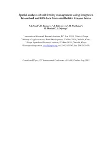
Conference Papers & Reports
Agosto, 2003
Quênia
África
África Oriental
Although soil fertility is recognized as a primary constraint to agricultural production in developing countries, use of fertilizer in Sub-Saharan Africa is declining. Smallholder farmers still rely heavily on livestock manure for soil fertility management. To explore the determinants of soil fertility management practices, including both the use of cattle manure and inorganic fertilizer, data are used from a sample of 3,330 geo-referenced farm households across Central and Western Kenya. A bivariate probit model is applied to jointly examine the use of the two technologies.
Suivi par teledetection des cultures de decrue dans la vallee du fleuve Senegal en saison froide 2000/2001. In FrenchEstimating crop yield in flood recession agriculture in the Senegal River Valley using remote sensing
Reports & Research
Dezembro, 2001
Senegal
África Ocidental
In the Senegal river floodplain, irrigated agriculture and traditional flood recession crops (mainly sorghum) coexist. The latter depends upon the extent of the annual flood, which is partly a function of the amount of water released from the upstream Manantali reservoir. Even though recession sorghum yield is clearly smaller than that of irrigated rice, this production system, because it covers a large area, is a major contributor to total food production in Podor and Matam departments. It is therefore important to quantify areas and yields.
Summaries of papers presented at the IRMU seminar series
Journal Articles & Books
Dezembro, 1996
Sri Lanka
Canadá
Indonésia
Surface runoff estimation over heterogeneous canal commands applying medium resolution remote sensing data with the SCS-CN method
Conference Papers & Reports
Dezembro, 2010
The precise estimation of surface runoff from rainfall is critical for water resource management. In the recent past, remote sensing and Geographic Information System (GIS) technologies have been widely used in the estimation of surface runoff from watersheds, and from agricultural fields in particular. This is due to the inherent ability of remote sensing to capture spatial heterogeneity of surface parameters such as land use and land cover. This could lead to better performances of surface runoff simulation models.
Sustainability of a warabandi system: SRS and GIS techniques to help identify issues
Conference Papers & Reports
Dezembro, 1997
Índia
Ásia Meridional
Sustaining surface and groundwater resources: proceedings of the International Workshop on Conjunctive Water Management for Sustainable Irrigated Agriculture in South Asia, Lahore, Pakistan, April 16-17 2002
Conference Papers & Reports
Dezembro, 2002
Paquistão
Austrália