Pasar al contenido principal

page search

There are 2, 446 content items of different types and languages related to Ordenación de tierras sostenible on the Land Portal.
Displaying 673 - 684 of 1355

Interdependences between Smallholder Farming and Environmental Management in Rural Malawi: A Case of Agriculture-Induced Environmental Degradation in Malingunde Extension Planning Area (EPA)

Peer-reviewed publication
Junio, 2013

The objective of this article was to develop a deeper understanding of the interdependences between smallholder farming and the state of environmental management in rural Malawi. We examined the agricultural local governance framework in Malingunde Extension Planning Area (EPA), its contribution to food security and how it conflicts with overall land and forest resources management. The charcoal production process was discussed in line with its implications for agricultural production and environmental sustainability.

Integrating Dendrochronology, Climate and Satellite Remote Sensing to Better Understand Savanna Landscape Dynamics in the Okavango Delta, Botswana

Peer-reviewed publication
Diciembre, 2013

This research examines the integration and potential uses of linkages between climate dynamics, savanna vegetation and landscape level processes within a highly vulnerable region, both in terms of climate variability and social systems. We explore the combined applications of two time-series methodologies: (1) climate signals detected in tree ring growth, from published literature, chronologies from the International Tree-Ring Data Bank, and minimal preliminary field data; and (2) new primary production (NPP) data of vegetation cover over time derived from remotely sensed analyses.

Simulating Future Forest Cover Changes in Pakxeng District, Lao People’s Democratic Republic (PDR): Implications for Sustainable Forest Management

Peer-reviewed publication
Marzo, 2013
Laos

Future forest cover changes were simulated under the business-as-usual (BAU), pessimistic and optimistic scenarios using the Markov-cellular automata (MCA) model in Pakxeng district, Lao People’s Democratic Republic (PDR). The Markov chain analysis was used to compute transition probabilities from satellite-derived forest cover maps (1993, 1996, 2000 and 2004), while the “weights of evidence” procedure was used to generate transition potential (suitability) maps.

Estratégia nacional de Conservação da Natureza e Biodiversidade ENCNB 2025 (Portugal)

Manuals & Guidelines
Mayo, 2017
Portugal

A ENCNB é um instrumento fundamental da prossecução da política de ambiente e na resposta às responsabilidades nacionais e internacionais de reduzir a perda de património natural. Avaliações à escala regional e global evidenciam, de modo crescente, que a prosperidade económica e o bem-estar da sociedade são suportados pelo capital natural, o que inclui os ecossistemas naturais e os seus serviços cuja funcionalidade depende, em larga escala, da utilização sustentável e eficiente dos recursos.

Estratégia e Plano de Ação de Segurança Alimentar e Nutricional

Manuals & Guidelines
Agosto, 2007
Mozambique

A Estratégia de Segurança Alimentar e Nutricional (ESAN II) resulta da evolução da

ESAN I aprovada pelo Governo de Moçambique em 1998, através da Resolução Interna

16/98. A ESAN I foi elaborada na sequência da Cimeira Mundial de Alimentação

(CMA), realizada em Roma em 1996, quando os diversos países se comprometeram a

reduzir a fome para metade até 2015. Este objectivo coincide com o Objectivo número

um do Desenvolvimento do Milénio (ODM), aprovado na Cimeira do Milénio, em 2000.

DEVELOPMENT AND IMPLEMENTATION OF THE LAND MANAGEMENT SYSTEM: AN IMPETUS OR A DETERRENT TO EFFECTIVE AND EFFICIENT LAND MANAGEMENT IN KENYA?

Journal Articles & Books
Febrero, 2016
Kenya

A Land Information Management System (LIMS) is an information system that enables the capture, management, and analysis of geographically referenced land-related data in order to produce land information for decision-making in land administration and management. The system is a Geospatial Information System (GIS) driven for the purposes of handling and managing parcel based information. The Republic of Kenya, located in East Africa, ranks 33rd in the world in terms of population with 38.6 million people and has a land area of 224,081 square miles.

Land for infrastructure development: compulsory acquisition and compensation of unregistered/undocumented land in Kenya

Journal Articles & Books
Febrero, 2017
Kenya

Kenya’s Vision 2030 aims at transforming the country into a newly industrialized middle income country


and infrastructural development is high on the agenda to achieve this. Competing land uses and existing


interests in land make the use of eminent domain by government in acquiring land inevitable. However


most of the land earmarked for compulsory acquisition comprises of un- registered land whose interests


Land laws amendment bills: a practitioner’s perspective on the land bills

Journal Articles & Books
Agosto, 2014
Kenya

The first set of the land laws were enacted in 2012 in line with the timelines outlined in the Constitution of Kenya 2010. In keeping with the spirit of the constitution, the Land Act, Land Registration Act and the national Land Commission Act respond to the requirements of Articles 60, 61, 62, 67 & 68 of the Constitution. The National Land Policy, which was passed as Sessional Paper No. 3 of 2009, arrived earlier than the Constitution, with some radical proposals on the land Management.

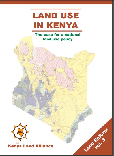
Land Use in Kenya; The case for a national land-use policy

Journal Articles & Books
Febrero, 2015
Kenya

This book exposes the key land use and environmental problems facing Kenya today due to lack of an appropriate national land use policy. The publication details how the air is increasingly being polluted, the water systems are diminishing in quantity and deteriorating in quality. The desertification process threatens the land and its cover. The soils are being eroded leading to siltation of the ocean and lakes. The forests are being depleted with impunity thus destroying the water catchments.

Unjust Enrichment

Journal Articles & Books
Reports & Research
Febrero, 2015
Kenya

Illegal and irregular allocations of public land were a common feature of the Moi regime and perhaps it’s most pervasive corrupt practice. The Ndung’u Report as well as various reports of the Public Investment Committee details numerous cases of public land illegal allocated to individuals and companies in total disregard of the law and public interest. Most allocations were made to politically correct individuals without justification and resulted in individuals being unjustly enriched at great cost to the people of Kenya.

Urban Land Use Planning Monitoring And Oversight Guidelines

Manuals & Guidelines
Noviembre, 2016
Kenya

Cities and Urban Areas play a crucial role as engines of development as well as centers of connectivity, creativity, innovation, and as service hubs for the surrounding areas. Kenya has experienced unprecedented urban growth. At independence the urban population was about 8%. This had grown to be about 40% by 2015. It is projected that by year 2030 at least half of the Kenyan population will be urbanized. The rapid rate of urbanization exerts increased pressure on authorities to meet the needs of growing urban populations.