Pasar al contenido principal

page search

Displaying 361 - 372 of 586

Development of soil information system for the Turkish Republic of Northern Cyprus

Policy Papers & Briefs
Diciembre, 2008
Chipre

In this study, detailed soil information based on Soil Mapping Units (SMU) that were identified during the soil survey were digitized using ArcGIS and Arc-View GIS software in order to create the Soil Information System (SIS) for the Turkish Republic of Northern Cyprus. A total of 7881 mapping units belonging to 109 soil series were compiled into the database. For each SMU geo-referenced physical, chemical and biological attributes in total 20 characteristics were entered. The selection of the criteria is based on the Soil Geographical Database for Eurasia and The Mediterranean.

Valuation of land use in the Netherlands and British Columbia: a spatial hedonic GIS-based approach

Reports & Research
Diciembre, 2008
Canadá
Países Bajos

The main reason for government intervention in land markets is market failure. Open space is a non-market output or externality of farmland and, although it might be important to people, there is no actual market for the good as such. The Netherlands and the Province of British Columbia in Canada both experience similar problems of expanding cities and pressure on open space, and they both use zoning to regulate land use and its externalities.

Determination the asppropriateness of Tokat Kazova lands to peach cultivation using geographic information system

Policy Papers & Briefs
Diciembre, 2008
Turkey

The aims of this study are to determine the appropriate peach orchard locations among Tokat Kazova lands and to classify the lands according to the suitability for peach cultivation by means of Geographic Information System (GIS). The distances and elevation differences of possible orchard locations to/from the available water resources, soil profile depth, soil profile texture, frost risk, land aspect, and land slope were considered as criterions to classify the lands of Tokat Kazova to determine appropriate lands for peach cultivation under Tokat Kazova conditions.

Qualitative assessment of the High Resolution soil sealing layer for the Netherlands

Reports & Research
Diciembre, 2008
Netherlands

The CLC2006 databases were produced by the Centre for Geo-Information (Alterra-WUR), the NRC Land cover for the Netherlands. The national CLC2006 project took place under the umbrella of the overall GMES Fast Track Service Percursor (FTSP) Land Monitoring. The basis for the production of the CLC2006 databases was the CLC2000 database that was also produced by the same team of Alterra. Alterra was also involved in the production of the CLC1990 database and the change database between 1990 and 2000.

Application of a GIS-BIOLOCO tool for the design and assessment of biomass delivery chains

Conference Papers & Reports
Diciembre, 2008

The spatial fragmentation of different biomass sources in one or more regions makes design and assessment of sustainable biomass delivery chains rather complicated. This paper presents a GIS tool that supports the design and facilitates a sustainability assessment of biomass delivery chains at a regional level, in terms of the regional availability of resources, costs, logistics and spatial and environmental implications. Green House Gas (GHG) efficiency targets are part of it.

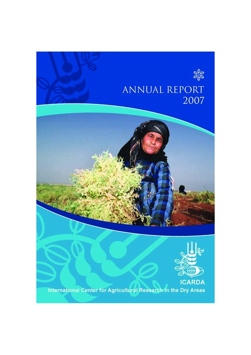
ICARDA Annual Report 2007

Reports & Research
Noviembre, 2008
Global

In 2007, ICARDA celebrated its thirtieth anniversary. The Center and its partners have worked together for three decades to improve the food security and livelihoods of the poor in dry and marginal areas. During this time, we have seen significant changes in the biophysical environment and in socio-economic circumstances. New farming technologies, new livelihood options, and better policies and institutions are speeding up agricultural development in the world's dry areas, and we are proud of the role we have played in this progress.

Soil organic carbon under different landscape attributes in croplands of Northeast China

Policy Papers & Briefs
Octubre, 2008
China

Soil organic carbon (SOC) was measured in topsoil samples of agricultural soils from 311 locations of Jiutai County, Northeast China. The spatial characteristics of SOC were studied using the Geographic Information Systems and geostatistics. Effects of other soil physical and chemical properties, elevation, slope, soil type and land use type were explored. SOC concentrations followed a lognormal distribution, with a geometric mean of 1.50%. The experimental variogram of SOC was fitted with an exponential model.

Assessing the stream water quality dynamics in connection with land use in agricultural catchments of different scales

Policy Papers & Briefs
Julio, 2008
República Checa

We introduce a simple method for estimating the changes of nitrate concentrations in surface waters regarding the land use modification. Stream and drainage water nitrate concentrations in prevailingly agricultural catchments of three different scales located in the Crystalline complex of the Czech massif, Czech Republic, were included in this study. Water quality samples were collected through the years 1992-2006 at monthly and bi-monthly intervals.

Assessing the stream water quality dynamics in connection with land use in agricultural catchments of different scales

Junio, 2008
Czech Republic

We introduce a simple method for estimating the changes of nitrate concentrations in surface waters regarding the land use modification. Stream and drainage water nitrate concentrations in prevailingly agricultural catchments of three different scales located in the Crystalline complex of the Czech massif, Czech Republic, were included in this study. Water quality samples were collected through the years 1992-2006 at monthly and bi-monthly intervals.

Topography impact on nutrition content in soil and yield

Policy Papers & Briefs
Junio, 2008

The main aim of this study was to determine the dependence of yield and selected soil properties on topography of the experimental field by using topographical data (elevation, slope and flow accumulation). The topography and yield data were obtained from a yield monitor for combine harvester, soil properties data were taken from sampling points of our experimental field. Initially, the topographical parameters of elevation and slope were estimated and then the Digital Elevation Model (DEM) grid was created.

Comparison of soil maps with different scales and details belonging to the same area

Policy Papers & Briefs
Enero, 2008
Turquía

Two different soil maps prepared by different institutes at scales of 1:200 000 and 1:25 000 covering identical areas were compared to determine the accuracy of reconnaissance. These soil maps are widely used in land resources assessment studies in Turkey. They were digitized and then the map layers were compared by using GIS technology in order to assess soil properties and land characteristics. The reconnaissance soil map at the scale of 1:200 000 has the highest accuracy for the slope.