Passar para o conteúdo principal

page search

There are 506 content items of different types and languages related to administração cadastral on the Land Portal.
Displaying 1 - 12 of 54

La agricultura chilena y el terremoto

Policy Papers & Briefs
Junho, 2010
Chile
América Central

 
*Miguel Ignacio Jerez Núñez
El pasado mes de febrero la población chilena vivió jornadas de angustia y luto, cuando varias regiones del sur y del centro del país fueron azotadas por un terremoto demoledor. Sobre esos hechos se han escrito numerosos artículos, estudios y testimonios. En el presente número de Diálogos se ofrece una mirada puntual sobre el impacto de la catástrofe en la agricultura chilena, particularmente en la situación de la pequeña agricultura o agricultura familiar.
La magnitud del daño

Cadastral Template 2.0 - Cambodia Country Profile

Multimedia
Setembro, 2015
Cambodja

The history of modern land management and administration in Cambodia begins with French initiatives in the late 19th century. The first Civil Code was adopted in 1920 and it established a system of French land law that recognized private property rights. Some traditional Cambodian rights, in particular that of creating a land right simply by occupation and possession, were included in the Civil Code. During the 1960s there was an adequate system of land management, including confirmation of private property rights with land records including cadastral maps and land titles.

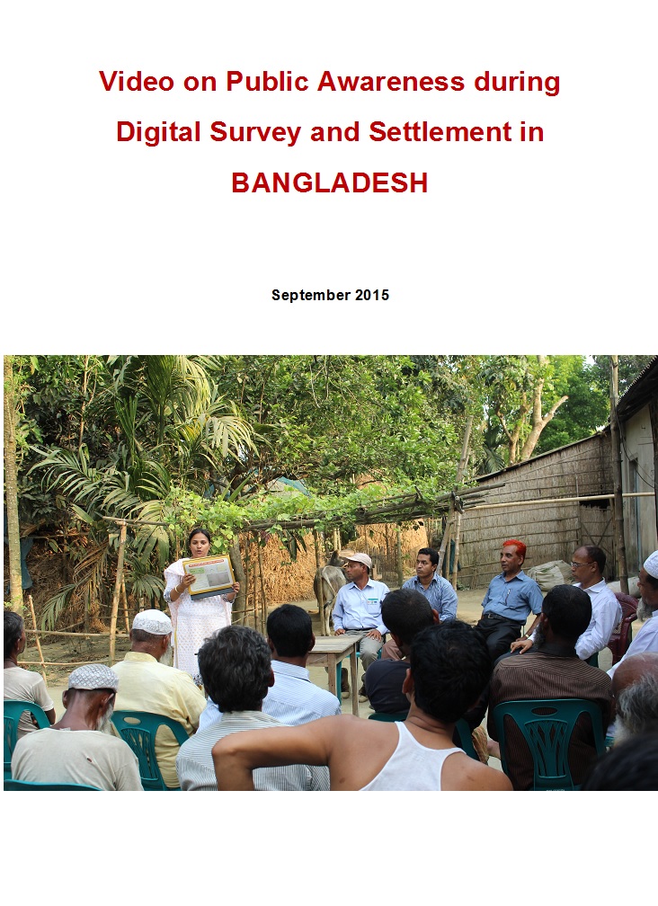
Video documentary on public awareness activities of Digital land Survey and Settlement

Videos
Fevereiro, 2015
Bangladesh

Uttaran (www.uttaran.net) is a local organisation (Bangladesh) working with vulnerable landowners i.e. women, widow, indigenous, minority and landless people to promote access to land. Uttaran is implementing a project titled, Sustainable Access to Land Equality-SALE' with support of European Union. SALE is the civil society component of overall access to land project that is lead by Department of Land Records and Surveys (DLRS) and Ministry of Land in Bangladesh.

Animated movie on Integrated Digital Land Records Systems -IDLRS in Bangladesh

Videos
Agosto, 2016
Bangladesh

Uttaran (www.uttaran.net) is a local organisation (Bangladesh) working with vulnerable landowners i.e. women, widow, indigenous, minority and landless people to promote access to land. Uttaran is implementing a project titled, Sustainable Access to Land Equality-SALE' with support of European Union. SALE is the civil society component of overall access to land project that is lead by Department of Land Records and Surveys (DLRS) and Ministry of Land in Bangladesh.

DEVELOPMENT AND IMPLEMENTATION OF THE LAND MANAGEMENT SYSTEM: AN IMPETUS OR A DETERRENT TO EFFECTIVE AND EFFICIENT LAND MANAGEMENT IN KENYA?

Journal Articles & Books
Fevereiro, 2016
Quênia

A Land Information Management System (LIMS) is an information system that enables the capture, management, and analysis of geographically referenced land-related data in order to produce land information for decision-making in land administration and management. The system is a Geospatial Information System (GIS) driven for the purposes of handling and managing parcel based information. The Republic of Kenya, located in East Africa, ranks 33rd in the world in terms of population with 38.6 million people and has a land area of 224,081 square miles.

Land for infrastructure development: compulsory acquisition and compensation of unregistered/undocumented land in Kenya

Journal Articles & Books
Fevereiro, 2017
Quênia

Kenya’s Vision 2030 aims at transforming the country into a newly industrialized middle income country


and infrastructural development is high on the agenda to achieve this. Competing land uses and existing


interests in land make the use of eminent domain by government in acquiring land inevitable. However


most of the land earmarked for compulsory acquisition comprises of un- registered land whose interests


Land Use in Kenya; The case for a national land-use policy

Journal Articles & Books
Fevereiro, 2015
Quênia

This book exposes the key land use and environmental problems facing Kenya today due to lack of an appropriate national land use policy. The publication details how the air is increasingly being polluted, the water systems are diminishing in quantity and deteriorating in quality. The desertification process threatens the land and its cover. The soils are being eroded leading to siltation of the ocean and lakes. The forests are being depleted with impunity thus destroying the water catchments.

LAND GOVERNANCE IN URBAN AREAS CASE OF NAIROBI CITY COUNTY

Journal Articles & Books
Fevereiro, 2017
Quênia

Globalisation and urbanisation trends in developing countries present both opportunities for growth and development on one hand while contributing to the complex myriad challenges of managing urbanisation on the other hand. Cities and urban areas play a critical in the development of a country. They provide platforms that incorporate intense combination of economic, cultural and political factors of a country or region. Nairobi city is Kenya’s economic capital and is a major economic hub in Africa.

Urban Land Use Planning Monitoring And Oversight Guidelines

Manuals & Guidelines
Novembro, 2016
Quênia

Cities and Urban Areas play a crucial role as engines of development as well as centers of connectivity, creativity, innovation, and as service hubs for the surrounding areas. Kenya has experienced unprecedented urban growth. At independence the urban population was about 8%. This had grown to be about 40% by 2015. It is projected that by year 2030 at least half of the Kenyan population will be urbanized. The rapid rate of urbanization exerts increased pressure on authorities to meet the needs of growing urban populations.

DEVELOPING LAND INFORMATION MANAGEMENT SYSTEM (LIMS) FOR COUNTY GOVERNMENTS IN KENYA: A CASE STUDY KIRINYAGA COUNTY.

Journal Articles & Books
Fevereiro, 2017
Quênia

This paper describes the development of a Land Information Management System (LIMS) for County Governments in Kenya. In the new Constitution 2010, devolution of some national government functions and formation of county governments was provided for. These invoked the development of new land laws to guide the devolution processes and procedures. According to the County Government Act 2012, all County Governments are supposed to develop digital Geographic Information System (GIS) based spatial plans and these calls for development of LIMS for and efficient breakthrough.

GOVERNANÇA FUNDIÁRIA FRÁGIL, FRAUDE E CORRUPÇÃO: UM TERRENO FÉRTIL PARA A GRILAGEM DE TERRAS

Reports & Research
Novembro, 2021
Brasil

O termo “grilagem” remete à prática antiga de forjar um título de propriedade e colocá-lo em uma gaveta com grilos para amarelar o documento, conferindo a aparência de um documento legitimo. As táticas se modernizaram, persistindo diversas práticas, conhecidas como grilagem, que buscam fraudar títulos e invadir terras com o objetivo de apropriar- -se indevidamente de áreas tanto públicas quanto particulares, muitas vezes com o auxílio de agentes corruptos, sejam eles da esfera pública ou privada.

III Seminário Internacional de Governança de Terras e Desenvolvimento Econômico: Regularização Fundiária

Journal Articles & Books
Dezembro, 2017
América Latina e Caribe
América do Sul
Brasil
É com enorme satisfação que apresentamos o resultado dos trabalhos do III SEMINÁRIO INTERNACIONAL DE GOVERNANÇA DE TERRAS E DESENVOLVIMENTO ECONÔMICO: REGULARIZAÇÃO FUNDIÁRIA, evento realizado entre os dias, 7, 8 e 9 de junho de 2017, no anfiteatro do Instituto de Economia da Unicamp.
 
Durante os 03 (três) dias de produtivas discussões, acadêmicos, especialistas e o público em geral tiveram a oportunidade de debater algumas das principais questões relativa à Regularização Fundiária, atuando como um instrumento que busca a otimização da gestão da