Passar para o conteúdo principal

page search

Displaying 1 - 12 of 33

Dimensionamento responsável da administração de terras adequada à finalidade: Equilíbrio entre os desafios tecnológicos e de governança

27 Setembro 2023

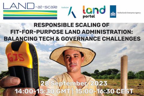
Junte-se a nós em um webinário instigante que explora os desafios e as direções futuras para ampliar a Administração de Terras Adequada ao seu Propósito (FFPLA - sigla em inglês) com base em experiências locais. As abordagens de FFPLA são amplamente reconhecidas e elogiadas por serem mais econômicas, rápidas e flexíveis (em termos de identificação espacial) do que os métodos convencionais de administração de terras.

Land Portal Foundation
Netherlands Enterprise & Development Agency
Kadaster International

Earth Observations for Humanitarian Applications

05 Junho 2024 - 19 Junho 2024

NASA’s Applied Remote Sensing Training Program (ARSET) has opened a new open, online webinar series: Earth Observations for Humanitarian Applications. Refugees, internally displaced people (IDPs), and other displaced populations are made more vulnerable to climate change impacts due to their socio-political marginalization. This three-part, intermediate training presents concrete strategies for mapping localized climate conditions with risks faced by refugee and IDP communities around the world.

The training will focus on flood risk assessments and specific challenges for assessing flood risk in refugee and IDP camps; gauging long-term heat stress in refugee camps and the challenges with decision making surrounding heat risk; and monitoring drought effects on agricultural landscapes in refugee settings using Earth observations (EO) to explore the correlations between anomalies in crop productivity and weather-based factors


Introduction to Lightning Observations and Applications

25 Março 2024 - 01 Abril 2024

NASA’s Applied Remote Sensing Training Program (ARSET) has opened a new open, online webinar series: Introduction to Lightning Observations and Applications. This three-part, introductory training focuses on global and regional lightning data products that can be applied to disaster risk preparedness.

As the intensity and frequency of extreme weather events are likely to increase due to climate change impacts, lightning activity will likely increase as well, causing more power outages, increased risks of wildfire ignition, and increased numbers of injuries and fatalities. Therefore, information about lightning activity is critical for better preparedness against these disasters.

Large Scale Applications of Machine Learning using Remote Sensing for Building Agriculture Solutions

04 Março 2024 - 18 Março 2024

NASA’s Applied Remote Sensing Training Program (ARSET) has opened a new open, online webinar series: Large Scale Applications of Machine Learning using Remote Sensing for Building Agriculture Solutions. Remote sensing data is becoming crucial to solve some of the most important environmental problems, especially pertaining to agricultural applications and food security. Participants will become familiar with data format and quality considerations, tools, and techniques to process remote sensing imagery at large scale from publicly available satellite sources, using cloud tools such as AWS S3, Databricks, and Parquet. Additionally, participants will learn how to analyze and train machine learning models for classification using this large source of data to solve environmental problems with a focus on agriculture. 


Land Rights for Sustainable Development - The Role of Data

16 Janeiro 2024
European Commission
Brussels
Belgium

Having secure land tenure, ensuring people's confidence in accessing, controlling and utilizing their land, is crucial for promoting sustainable land management practices. It also plays a key role in building resilience against the impacts of climate change, including extreme weather events, rising sea levels, and increased desertification due to higher temperatures.

International Land Coalition
Land Portal Foundation
Land Matrix
Prindex

Transforming Earth Observation (EO) Data into Building Infrastructure Data Sets for Disaster Risk Modeling

02 Outubro 2023 - 09 Outubro 2023

NASA’s Applied Remote Sensing Training Program (ARSET) has opened a new open, online, intermediate webinar series: Transforming Earth Observation (EO) Data into Building Infrastructure Data Sets for Disaster Risk Modeling. This three-part training, presented in English and Spanish, is open to the public and will cover the basics of natural hazard risk modeling and exposure development with a focus on fusing data from multiple datasets expressly for the purposes of risk assessment.  We will also present examples applying the techniques to applications related to flood risk assessment, climate adaptation, and earthquake modeling.

Monitoring Water Quality of Inland Lakes using Remote Sensing

17 Julho 2023 - 24 Julho 2023

NASA’s Applied Remote Sensing Training Program (ARSET) has opened a new open, online webinar series: Monitoring Water Quality of Inland Lakes using Remote Sensing. This advanced-level training will focus on using remote sensing observations from Landsat 8 and 9, Sentinel-2, and Sentinel-3 for assessing water quality parameters, including chlorophyll-a concentration, turbidity, and Total Suspended Solids (TSS) in inland lakes. This training will also highlight the importance of in situ measurements of these parameters, coincident with satellite observations, in developing methodologies for operational water quality monitoring.

O estado dos dados fundiários: Transformando a África em uma potência do futuro

21 Junho 2023

Este webinário tem como objetivo desenvolver o potencial de pesquisadores(as) e profissionais de toda a África para entender melhor as abordagens sustentáveis da governança de dados fundiários. O webinário destacará a importância da boa governança de dados fundiários para melhorar os direitos de propriedade e permitir serviços governamentais mais eficientes.

Land Portal Foundation
German Federal Ministry for Economic Cooperation and Development
Deutsche Gesellschaft für Internationale Zusammenarbeit (GIZ) GmbH
The Network of Excellence on Land Governance in Africa

Application of NASA SPoRT-Land Information System (SPoRT-LIS) Soil Moisture Data for Drought

16 Maio 2023 - 30 Maio 2023

NASA’s Applied Remote Sensing Training Program (ARSET) has opened a new open, online webinar series: Application of NASA SPoRT-Land Information System (SPoRT-LIS) Soil Moisture Data for Drought. This 3-part webinar series is focused on the introduction of the NASA Land Information System (LIS) output of soil moisture at various depths for drought analysis and monitoring. Examples from operational applications as well as practice exercises (for using LIS data for drought monitoring) will be included in this course. Access to the SPoRT-LIS products via online viewer, in GIS formats, and GIS-based display tools, will also be included. Moreover, self-paced microlessons will be available to help users confirm their understanding and improve their skill via homework lessons between live sessions.

Fundamentals of Machine Learning for Earth Science

19 Abril 2023 - 03 Maio 2023

NASA’s Applied Remote Sensing Training Program (ARSET) has opened a new online introductory webinar series: Fundamentals of Machine Learning for Earth Science. This three-part training, presented in English and Spanish, is open to the public and will provide attendees an overview of machine learning in regards to Earth Science, and how to apply these algorithms and techniques to remote sensing data in a meaningful way. Attendees will also be provided with end-to-end case study examples for generating a simple random forest model for land cover classification from optical remote sensing. We will also present additional case studies to apply the presented workflows using additional NASA data.