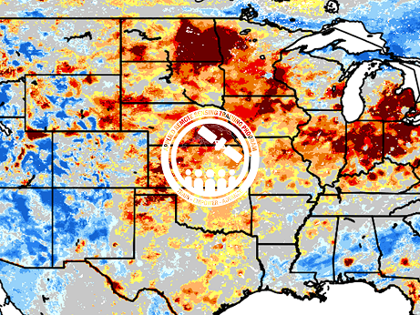
This training is focused on the introduction of the NASA Land Information System (LIS) output of soil moisture at various depths for drought analysis and monitoring. Traditional drought applications and indices focus on sensible weather (temperature, wind, etc.) and precipitation trends and their impacts on the hydrologic system. As a result of the NASA Short-term Prediction Research and Transition Center (SPoRT) program and its research-to-operations (R2O) work, this training will demonstrate how LIS output of soil moisture from a land surface model (LSM) can be included in traditional drought monitoring applications. The NASA SPoRT Program has implemented a version of NASA LIS (SPoRT-LIS) that utilizes near real-time Green Vegetation Fraction (GVF) from S-NPP/VIIRS retrievals, as opposed to static, climatology values of GVF.
Additionally, near real-time forcing of the LSM by the Multi-Radar Multi-Sensor (MRMS) precipitation and the Global Data Assimilation System (GDAS) sensible weather data provide near real-time, observation-driven products with ~2–8 hours latency. Each of these enable a more accurate depiction of vegetation and soil moisture impacts related to both long-term and short-term drought events, including rapid-onset flash drought events. Research-to-Operations work at SPoRT has led to the development of value-added products such as the derived percentile products for soil moisture. For example, low percentile values from SPoRT-LIS have been shown to correspond well to areas experiencing short-term drought within the U.S. Drought Monitor (USDM). Via Operations-to-Research (O2R) activities with end-users, soil moisture changes on various timescales pertinent to drought applications have been added to the SPoRT-LIS output data suite.
This training will improve the user’s understanding of how soil moisture is modeled within LIS in order to improve the interpretation and application of this output for drought monitoring. Conducted by experts in LIS and operational drought monitoring, the overall course will enable users to interpret SPoRT-LIS soil moisture percentile products for drought applications. Examples from operational applications as well as practice exercises (for using LIS data for drought monitoring) will be included in this course. Access to the SPoRT-LIS products via online viewer, in GIS formats, and GIS-based display tools, will also be included. Moreover, self-paced microlessons will be available to help users confirm their understanding and improve their skill via homework lessons between live sessions.
Relevant UN Sustainable Development Goals:
- Goal 2: End hunger, achieve food security and improved nutrition and promote sustainable agriculture
- Target 2.4: By 2030, ensure sustainable food production systems and implement resilient agricultural practices that increase productivity and production, that help maintain ecosystems, that strengthen capacity for adaptation to climate change, extreme weather, drought, flooding and other disasters and that progressively improve land and soil quality
- Target 6.4: By 2030, substantially increase water-use efficiency across all sectors and ensure sustainable withdrawals and supply of freshwater to address water scarcity and substantially reduce the number of people suffering from water scarcity
- Target 15.3: By 2030, combat desertification, restore degraded land and soil, including land affected by desertification, drought and floods, and strive to achieve a land degradation-neutral world
Course Dates: May 17, 24, & 31, 2023
Times: 10:00-11:30 or 15:00-16:30 EDT (UTC-4); There will be identical sessions at two different times of the day. Participants need only to register and attend one daily session.
Learning Objectives: By the end of this training, A user will be able to apply LIS output to efficiently analyze drought over large spatial areas in conjunction with current practices and to integrate this capability with existing data.
- Identify the NASA/LIS basics regarding the framework, input forcing, static fields, LSM structure, and output most relevant to drought
- Summarize the derived soil moisture percentile products and how these are created
- Apply SPoRT-LIS output and/or derived products to both complement existing data and overcome limitations to monitoring drought over large areas
- Recognize ‘best practices’ for LIS impact related to drought
- Configure LIS output file for viewing within a GIS-based display tool and for tailored output products and graphics
Audience: This training series is intended for local, state, regional, federal, and international governmental and non-governmental organizations interested in using NASA data for drought monitoring and forecasting. Appropriate for operational end-users, decision-makers, and researchers with interests/needs in assessing drought, water resources, agriculture, and wildland fire management.
Course Format: Three, 1.5-hour parts