There are 3, 432 content items of different types and languages related to gestão da água on the Land Portal.
gestão da água
AGROVOC URI:
Water rights in informal economies in the Limpopo and Volta basins
Reports & Research
Janeiro, 2010
Burkina Faso
Gana
Moçambique
África do Sul
Sudeste Asiático
África
Most African countries underwent water legislation reform since the 1990s, through
which existing plural legal systems were changed into nation-wide permit systems, in
which the state acts as custodian of the nation’s water resources. Although globally
heralded as the best way to manage water resources within the broader context of
Integrated Water Resource Management, this project examines the problematic
implications of the new laws for the majority of the rural and peri-urban poor. Since time
Water productivity impacts in the Nile BDC projects

Multimedia
Maio, 2011
Etiópia
África
África Oriental
In early May 2011, people working on the Nile Basin Development Challenge (http://nilebdc.org) met in Addis Ababa in a 'science and reflection workshop'. In this session 4 of the workshop, participants discussed what-how-why of some of the different aspects of water and productivity across Nile projects. This video contains video reports from the group discussions
Water users associations in the NEN [Near East and North Africa] Region: IFAD interventions and overall dynamics. [Project report submitted to IFAD by IWMI]
Reports & Research
Dezembro, 2012
Iémen
Sudão
Turquia
Ásia Central
Sudoeste Asiático
Norte de África
Water resource research and education in mountain communities
Journal Articles & Books
Dezembro, 2008
Bolívia
América do Sul
High elevation páramo (wetland) ecosystems in the Andes are important water sources for local communities and downstream agricultural and urban users. These headwater catchments, however, are often impacted by human activities (eg agricultural production) that affect both stream water quality and flow. Knowledge about water availability, quality, and use is essential for effective management but is often lacking, particularly in smaller mountain communities.

Water-use accounts in CPWF basins: Simple water-use accounting of the São Francisco Basin
Reports & Research
Dezembro, 2010
Brasil
América do Sul
This paper applies the principles of water-use accounts, developed in the first of the
series, to the São Francisco basin in South America. The São Francisco Basin lies wholly
within Brazil. There are several major dams and wetlands in the Basin.
Net runoff is about 16% of total precipitation. Grassland is the most extensive land use,
covering 59% of the Basin and uses 48% of the water. Rainfed agriculture covers 23%
of the basin, but uses 14% of the water in the Basin. Forest and woodland cover 16% of
Who will pay for water?: the Vietnamese state?s dilemma of decentralization of water management in the Red River Delta
Journal Articles & Books
Dezembro, 2007
Vietnam
Sudeste Asiático
Water-use accounts in CPWF basins: Models and Concepts
Reports & Research
Dezembro, 2010
Burkina Faso
Gana
África Ocidental
This paper applies the principles of water-use accounts, developed in the first of the series, to the Nile River basin in Northeast Africa. The Nile and its tributaries flow though nine countries. The White Nile flows though Uganda, Sudan, and Egypt. The Blue Nile starts in Ethiopia. Zaire, Kenya, Tanzanian, Rwanda, and Burundi all have tributaries, which flow into the Nile or into Lake Victoria.
What are the main drivers behind Ethiopian farmers soil and water conservations practices?
Reports & Research
Dezembro, 2012
Etiópia
África
África Oriental
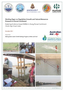
Working Paper on Population Growth and Natural Resource Pressures in Pursat Catchment
Reports & Research
Dezembro, 2013
Cambodja
This project examined the linkages between population and demand for food and water. Cambodia, in general, and Pursat Province in particular, have a complex and interesting mosaic of demographic attributes and development issues. The Tonle Sap basin and Pursat catchment possess the country’s largest potential water resources.
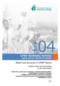
Water-use accounts in CPWF basins: Simple water-use accounting of the Volta Basin
Reports & Research
Dezembro, 2010
Burkina Faso
Gana
África Ocidental
This paper apples the principle of west –use accounts, developed in the first of the series, to the Volta River in West Africa. The Volta Basin covers six countries, with 85% of its area in Ghana and Burkina Faso.
Runoff in all three tributaries increases from 2-7% in the drier north to 12-26 % in the higher – rainfall south. Grassland is the dominant land use throughout Basin ranging from 76% of the Delta catchment in the south to 98% of the Arly catchment with corresponding water use of 55% and 92% of water used in each.