Passar para o conteúdo principal

page search

Issuesuso da terraLandLibrary Resource
There are 9, 839 content items of different types and languages related to uso da terra on the Land Portal.

uso da terra

AGROVOC URI:

Displaying 2809 - 2820 of 4573

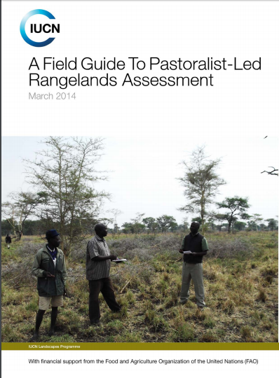
A Field Guide to Pastoralist-led Rangelands Assessment

Manuals & Guidelines
Fevereiro, 2014
Global

Community-Led Rangelands Assessment promotes the use of traditional or indigenous knowledge of pastoralists, as the dominant group utilizing rangelands, to guide planning and management of rangelands resources to support and build resilient pastoral livelihoods. Use of traditional knowledge is considered cheaper, easier to use and replicable. It promotes the respect of local communities’ culture and its integration into scientific methods.

A Delicate Balance

Journal Articles & Books
Fevereiro, 2014
África

Excluding the introductory and concluding chapters, this book has 11 chapters presented in three sections. The first section dwells primarily on conceptual issues, which comprehensively unravels large-scale agricultural investments and their impacts at the theoretical level.

Options for Support to Grassland Restoration in the context of Climate Change Mitigation

Reports & Research
Abril, 2012
Global

This report reviews the options for support to grassland restoration in the context of demand growth for livestock products and climate change mitigation. Key messages are: Grasslands provide crucial economic, social and environmental outputs Gasslands cover a total of 52.5 million km2 , or about 40% of the world’s ice-free terrestrial surface area. Extensive grasslands contribute about 7% of global beef production, 12% of sheep and goat meat production and 5% of global milk supply.

MAKING R ANGEL ANDS SECURE IN EAST AND HORN OF AFRICA

Policy Papers & Briefs
Outubro, 2012
África

INDEX 3.0 RECENT EVENTS 4.0 CERTIFYING CUSTOMARY OWNERSHIP FOR PASTORALISTS, UGANDA 5.0 MODEL FOR RECOGNISING COMMUNITY LAND RIGHTS IN KENYA 6.0 PARTICIPATORY MAPPING AS TOOL FOR SECURING RIGHTS 7.0 DEVELOPING A LAND USE MASTER PLAN, KITENGELA 8.0 SECURING WOMEN’S RIGHTS TO LAND, GARBA TULA 9.0 UPDATE ON RANGELAND OBSERVATORY 10.0 PROTECTING COMMON PROPERTY RIGHTS IN INDIA THROUGH COMMUNITY MOBILISATION 11.0 PASTORALISTS AND HUNTER GATHERERS SEEK PROTECTION IN TANZANIA’S NEW CONSTITUTION 12.0 ENDNOTES

CONSERVATION AND LAND GRABBING: PART OF THE SOLUTION OR PART OF THE PROBLEM?

Policy Papers & Briefs
Maio, 2013
África

2.0 OTHER RECENT EVENTS 5.0 MAASAI WOMEN LEAD STRUGGLE TO PROTECT LAND RIGHTS IN RECENT ROUNDS OF LOLIONDO CONFLICT 6.0 PARTICIPATORY RANGELAND MANAGEMENT (PRM): AN EFFECTIVE PROCESS FOR ETHIOPIA’S PASTORAL COMMUNAL LANDS? 7.0 NEW HOPE FOR THE TANA DELTA, KENYA 8.0 PASTORAL RESOURCE MAPPING AT SCALE,TO SUPPORT CLIMATE RESILIENT LIVESTOCK KEEPING IN TANZANIA 9.0 PASTORAL PEOPLES’ PARLIAMENT INDIA - A PLATFORM FOR THE UNHEARD, THE UNSEEN 11.0 OPPORTUNITIES FOR NEW LAND LAWS TO SUPPORT CBP&NRM IN MONGOLIA 12.0 ENDNOTES

Transformation of the learning initiative Making Rangelands Secure

Policy Papers & Briefs
Setembro, 2013
África

2.0 RECENT EVENTS 5.0 UGANDA GAZETTES A NATIONAL LAND POLICY 6.0 PLAYING THE “CONSERVATION CARD’: THE KHWE SAN IN NAMIBIA’S BWABWATA NATIONAL PARK 7.0 SECURING LAND TITLES FOR PASTORALIST WOMEN: THE STORY OF SAKALA 8.0 PROTESTS AGAINST CONVERSION OF PASTORAL LANDS INTENSIFY IN INDIA 9.0 PASTURE PROTECTOIN IN ADILA LOCALITY, DARFUR, SUDAN 10.0 VICTORIOUS IN TANZANIA 11.0 MORE RECENT EVENTS 12.0 18,000 CATTLE GIVEN PASSAGE ACROSS AUSTRALIA

LEARNING ROUTE: NAIROBI TO ARUSHA, FEBRUARY 2012

Journal Articles & Books
Junho, 2012
África
Quênia

INDEX 2.0 RECENT EVENTS 3.0 PROTECTING LIVESTOCK MOBILITY ROUTES: LESSONS LEARNED 4.0 KENYA’S CONSTITUTION 2010 What will it mean for tenure security in rangelands? ‘Equal rights for women’ say Maasai elders 5.0 CAN VILLAGE LAND USE PLANNING WORK FOR RANGELANDS? 6.0 PROTECTING RIGHTS OF HUNTER-GATHERERS IN TANZANIA 7.0 OTHER NEWS FROM THE REGION Improving rangeland quality through land use planning Developing policies in Uganda 8.0 LAUNCH OF RANGELAND OBSERVATORY

Participatory Land Use Planning to Support Tanzanian Farmer and Pastoralist Investment

Policy Papers & Briefs
Junho, 2014
Tanzania

The food security of more than 80% of Tanzania’s population and the country’s economic growth depend on family farming on certifi ed village lands. Realizing importance of smallholder’s roles in food security and economic development, the government introduced Village Land Use Planning (VLUP) as a tool towards sustainable family farming in support of green growth – a strategy for sustainably improving productivity within degrading natural resources.

PASTORALIST PARTICIPATION AND NETWORKING IN POLICY DIALOGUE: DIMENSIONS AND CHALLENGES

Conference Papers & Reports
Outubro, 2015
Global

Pastoralists have a unique relationship of mutual dependency with their livestock and their environment; the uniqueness of this relationship distinguishes them from other livestock keepers. They depend highly on the environment where they develop their livelihood, that they make productive through highly adapted animals, but at the same time the quality of this environment depends on how well they take care of it, which in turns depends on complex social regulations and on large-scale mobility. The way they keep their animals forms part of their daily life and of a complex culture.

Guidelines land evaluation for extensive grazing

Manuals & Guidelines
Janeiro, 2010
Global

Extensive grazing is the predominant form of land use on at least a quarter of the world’s land surface, in which livestock are raised on food that comes mainly from rangelands. The term livestock includes both domesticated animals such as cattle, sheep, goats, camels, horses, llamas and alpacas, and a broad range of wild animals kept for meat or game viewing. It is estimated that tropical grasslands alone cover 18 million square kilometres, where the natural vegetation is used by mobile animals requiring forage and water throughout the year.

Resource Atlas of Isiolo County, Kenya: Community-based mapping of pastoralist resources and their attributes

Reports & Research
Junho, 2015
Quênia

Participatory digital mapping using satellite imagery and digital earth and other open source Geographic Information Systems (GIS) is a practical tool bridging the knowledge and communication gap between pastoral communities and county government planners. It is offering an effective option for participatory planning and decision-making in support of climate change adaptation in the drylands of Kenya.


Land Use Planning Guidelines for Somaliland

Manuals & Guidelines
Fevereiro, 2009
África

Purpose of the guidelines The purpose of the present Guidelines is threefold: 1. to explain the basic principles of land use planning 2. indicate which land use planning activities could be carried out in Somaliland at different levels, and how 3. provide a number of tools and resources which could be of practical use by land use planners in Somaliland The guidelines are not a manual which has to be followed strictly. Such manuals could be developed at a later stage, particularly for land use planning at village level.