Passar para o conteúdo principal

page search

Displaying 1369 - 1380 of 6252

interactive water indicator assessment tool to support land use planning

Journal Articles & Books
Dezembro, 2012

This paper presents an interactive web‐based rapid assessment tool that generates key water related indicators to support decision making by stakeholders in land use planning. The tool is built on a consistent science based method that combines remote sensing with hydrological and socioeconomic analyses. It generates transparent, impartial, and verifiable information regarding the impact of land use changes on water productivity, water consumption, water availability, and employment.

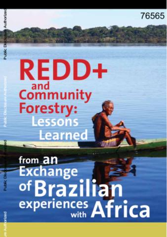
REDD+ and Community Forestry

Reports & Research
Policy Papers & Briefs
Dezembro, 2012
Brasil
África
América Latina e Caribe

This publication is the result of an initiative to promote an exchange between Brazil and African countries on lessons learned about the role of community forestry as a strategic option to achieve the goals of Reducing Emissions from Deforestation and Forest Degradation (REDD+). The initiative was supported by the World Bank with funding from the Global Environment Facility (GEF), and coordinated by the Amazonas Sustainable Foundation (FAS) with support from the National Forestry Agency International (ONFI).

Multifunctionele Platforms op Zee, het concept, de wet en regelgeving en de lessen voor de toekomst

Reports & Research
Dezembro, 2012

De mariene systemen en de kustzones worden steeds intensiever gebruikt voor verschillende functies. Hierdoor ontstaan nieuwe 'competing claims' op deze ruimte. Deze variëren van claims van natuur en biodiversiteit (zee-reservaten), vanuit de economie (visreservaten voor de visserij) tot het ontwikkelen van zones voor windmolens, boorplatforms, zandwinning, scheepvaart etc. Dit rapport geeft een beschrijving van een relatief nieuw fenomeen dat in opkomst is: Multifunctionele Platforms op Zee waarop maritieme activiteiten met elkaar zijn geclusterd op zee.

Scaling human-induced pressures to population level impacts in the marine environment : implementation of the prototype CUMULEO-RAM model

Reports & Research
Dezembro, 2012

For centuries the Dutch coastal waters and the North Sea were primarily used for fisheries and shipping, but during the last 20 years the number of uses has increased rapidly. These human uses (such as wind farms, mineral extraction, coastal defences and fisheries) will lead to a decrease in biodiversity and a reduction in ecosystem and mineral resources. Under several European policies and conventions, the EU North Sea member states must establish a sustainable management regime for the marine environment.

Impact van onderwaterlawaai onderzocht

Journal Articles & Books
Dezembro, 2012

Vroeger was de enige menselijke activiteit op zee de scheepvaart. Maar de Noordzee krijgt steeds meer windmolenparken, pijpleidingen en olieplatforms, en er wordt bijvoorbeeld gebaggerd en seismisch onderzoek gedaan. Over de effecten van geluiden onder water op het leven in zee is echter nog weinig bekend. In samenwerking met de gas- en olie-industrie proberen onderzoekers van onder meer IMARES daar beter zicht op te krijgen.

Ecologische ontwikkeling in een voor menselijke activiteiten gesloten gebied in de Nederlandse Waddenzee : tussentijdse analyse van de ontwikkeling in het gesloten gebied invergelijking tot niet-gesloten gebieden, vijf jaar na sluiting

Reports & Research
Dezembro, 2012

In dit project is de ontwikkeling van het ecosysteem in een voor menselijke activiteiten gesloten gebied (Referentiegebied) gevolgd en vergeleken met een gebied waar zulke activiteiten wel toegestaan zijn (controle-gebied). Hierbij is vooral gekeken naar benthische mariene fauna en de bodembedekking (schelpengruis) in de geul, maar ook litorale en sublitorale mosselbanken, de zeehondenpopulatie en de vogelvoorkomens zijn meegenomen.

Species in a dynamic world: Consequences of habitat network dynamics on conservation planning

Journal Articles & Books
Dezembro, 2012

Habitat dynamics (habitat turnover due to natural perturbations or human activity) are commonplace, particularly in intensively used landscapes. Conservation planning requires an understanding of how spatio-temporal habitat dynamics and species characteristics interact with and relate to species persistence. We conducted a systematic literature review to determine how spatial and temporal properties of habitat networks can be changed to improve species viability in dynamic landscapes.

Landuse planning for conservation of forest resources in Phitsanulok province 2560 b.e.

Conference Papers & Reports
Dezembro, 2012
Thailand

Objective of study were to simulate size area of land use change in Phitsanulok province from 2552 to 2560 B.E., and decided agriculture area and forest area, and to be use as a guideline map for formulating the land use and forest conservation, In Phitsanulok province. Geographic Information System couples with CLUE-S model by Logistic Regression and Markov chain model were used to predict of future land use in Phitsanulok province.