Passar para o conteúdo principal

page search

Displaying 1561 - 1572 of 3109

Utilising a farmer typology to understand farmer behaviour towards water quality management: Nitrate Vulnerable Zones in Scotland

Journal Articles & Books
Dezembro, 2011

Nitrate Vulnerable Zones (NVZ) are employed as compulsory instruments to meet standards on EU water quality. Farmers operating in NVZs face a number of restrictions on agricultural activity and a greater requirement for record keeping in relation to timing and quantities of nitrogen inputs used. This paper presents results of a survey into the attitudes and values of farmers within the designated Nitrate Vulnerable Zones (NVZs) in Scotland. A typology based on perceptions towards water quality management was developed using factor and cluster analysis techniques.

Water management and multiple land use: the dutch approach: competing and complementary functions in water management

Journal Articles & Books
Dezembro, 2011
Países Baixos

Climate change, food crises and deterioration of the environment create immense challenges in water management. In the Netherlands land subsidence, high population density and intensity of land use aggravate these problems. Increased awareness of these problems and civil society's participation in the discussions complicate these challenges. The Netherlands' Government Service for Land and Water Management (DLG), an organisation specialising in integrated land development, has tackled these problems at a regional/local scale.

Environmental factors of spatial distribution of soil salinity on flat irrigated terrain

Journal Articles & Books
Dezembro, 2011
Usbequistão

Inefficient irrigation and the excessive use of water on agricultural land in the Aral Sea Basin over several decades have led to saline soils. The main objective of this paper is to identify the environmental predictors to model the spatial distribution of soil salinity in a highly irrigated landscape. Soil salinity at farm scale was measured in the topsoil (Total Dissolved Solids, TDS) and down to a depth of 1.5m by electromagnetic conductivity meter (CMv) over a regular grid covering an area of approximately 15km² in Khorezm Province, Uzbekistan.

FEM–GIS based channel network model for runoff simulation in agricultural watersheds using remotely sensed data

Journal Articles & Books
Dezembro, 2011
Índia

Event based rainfall-runoff simulation is very important in water resources management. In this paper, an integrated watershed model considering important hydrological processes has been presented for the event based runoff simulation. Green–Ampt–Mein–Larson model has been used for the estimation of infiltration. For runoff estimation, kinematic wave equations are solved for a channel network using finite-element method. Remotely sensed data have been used for evaluating land use/land cover data.

Monitoring and assessing groundwater level by GIS:A case study in the irrigated soils of Bafra Plain in Northern Turkey

Policy Papers & Briefs
Dezembro, 2011

This study aimed to determine monthly and seasonal ground water level variations of agricultural soils of the right-land irrigated area in Bafra Plain using Geographical Information systems (GIS). To achieve this purpose, ground water levels were monitored at 62 different points. The maps of problematic areas for drainage were developed using the highest and lowest ground water levels to determine the problems caused by high ground water level.

Forest proportion as indicator of ecological integrity in streams using Plecoptera as a proxy

Journal Articles & Books
Dezembro, 2011

An assessment system suitable to support implementation of the EU Water Framework Directive's local water management plans should build on quantitative knowledge about a suite of well-documented indicator and umbrella species’ requirements for different stream orders. Assuring high communication value for improving local public awareness and participation for restoring ecological integrity in impaired headwater streams is critical. Loss and fragmentation of forests are major threats to ecological integrity.

An overview of the development challenges and constraints of the Niger Basin and possible intervention strategies

Reports & Research
Dezembro, 2011
Burkina Faso
Mali
Níger
Nigéria
África
África Ocidental

The Niger River Basin covers 7.5% of the African continent, and is shared between nine riparian

countries. The basin countries can be categorized into water resources producers, consumers, both

producers and consumers, and minimum contributors and consumers. As in the case for most

transboundary rivers, upstream and downstream conflicts emanating from the development and

utilization of the Niger River are inevitable and are expected to be intense, particularly given the

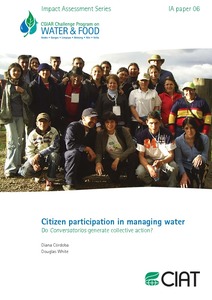
Citizen participation in managing water: Do Conversatorios generate collective action?

Reports & Research
Dezembro, 2011
Colômbia
América do Sul

A central challenge for effective watershed

management is improving the welfare of residents who

live in upper catchments while providing adequate

environmental goods and services to people and

areas downstream. A CPWF project, Sustaining

Collective Action Linking Economic and Ecological

Scales in Upper Watersheds (SCALES), addressed

this challenge in three sites.1 This document is an

evaluation of a project activity that intended to

enhance collective action in one site: the Coello

watershed of Colombia.

Conditions for collective action: Understanding factors supporting and constraining community-based fish culture in Bangladesh, Cambodia and Vietnam

Reports & Research
Dezembro, 2011
Bangladesh
Cambodja
Vietnam
Ásia Meridional
Sudeste Asiático
Ásia

Flood-prone ecosystems in South and Southeast Asia are traditionally farmed with deepwater rice followed by post-flood rice culture during the dry season. During the

flood season, the same land is inundated, creating an open-access water body subject to multiple uses by multiple users. Fish production in these areas is based on