Passar para o conteúdo principal

page search

Displaying 17809 - 17820 of 17904

Urban Land Cover Change in Ecologically Fragile Environments: The Case of the Galapagos Islands

Peer-reviewed publication

The Galapagos Islands are a unique sanctuary for wildlife and have gone through a fluctuating process of urbanization in the three main inhabited islands. Despite being colonized since the 1800s, it is during the last 25 years that a dramatic increase in population has been observed. Analyzing impervious surface change over this period in an ecologically fragile environment is a challenging task, thus two methods that have been widely employed in studying urban environments were compared in this study: sub-pixel using spectral mixture analyses (SMA) and object-based classification.

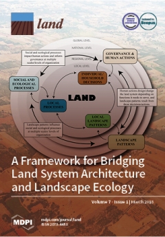
Moderating Climate Hazard Risk through Cooperation in Asian Drylands

Peer-reviewed publication
Ásia

Asia drylands face increasing climate hazard risk, changing socio-economic forces, and environmental challenges that affect community viability. As home to >1 billion residents, deserts are at the centre of the continent’s climate-human predicament. Extreme water scarcity, dependence on food imports and now conflict increase hazard exposure across shared drylands, yet management differs from state to state. This paper argues that a more coherent strategy for mitigating risk would be based on natural environments.

“Medium-Scale” Forestland Grabbing in the Southwestern Highlands of Ethiopia: Impacts on Local Livelihoods and Forest Conservation

Peer-reviewed publication
Etiópia

Tropical forest provides a crucial portion of sustenance in many rural communities, although it is increasingly under pressure from appropriations of various scales. This study investigated the impacts of medium-scale forestland grabbing on local livelihoods and forest conservation in the southwestern highlands of Ethiopia. Data were generated through interviews, discussions and document review.

Salween River

Reports & Research
Myanmar

The Salween River originates in the eastern highlands of the Tibetan Plateau and flows through valleys that are at first steep and narrow, then increasingly broad as the river approaches the tropical lowlands. Eventually it enters the Andaman Sea in eastern Myanmar.

The 2815 km long Salween river runs parallel to the mighty Mekong River for much of its course and forms part of the border between Myanmar and Thailand. When it flows through Yunnan, it is known as the Nujiang river.

World Rainforest Movement (WRM)

Reports & Research
Myanmar

A major resource. Several articles on Burma (use the Search and Info by country). Extremely good links page: NGOs, Intergovernmental Sites, Research Institutes; Other links. "The World Rainforest Movement is an international network of citizens' groups of North and South involved in efforts
to defend the world's rainforests. It works to secure the lands and livelihoods of forest peoples and supports their
efforts to defend the forests from commercial logging, dams, mining, plantations, shrimp farms,
colonisation and settlement and other projects that threaten them...

Forest Inform Pty Ltd

Reports & Research
Myanmar

Forest Inform Pty Ltd provides "Land Logic Services" that combine government agencies' and stakeholders’ decision rules with accurate spatial data to resolve forest land use conflicts, integrate regional development, prepare conservation plans, and Reduce Emissions from Deforestation and Forest Degradation (REDD+).

Myanmar Land, Agribusiness, and Forestry Forum (MYLAFF)

Reports & Research
Myanmar

MYLAFF - a forum for sharing information about land, rural livelihoods, forests, fisheries, agribusiness investment and natural resource management in Myanmar...
The main URL given here is the public entry to MYLAFF. For access to more documents, users have to sign up to MYLAFF...
*Members of the forum include government officials, staff of donor agencies and NGOs, project experts, academics and business people...

The World Agroforestry Centre (ICRAF)

Reports & Research
Myanmar

The World Agroforestry Centre (ICRAF) is a CGIAR Consortium Research Centre. ICRAF’s headquarters are in Nairobi, Kenya, with six regional offices located in Cameroon, China, India, Indonesia, Kenya and Peru.

The Centre’s vision is a rural transformation throughout the tropics as smallholder households increase their use of trees in agricultural landscapes to improve their food security, nutrition security, income, health, shelter, social cohesion, energy resources and environmental sustainability.

Myanmar Forest Information and Data

Reports & Research
Myanmar

TROPICAL RAINFORESTS: Deforestation rates tables and charts
...

"According to the U.N. FAO, 48.3% or about 31,773,000 ha of Myanmar is forested, according to FAO. Of this 10.0% ( 3,192,000 ) is classified as primary forest, the most biodiverse and carbon-dense form of forest. Myanmar had 988,000 ha of planted forest.

Change in Forest Cover: Between 1990 and 2010, Myanmar lost an average of 372,250 ha or 0.95% per year. In total, between 1990 and 2010, Myanmar lost 19.0% of its forest cover, or around 7,445,000 ha.

DEPARTMENT OF METEOROLOGY AND HYDROLOGY (MYANMAR)

Reports & Research
Myanmar

Objectives of the DMH is as follows:
(1) To take precautionary measures against and minimize the effects of natural disasters
(2) To promote safety, comfort, efficiency and regularity of air, land (rail & road), sea and inland water transportation.
(3) To bring sustainable development of natural resources (hydro electric power, forest produce, water use, wind energy, etc.)
(4) To promote agricultural and food production.