Passar para o conteúdo principal

page search

Displaying 133 - 144 of 195

Kenya Cimate-Smart Agriculture Monitoring and Evaluation Framework.

Dezembro, 2020
Kenya

This monitoring and evaluation framework (M&EF) for Climate-Smart Agriculture (CSA) has been developed to foster the effective transformation of the agricultural sector toward resilient, low-carbon development, and to check whether the implementation of the Kenya Climate Smart Implementation Framework (KCSAIF) objectives, outcomes, and outputs are proceeding as planned, in order to support optimal planning and efficiency in the utilization of resources.

Establishment of Permafrost Thermal Monitoring Sites in East Siberia

Peer-reviewed publication
Dezembro, 2020
United States of America

Permafrost lies close to the surface of the day, therefore, it is able to quickly respond to modern climatic changes. Under these conditions, the goal of understanding the evolution of permafrost in the near future requires monitoring studies of the current state of permafrost and, first of all, its thermal conditions.

Global Open Data Remote Sensing Satellite Missions for Land Monitoring and Conservation: A Review

Peer-reviewed publication
Outubro, 2020
Global

The application of global open data remote sensing satellite missions in land monitoring and conservation studies is in the state of rapid growth, ensuring an observation with high spatial and spectral resolution over large areas. The purpose of this study was to provide a review of the most important global open data remote sensing satellite missions, current state-of-the-art processing methods and applications in land monitoring and conservation studies.

Performance of the Remotely-Derived Products in Monitoring Gross Primary Production across Arid and Semi-Arid Ecosystems in Northwest China

Peer-reviewed publication
Setembro, 2020
China
Russia
United States of America

As an important component to quantify the carbon budget, accurate evaluation of terrestrial gross primary production (GPP) is crucial for large-scale applications, especially in dryland ecosystems. Based on the in situ data from six flux sites in northwestern China from 2014 to 2016, this study compares seasonal and interannual dynamics of carbon fluxes between these arid and semi-arid ecosystems and the atmosphere.

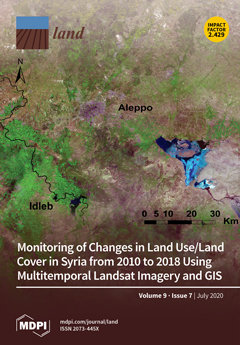
Monitoring of Changes in Land Use/Land Cover in Syria from 2010 to 2018 Using Multitemporal Landsat Imagery and GIS

Peer-reviewed publication
Julho, 2020
Syrian Arab Republic

Understanding the effects of socio-ecological shocks on land use/land cover (LULC) change is essential for developing land management strategies and for reducing adverse environmental pressures. Our study examines the impacts of the armed conflict in Syria, which began in mid-2011, and the related social and economic crisis on LULC between 2010 and 2018. We used remote sensing for change detection by applying a supervised maximum likelihood classification to Landsat images of the three target years 2010, 2014, and 2018.

Influence of Climate Change on the Thermal Condition of Yakutia’s Permafrost Landscapes (Chabyda Station)

Peer-reviewed publication
Maio, 2020
Russia

This paper presents the results of 39 years of observations conducted at the Chabyda station to monitor the thermal state of permafrost landscapes under current climatic warming. The analysis of long-term records from weather stations in the region has revealed one of the highest increasing trends in mean annual air temperature in northern Russia. The partitioning of the energy balance in different landscape units within the study area has been analyzed.

Using Social Network Analysis (SNA) to Assess the Availability of Spatial Data and Data Sharing Mechanisms in Rwanda

Peer-reviewed publication
Abril, 2020
Ruanda

This paper aims at analysing the extent to which spatial data are accessed and shared among stakeholders. It also uses Social Network Analysis to investigate institutional and individual behaviour in that process. Finally, it investigates the level of cooperation of all involved actors towards Spatial Data Infrastructure development. Results showed that public and private organizations have been individually engaged data collection and management. However, they are still using different standards and this has led to some disparities in terms of spatial data quality.

Building Harmonized Private and State Land Holding Data and Information Systems in Ethiopia

Peer-reviewed publication
Abril, 2020
Etiópia

Different government institutions in Ethiopia working on land related issues tackle and manage data and information independently, while their activities and mandates are often related or even overlapping. Ministry of Agriculture (MoA) deals with small holder rural land and until recently the Ethiopian Horticulture and Agricultural Investment Authority (EHAIA) was dealing with commercial agricultural land. Those institutions have not been able to share information each other’s data to make informed decisions.

ODS y Desarrollo Territorial Medición Experimental en el Norte Amazónico de Bolivia

Reports & Research
Março, 2020
Bolivia

El presente documento ODS Y DESARROLLO TERRITORIAL. Medición Experimental en el Norte Amazónico de Bolivia es un ejercicio de aplicación rigurosa de ocho de los 17 ODS, en un territorio delimitado, por una parte, para demostrar la utilidad de la medición y, por otra parte, para ejemplificar en la práctica las dificultades que se presentan y las respuestas metodológi- cas que es necesario hacer durante esa aplicación en espacios locales subnacionales.

Mapping and monitoring of the land use/cover changes in the wider area of Itanos, Crete, using very high resolution EO imagery with specific interest in archaeological sites

Reports & Research
Fevereiro, 2020
United States of America

Archaeological site mapping is important for both understanding the history and protecting the sites from excavation during developmental activities. As archaeological sites are generally spread over a large area, use of high spatial resolution remote sensing imagery is becoming increasingly applicable in the world. The main objective of this study is to map the land cover of the Itanos area of Crete and of its changes, with specific focus on the detection of the landscape’s archaeological features.

Land rights and investments: why business standards are not enough

Fevereiro, 2020

Notes that a record 212 land and environmental defenders were reported killed in 2019 but believes that the real number was certainly higher. Mining;logging and agribusiness were the main drivers of this. States that ‘verifying cases from Africa continues to be difficult. Limited monitoring of the issue by civil society;media repression and localised conflict mean attacks are probably underreported in some regions.Seven were reported killed in DR Congo;Burkina Faso;Uganda;Ghana and Kenya. Makes recommendations to governments;companies and investors.

Rangeland ecology

Dezembro, 2019
Kenya

Rangelands research in arid and semi-arid sub-Saharan Africa has been reinvigorated by renewed government and donor interest in pastoral livelihoods. The challenges facing productive rangelands remain competition over resources, which has been exacerbated by armed conflict; overuse of some rangelands as fragmentation continues; and the failure of many technical and governance interventions.