This paper presents an evaluation of the multi-source satellite datasets such as Sentinel-2, Landsat-8, and Moderate Resolution Imaging Spectroradiometer (MODIS) with different spatial and temporal resolutions for nationwide vegetation mapping. The random forests based machine learning and cross…
In this study, we compared pixel-based image analysis and object-based image analysis (OBIA) as methods of land cover classification of urban areas, using high resolution digital aerial photography. The study area was Setagaya Ward, Tokyo, Japan, and we carried out supervised classification…
To understand the rainfall-runoff process and sediment delivery process in headwater catchment, hydrological observation and the monitoring of suspended sediment concentrations (SSC) was conducted at a forested headwater catchment in Japanese Alps region. The study site is Nodagasawa watershed (…
This study aims to understand the effective management of abandoned properties such as forest, farmlands, houses in depopulated areas in Japan. Specifically, this study focuses on 'absentee landlords' who own their property away from their current residence. Descriptive analyses of the…
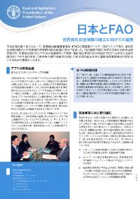
日本は過去数十年にわたって、国際連合食糧農業機関(FAO)の最重要パートナー国のひとつであり、食料安全保障の確立と天然資源の持続的利用の促進に努めてきました。FAO通常予算に対する日本の分担金は世界第2位、任意拠出金においても多大な貢献をしており、現在進行中の2500の現地プログラムを支える協力国のひとつでもあります。日本の持つ専門技術や人材は、FAOの取り組んできた農林水産業開発の分野においてきわめて重要といえます。
Quantitative assessment of the impacts of climate change on groundwater levels is important for sustainable groundwater use. This study examined the Tedori River alluvial fan in Ishikawa Prefecture, Japan, where paddy fields occupy 45 % of the total area. A regional groundwater flow model…
QUESTIONS: How does small linear grassland elements (paddy levees and road verges) contribute to plant diversity patterns in sites with modern or traditional management? Which factors determine small‐scale plant species richness of small linear grassland elements in a Japanese agricultural…
Most anthropogenic activities impacted on water quality and quantity, and further impacted on ecosystem services (ESs) in watershed are related to land use and climate changes those may cause losses of ecosystem functions. Effective information regarding ESs and their optimal priority…
This study analyzes a case which improved the utilization rate of arable land through production of rice for non-principal food. The main outcomes are as follows. Rice for non-principal food is produced jointly in Nagashima-cho by a lot of large-scale farmers. Land owners and cultivators have a…


