Location
The International Center for Agricultural Research in the Dry Areas (ICARDA) was established in 1977. It is one of 15 such centers supported by the CGIAR. ICARDA’s founding mandate to promote agricultural development in the dry areas of developing countries remains highly relevant today.
ICARDA works with a tight focus on the problem-solving needs of resource-poor farmers, achieving this through the in-field delivery of its research outputs. Although global food production has increased by 20 per cent in the past decade, food insecurity and poverty remain widespread, while the natural resource base continues to decline.
International research centers such as ICARDA, which have helped drive previous improvements, continue to deliver new technologies to support sustainable growth in agriculture, and crucially, to work with a wide range of partners to accelerate the dissemination of these technologies.
ICARDA’s biggest strength is its staff – 600 highly skilled men and women from 32 countries. Our research and training activities cover crop improvement, water and land management, integrated crop-livestock-rangeland management, and climate change adaptation.
Other interventions include:
- Water harvesting - supplemental irrigation and water-saving irrigation techniques
- Conservation agriculture methods to reduce production costs and improve sustainability
- Diversification of production systems to high-value crops – horticulture, herbal and medicinal plants
- Integrated crop/rangeland/livestock production systems including non-traditional sources of livestock feed
- Empowerment of rural women – support and training for value-added products.
The ICARDA genebank holds over 135,000 accessions from over 110 countries: traditional varieties, improved germplasm, and a unique set of wild crop relatives. These include wheat, barley, oats and other cereals; food legumes such as faba bean, chickpea, lentil and field pea; forage crops, rangeland plants, and wild relatives of each of these species.
ICARDA’s research portfolio is part of a long-term strategic plan covering 2007 to 2016, focused on improving productivity, incomes and livelihoods among resource-poor households.
The strategy combines continuity with change – addressing current problems while expanding the focus to emerging challenges such as climate change and desertification.
We work closely with national agricultural research systems and government ministries. Over the years the Center has built a network of strong partnerships with national, regional and international institutions, universities, non-governmental organizations and ministries in the developing world and in industrialized countries with advanced research institutes.
THE ‘DRY AREAS’
Research and training activities cover the non-tropical dry areas globally, using West Asia, North Africa, Central Asia and the Caucasus as research platforms to develop, test, and scale-out new innovations and policy options.
Dry areas cover 41 per cent of the world’s land area and are home to one-third of the global population. About 16 per cent of this population lives in chronic poverty, particularly in marginal rainfed areas. The dry areas are challenged by rapid population growth, frequent droughts, high climatic variability, land degradation and desertification, and widespread poverty. The complex of relationships between these challenges has created a "Poverty Trap."
Members:
Resources
Displaying 126 - 130 of 431GeOC User Guide
This is the user guide of the The Global Geo-Informatics Options by Context (GeOC) tool. The Global Geo-informatics Context and Options (GeCO) is a new web-based GIS tool that enables its users to define, monitor, assess and co-create knowledge and learning on relevant Sustainable Land Management (SLM) options that match the social-ecological context at global, regional and national scales.
Data domains of the GeOC Tool
This presentation illustrated the data domains of the GeOC tool. This presentation comes under the session 2 “GeOC in details” of the training "Sustainable Land Management Options by Context: Approach and Geospatial tool to support Achieving Land Degradation Neutrality”, held in Zaghouan on 16-17 March 2017.
Concept of land degradation neutrality

This presentation presented the concept of the "Land Degradation Neutrality", held in Zaghouan on 02-03 November 2016. This presentation comes under the introductory session of the training "Sustainable Land Management Options by Context: Approach and Geospatial tool to support Achieving Land Degradation Neutrality”, held in Zaghouan on 16-17 March 2017.
The web-based SLM form
This presentation illustrated the overview of the first session of the workshop "Systems Tool-aided Participatory Development of Sustainable Land Management Scenarios: 2nd Workshop", held in Zaghouan on 14-15 March 2017. This presentation comes under the training "Sustainable Land Management Options by Context: Approach and Geospatial tool to support Achieving Land Degradation Neutrality”, held in Zaghouan on 16-17 March 2017.
Concept and design of GeOC tool
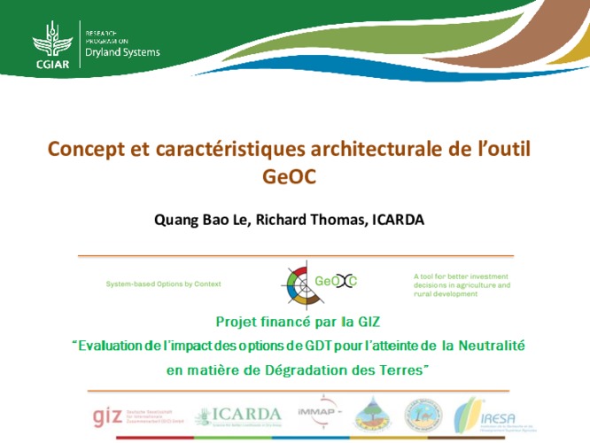
This presentation presented the concept and design of the GeOC tool. This presentation comes under the introductory session of the training "Sustainable Land Management Options by Context: Approach and Geospatial tool to support Achieving Land Degradation Neutrality”, held in Zaghouan on 16-17 March 2017.