Location
The International Center for Agricultural Research in the Dry Areas (ICARDA) was established in 1977. It is one of 15 such centers supported by the CGIAR. ICARDA’s founding mandate to promote agricultural development in the dry areas of developing countries remains highly relevant today.
ICARDA works with a tight focus on the problem-solving needs of resource-poor farmers, achieving this through the in-field delivery of its research outputs. Although global food production has increased by 20 per cent in the past decade, food insecurity and poverty remain widespread, while the natural resource base continues to decline.
International research centers such as ICARDA, which have helped drive previous improvements, continue to deliver new technologies to support sustainable growth in agriculture, and crucially, to work with a wide range of partners to accelerate the dissemination of these technologies.
ICARDA’s biggest strength is its staff – 600 highly skilled men and women from 32 countries. Our research and training activities cover crop improvement, water and land management, integrated crop-livestock-rangeland management, and climate change adaptation.
Other interventions include:
- Water harvesting - supplemental irrigation and water-saving irrigation techniques
- Conservation agriculture methods to reduce production costs and improve sustainability
- Diversification of production systems to high-value crops – horticulture, herbal and medicinal plants
- Integrated crop/rangeland/livestock production systems including non-traditional sources of livestock feed
- Empowerment of rural women – support and training for value-added products.
The ICARDA genebank holds over 135,000 accessions from over 110 countries: traditional varieties, improved germplasm, and a unique set of wild crop relatives. These include wheat, barley, oats and other cereals; food legumes such as faba bean, chickpea, lentil and field pea; forage crops, rangeland plants, and wild relatives of each of these species.
ICARDA’s research portfolio is part of a long-term strategic plan covering 2007 to 2016, focused on improving productivity, incomes and livelihoods among resource-poor households.
The strategy combines continuity with change – addressing current problems while expanding the focus to emerging challenges such as climate change and desertification.
We work closely with national agricultural research systems and government ministries. Over the years the Center has built a network of strong partnerships with national, regional and international institutions, universities, non-governmental organizations and ministries in the developing world and in industrialized countries with advanced research institutes.
THE ‘DRY AREAS’
Research and training activities cover the non-tropical dry areas globally, using West Asia, North Africa, Central Asia and the Caucasus as research platforms to develop, test, and scale-out new innovations and policy options.
Dry areas cover 41 per cent of the world’s land area and are home to one-third of the global population. About 16 per cent of this population lives in chronic poverty, particularly in marginal rainfed areas. The dry areas are challenged by rapid population growth, frequent droughts, high climatic variability, land degradation and desertification, and widespread poverty. The complex of relationships between these challenges has created a "Poverty Trap."
Members:
Resources
Displaying 356 - 360 of 431The use of the microcatchment water harvesting for fodder shrub production
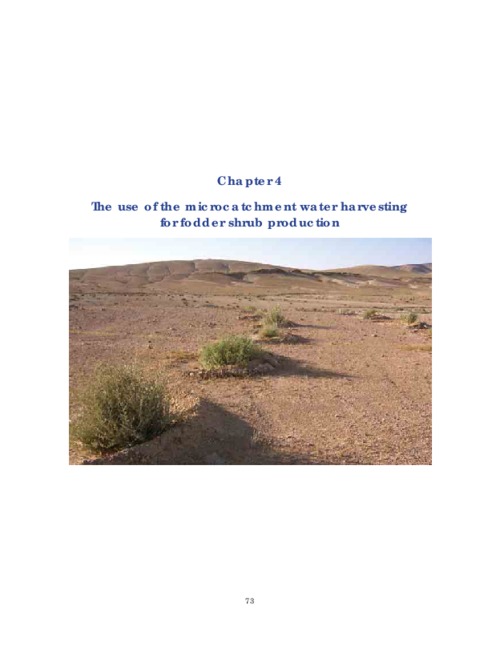
The Badia constitutes about 90% of the total land area of Jordan, which is 89 342 km2. Its average annual rainfall is < 200 mm. The area with annual rainfall of 100–200 mm is considered the promising rangeland for rehabilitation. The Badia (part of the rangeland) supplies the livestock sector with about 20% of forage needs, while all the other sources provide the sector with only about 5% of forage.
Role of current policies and institutions Egypt in improving irrigated agriculture

The objective of any national water policy is, normally, to ‘Generate the maximum possible economic value for the nation’. Under water scarcity situations, water should be allocated so that users who generate a higher income per unit volume of water are given priority over those who generate less income. This applies not only to water quantity, but also to water quality. The above statements are valid when water is considered as an economic commodity.
Towards sustainable and improved water productivity in the old lands of the Nile Delta

Almakatei village, located on Alatf canal, was selected purposely to represent the community. Its agricultural land is located across three main districts in Menoufia Governorate – Al Bagour, Shebin Al Koum and Quesna. This was considered as one of the main advantages of selecting this site. El-Menira tertiary on Alatf canal was selected as the site for the study of the pipeline group. It is about 870 m long and it serves an area of about 40 ha. El-Hamra tertiary was selected for the study of the open canal group and serves an area of 30 ha.
Guidelines for setting up community-based sheep breeding programs in Ethiopia: Lessons and experiences for sheep breeding in low-input systems
Selection of benchmark research watersheds in Libya

This report describes the use of improved methodologies developed to identify suitable watersheds based on an integrated resources management concept. The approach integrates multi-disciplinary knowledge, GIS utilities, and verification in the field to develop and test a methodology to identify watersheds with specific characteristics
– in this case, the watersheds most suited to the project activities.