Pasar al contenido principal

page search

IssuesOrdenación de tierrasLandLibrary Resource
There are 8, 235 content items of different types and languages related to Ordenación de tierras on the Land Portal.
Displaying 4657 - 4668 of 5231

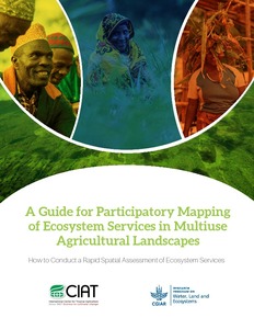
A Guide for participatory mapping of ecosystem services in multiuse agricultural landscapes: How to conduct a rapid spatial assessment of ecosystem services

Manuals & Guidelines
Noviembre, 2016
África
África oriental
Kenya
Malawi
Tanzania
Ghana

This guide presents a step-by-step approach in using a participatory mapping method with community members to identify and map ecosystem services and changes in their supply across multiuse agricultural landscapes. Non-governmental organizations (NGOs), government agencies and researchers can use this approach to learn from communities about how they use and access natural resources.

A method to identify and evaluate the legal and institutional framework for the management of water and land in Asia: the outcome of a study in Southeast Asia and the People?s Republic of China

Reports & Research
Diciembre, 2003
Bangladesh
Filipinas
Laos
China

By determining the capacity of relevant international, national and regional legislation to support sustainable use of water and land, planners, legislative drafters and policymakers have a basis for recommending legal and institutional reform. This report, based on an investigation into existing water- and land- management laws and issues in three countries in the region, offers a methodology that can be used for such evaluations.

A plot of one's own: gender relations and irrigated land allocation policies in Burkina Faso

Reports & Research
Diciembre, 1996
Burkina Faso
África occidental

Explores the effects of plots allocation on women's labor contributions in the Dakiri irrigation system of Burkina Faso. Compares intra-household distribution of income derived from agricultural activities when men are the sole owners of plots to income distribution when both men and women within the same household own irrigated plots.

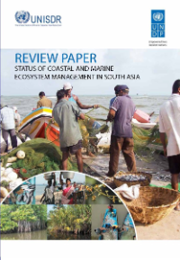
Review Paper: Status of Coastal and Marine Ecosystem Management in South Asia

Reports & Research
Septiembre, 2012
India

The coastal sub-region of South Asia including Bangladesh, India, the Maldives, Pakistan and Sri Lanka harbours some of the world’s most significant coastal and marine ecosystems such as coral reefs, mangroves, seagrass meadows, river deltas and estuaries. They play a crucial role in reducing the effects of natural disasters. The paper reviews the status of coastal and marine ecosystem management in the region to enable adoption of an integrated approach to ecosystem management for effective risk reduction.

Final Evaluation Report (Socio-economic Impact): Integrated Land and Ecosystem Management to Combat Land Degradation and Deforestation in Madhya Pradesh

Reports & Research
Marzo, 2016
India

The study assessed the socio-economic impact of the project supported by UNDP and the Government of Madhya Pradesh to support local communities in rehabilitating degraded forest, generating sustainable livelihoods and protecting the areas rich ecosystem. The project was supported by the Global Environment Facility.

Towards Creating a Model Forest and Scheduled Area Governance in Chhattisgarh: A Manual on Forest Rights Act and PESA

Manuals & Guidelines
Training Resources & Tools
Octubre, 2012
India

This manual has been prepared under the auspices of the Government of India and UNDP project on "Access to Justice for Marginalized People." The simplified user manual aims to raise awareness of two crucial legislative acts which together expand the legal rights of some

Land Use Management in Odisha

Reports & Research
Septiembre, 2013
India

RCDC pursued a bio-resource governance programme during the period of 2009-11 in four tribal districts of Odisha with an objective of developing model GPs on bioresource governance. Land use being a major factor in natural resource governance, changes in land utilization, particularly forest land diversion, has been a matter of concern for these areas. In this backdrop, RCDC intended for an in-depth analysis of the dynamics of the changes in land utilization pattern in the state with focus on forest land diversion.

Assessment of Land Use and Land Cover Changes: Impact of Common Land Development

Reports & Research
Febrero, 2009
India

Imageries of Remote Sensing (RS) satellites provide data on the temporal and spatial status  of  natural  resources.  Repetitive  coverage  helps  in  understanding  various changing  physical  processes  in  a  particular  area  as  also  in  monitoring  closely,  the changes taking place across different areas.  The availability of data at different spatial resolutions (as coarse as 1 km or as fine as 1 m) provides the means of observing the land simultaneously at  micro as well as macro levels.

Law on Managing of Land Affairs

Legislation & Policies
Diciembre, 2007
Afganistán

Article One:

This law is enacted the provisions of paragraph two article nine of constitution of Afghanistan in order to regulate the affairs of the land.

Objective

Article Two:

Objectives of the law have included: