Aller au contenu principal

page search

Issuesindustrie minièreLandLibrary Resource
There are 1, 090 content items of different types and languages related to industrie minière on the Land Portal.

industrie minière

AGROVOC URI:

Displaying 337 - 348 of 365

Mining water governance : everyday community-mine relationships in the Peruvian Andes

Reports & Research
Décembre, 2017
Pérou

This thesis documents as well as questions how the presence of large mining operations in Andean regions of Peru alters social and natural landscapes. Taking conflicts over water as a useful entry-point for the analysis, it explores and unravels the dilemmas and challenges faced by the main conflicting actors: rural communities and mining companies. Through an in-depth analysis of how the actors navigate these challenges, focusing on those related to water, the thesis sets out to understand what happens with water in contexts of mineral extraction.

Disputes over land and water rights in gold mining : the case of Cerro de San Pedro, Mexico

Journal Articles & Books
Décembre, 2016
Mexique

This article analyzes different visions and positions in a conflict between the developer of an open-pit mine in Mexico and project opponents using the echelons of rights analysis framework, distinguishing four layers of dispute: contested resources; contents of rules and regulations; decision-making power; and discourses. Complexities in this study manifest how communities’ land and water rights are circumvented by governmental bodies and ambivalent regulations favouring the large mining company. This process is importantly reinforced by international trade legislation.

Proceso Campesino y Popular La Vega

Reports & Research
Mai, 2017
Colombie

El Proceso Campesino y Popular del Municipio La Vega, Cauca (PCPV) es una experiencia popularcampesina y comunitaria de autonomía y resistencia enmarcada dentro del municipio de LaVega, localizado al sur del departamento del Cauca, a 3 horas aproximadamente de Popayán,capital departamental. Entre montañas, valles, ríos, páramos y lagunas, La Vega se encuentraenmarcada en la región biográfica d

Discordia y ambigüedad: Minería y posibilidades de desarrollo

Novembre, 2008
Bolivie

Discordia y ambigüedad, son las dos palabras que describen la relación entre la minería a gran escala y el desarrollo. “Discordia” porque para la mayoría la minería frecuentemente ha producido efectos sociales, medio ambientales y económicos adversos y, para muy pocos ganancias significativas. Ambigüedad porque entre las poblaciones locales, así como a nivel de los profesionales del desarrollo, existe el sentimiento de que la minería podría contribuir mucho más. Los conflictos sociales y medioambientales producidos por el impacto de la minería surgen dentro de esa ambigüedad y conflicto.

Preventing corruption in community mineral beneficiation schemes

Policy Papers & Briefs
Janvier, 2017
Global

This paper analyses patterns of corruption and corruption risks related to community mineral beneficiation schemes (CMBSs) that distribute benefits funded by mineral revenues to communities. It analyses insights from existing scholarship on CMBSs, evidence from seven cases of corruption, and lessons from guidance documents on reducing corruption in the mining value chain. The aim of the paper is to stimulate debate and further research about the suitability of anti-corruption strategies for CMBSs.

Determining the Frequency of Dry Lake Bed Formation in Semi-Arid Mongolia From Satellite Data

Peer-reviewed publication
Décembre, 2017
Global

In the Mongolian Plateau, the desert steppe, mountains, and dry lake bed surfaces may affect the process of dust storm emissions. Among these three surface types, dry lake beds are considered to contribute a substantial amount of global dust emissions and to be responsible for “hot spots” of dust outbreaks. The land cover types in the study area were broadly divided into three types, namely desert steppe, mountains, and dry lake beds, by a classification based on Normalized Difference Water Index (NDWI) calculated from MODIS Terra satellite images, and Digital Elevation Model (DEM).

Dirty Water, Muddied Politics: Hybridisation of Local and National Opposition to Kumtor Mine, Kyrgyzstan

Peer-reviewed publication
Juin, 2018
Kirghizistan
Asie central

From a Mongolian ‘super mine’ to China’s One Belt One Road, rapid infrastructural development is reforging Central Asia as an economic pivot of the future. Such development offers enticing economic benefits, but threatens fragile environments and local livelihoods. Due to the weakness of the state, the emphasis will be on citizens to hold developers accountable to their social and environmental pledges. Reports of political elites influencing the demands of popular protests call into question the ability of citizens to fulfil this function.

Timacum Minus in Moesia Superior—Centrality and Urbanism at a Roman Mining Settlement

Peer-reviewed publication
Décembre, 2018
Global

When applying traditional criteria of Roman urbanism, several settlements in the province of Moesia are not recognised as parts of the urban network. To avoid this, previous criteria of urbanism should be revised. This paper suggests revisions, which provide a more inclusive definition of urbanism: Thus, instead of focusing on administrative status and monumentality as primary markers of urbanity and urbanization, development factors for agglomeration and centrality are emphasized as decisive conditions for, and characteristics of, urban settlement.

People and Post-Mining Environments: PPGIS Mapping of Landscape Values, Knowledge Needs, and Future Perspectives in Northern Finland

Peer-reviewed publication
Décembre, 2018
Finlande

Mining can have a notable environmental and social footprint both during the production phase and after the mine closure. We examined local stakeholders’ viewpoints on two post-mining areas in northern Finland, Hannukainen and Rautuvaara, using a public participation geographic information system (PPGIS) approach. Spatially explicit data on local residents’ and visitors’ values, knowledge needs, and future perspectives on mining landscapes were collected with an online map-based survey tool (Harava). The results show that post-mining sites were generally considered unpleasant places.

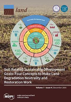
Determining Land Management Zones Using Pedo-Geomorphological Factors in Potential Degraded Regions to Achieve Land Degradation Neutrality

Peer-reviewed publication
Juin, 2019
Global

The proper delineation of site-specific management zones is very important in the agricultural land management of potentially degraded areas. There is a necessity for the development of prospective tools in management plans to correctly understand the land degradation processes. In order to accomplish this, we present a pedo-geomorphological approach using soil texture, land elevation and flow vector aspects to distinguish different management zones and to discretize soil micronutrients. To achieve this goal, we conducted the study in the Neyshabur plain, Northeast Iran.