Aller au contenu principal

page search

There are 200 content items of different types and languages related to changement dans l'usage des terrres on the Land Portal.
Displaying 1 - 12 of 12

Global and Local Modeling of Land Use Change in the Border Cities of Laredo, Texas, USA and Nuevo Laredo, Tamaulipas, Mexico: A Comparative Analysis

Peer-reviewed publication
Septembre, 2020
Mexique
États-Unis d'Amérique
Norvège
Espagne
Global

This paper estimates global logistic regression and logistic geographically weighted regression (GWR) models of urban growth in the adjacent border cities of Laredo, Texas in the United States and Nuevo Laredo, Tamaulipas in Mexico, for two time periods from 1985 to 2014. Historical land use and land cover patterns were monitored through Landsat imagery from the United States Geological Survey to identify instances of urban growth through land type change. Data on socioeconomic variables related to urban growth were collected from various sources and used as independent variables.

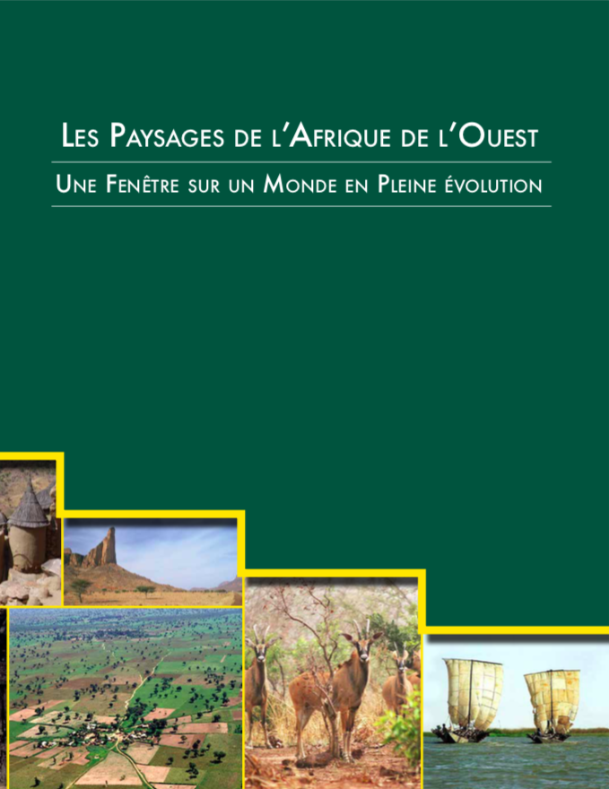
Les Paysages de l'Afrique de l'Ouest

Reports & Research
Novembre, 2016
Afrique occidentale

Les Paysages de l’Afrique de l’Ouest : Une Fenêtre sur un Monde en Pleine Évolution dresse un tableau fascinant des transformations de l’environnement naturel de l’Afrique de l’Ouest. Utilisant des images collectées par des satellites orbitant à des centaines de kilomètres au-dessus de la Terre, cet atlas décrit quatre décennies de rapides changements environnementaux.

Compliance with Planning Regulations in Hazardous Areas and its impacts. A Case of Msasani Bonde la Mpunga in Dar es Salaam City, Tanzania

Peer-reviewed publication
Août, 2018
Tanzania

 Most of the cities and urban centres of developing nations, Tanzania inclusive are faced with increased urbanization coupled with informal land development in non-designated areas including marginal and hazardous lands. This paper reports the findings of a study undertaken to assess the processes of land development and the associated impacts in Msasani Bonde la Mpunga, a, flood prone area in the City of Dar es Salaam.

Cartographie des changements de l’occupation du sol entre 2002 et 2016 à partir des images Landsat. Cas de la région Tanger Tetouan Al-Hoceima (Maroc).

Peer-reviewed publication
Avril, 2020
Maroc

La région Tanger-Tetouan-Al Hoceima située au nord-ouest du Maroc a connu, dans des dernières décennies, différents travaux d’aménagement de territoire qui ont eu, certainement, un impact sur le paysage et l’écosystème de la région. La région a accueilli des infrastructures de grandes tailles telles que le port Tanger Med installé au bord du détroit Gibraltar, la ligne de train à grande vitesse reliant Tanger à Casablanca, réseaux routiers, barrages…etc. L’objectif de cet article est de cartographier les changements du paysage de la région via l’analyse diachronique de l’occupation du sol.

Climate, Land Use Change and Local Adaptation Strategies in Ecological Areas. Case of Miwaleni River Valley

Peer-reviewed publication
Avril, 2019
Afrique

Climate change issues are contemporary global phenomena which affect the largest part of the world in different ways. This paper explores how local communities living in sensitive ecological areas, particularly in river valleys, respond to and adapt to climate change. By employing a qualitative research approach, findings have indicated that heavy rainfall and prolonged droughts coupled with population increase have led to land use changes and loss of biodiversity in the river valley.

Fine-grained detection of land use and water table changes on organic soils over the period 1992⿿2012 using multiple data sources in the Drömling nature park, Germany

Peer-reviewed publication
Novembre, 2016
Allemagne
Japon
Norvège

The construction of consistent time series of land use presents a key challenge when accounting for elective land use-based activities under the Kyoto Protocol (wetland drainage and rewetting (WDR), cropland management (CM) and grazing land management (GM)), in which current land use-driven greenhouse gas emissions are compared to a reference situation in 1990. This case study is the first to demonstrate the feasibility of using high-resolution land-use proxies from different datasets for Kyoto accounting in a data-rich case study region in Germany.

Exploring the socioeconomic and ecological consequences of cash crop cultivation for policy implications

Peer-reviewed publication
Juin, 2018
Chine
Fédération de Russie
États-Unis d'Amérique

Cash crops have kept expanding at an accelerating rate across the globe during the last decades. It therefore requires elaborate efforts to examine the socioeconomic and ecological consequences of cash crop cultivation. With a case of the Hangzhou region in subtropical China, this paper investigated the dynamic patterns of four cash crop types (tea, fruit, mulberry and nursery) at town level by using aerial photos; and then quantified the subsequent socioeconomic and ecological consequences using spatial regression.

Property-level direct and indirect deforestation for soybean production in the Amazon region of Mato Grosso, Brazil

Peer-reviewed publication
Octobre, 2018
Brésil
États-Unis d'Amérique

Brazil’s Soy Moratorium solidified the world’s largest traders’ commitment to stop soybean purchases from production areas deforested after July 2006. The aim was to remove deforestation from the soybean supply-chain and halt one of the main drivers of forest loss in the Amazon biome. In this study, we investigated changes in deforestation at the property-level for the period 2004 to 2014.

Small-scale land acquisitions, large-scale implications: Exploring the case of Chinese banana investments in Northern Laos

Peer-reviewed publication
Novembre, 2016
Laos

The scholarly debate around ‘global land grabbing’ is advancing theoretically, methodologically and empirically. This study contributes to these ongoing efforts by investigating a set of ‘small-scale land acquisitions’ in the context of a recent boom in banana plantation investments in Luang Namtha Province, Laos. In relation to the actors, scales and processes involved, the banana acquisitions differ from the state-granted large-scale land acquisitions dominating the literature on ‘land grabbing’ in Laos.

Land use optimization tool for sustainable intensification of high-latitude agricultural systems

Peer-reviewed publication
Octobre, 2019
Finlande
Norvège

Recent studies assessing agricultural policies, including the EU’s Agri-Environment Scheme, have shown that these have been successful in attaining some environmental goals. In Finland, however, the economic situation of farms has dramatically fallen and hence, the actions do not result in social acceptability. Sustainable intensification is a means to combine the three dimensions of sustainability: environmental, economic and social. Here we introduce a novel land use optimization and planning tool for the sustainable intensification of high-latitude agricultural systems.

Learning through practice? Learning from the REDD+ demonstration project, Kalimantan Forests and Climate Partnership (KFCP) in Indonesia

Peer-reviewed publication
Janvier, 2020
Indonésie

Despite a growing recognition of the importance of social learning in governing and managing land use, the understanding and practice of learning has received limited attention from researchers. In global environmental programs and projects aimed at supporting sustainable land use in developing countries, learning is often promoted but without explicit learning goals. The focus may be on capacity building and community participation, and on testing policy tools, rather than on collaborative social learning.

Complementary land use in the Richmond River catchment: Evaluating economic and environmental benefits

Peer-reviewed publication
Août, 2019
Australie

Agricultural land uses can contribute to land degradation, water quality decline, and loss of ecosystem function and biodiversity in the surrounding catchment. Trees can assist in catchment management, and re-afforestation strategies have been implemented in an effort to mitigate agricultural impacts and improve degraded land and waterways worldwide. Re-afforestation strategies often target private land, and their success relies on landholder participation.