Aller au contenu principal

page search

Displaying 685 - 696 of 8601

An Experimental Framework for Integrating Citizen and Community Science into Land Cover, Land Use, and Land Change Detection Processes in a National Mapping Agency

Peer-reviewed publication
Septembre, 2018
France

Accurate and up-to-date information on land use and land cover (LULC) is needed to develop policies on reducing soil sealing through increased urbanization as well as to meet climate targets. More detailed information about building function is also required but is currently lacking.

Analyses of Land Cover Change Trajectories Leading to Tropical Forest Loss: Illustrated for the West Kutai and Mahakam Ulu Districts, East Kalimantan, Indonesia

Peer-reviewed publication
Septembre, 2018
Indonésie

In Indonesia, land cover change for agriculture and mining is threatening tropical forests, biodiversity and ecosystem services. However, land cover change is highly dynamic and complex and varies over time and space. In this study, we combined Landsat-based land cover (change) mapping, pixel-to-pixel cross tabulations and expert knowledge to analyze land cover change and forest loss in the West Kutai and Mahakam Ulu districts in East Kalimantan from 1990–2009.

Modelling Farm Growth and Its Impact on Agricultural Land Use: A Country Scale Application of an Agent-Based Model

Peer-reviewed publication
Septembre, 2018
Belgique

The ongoing economic pressure on farmers has resulted in lower gross margins, lower income, and a continuous decrease in the number of farmers in large parts of the world. Most remaining farmers upscale their activities by taking over the land of their former competitors, resulting in a decrease in agricultural employment and an increase in average farm size, accompanied by specialisation and new management techniques.

Analyses of Land Cover Change Trajectories Leading to Tropical Forest Loss: Illustrated for the West Kutai and Mahakam Ulu Districts, East Kalimantan, Indonesia

Journal Articles & Books
Septembre, 2018
Indonesia

In Indonesia, land cover change for agriculture and mining is threatening tropical forests, biodiversity and ecosystem services. However, land cover change is highly dynamic and complex and varies over time and space. In this study, we combined Landsat-based land cover (change) mapping, pixel-to-pixel cross tabulations and expert knowledge to analyze land cover change and forest loss in the West Kutai and Mahakam Ulu districts in East Kalimantan from 1990-2009.

Study on improving the formal registration of land transactions

Reports & Research
Septembre, 2018
Ethiopia

This study examines the reasons why landholders choose to formally or informally transact land use rights and provides recommendations on how to increase the number of households formally registering transactions..This resource was published in the frame of the Land Investment for Transformation (LIFT) Programme. For more information;please check: https://landportal.org/community/projects/land-investment-transformation...

Climate-Smart Agriculture in Zimbabwe

Policy Papers & Briefs
Septembre, 2018
Zimbabwe
Africa

The climate-smart agriculture (CSA) concept reflects an ambition
to improve the integration of agriculture development and climate
responsiveness. It aims to achieve food security and broader
development goals under a changing climate and increasing food
demand. CSA initiatives sustainably increase productivity, enhance
resilience, and reduce/remove greenhouse gases (GHGs), and
require planning to address trade-offs and synergies between
these three pillars: productivity, adaptation, and mitigation [1].

Climate-Smart Agriculture in Lesotho

Policy Papers & Briefs
Septembre, 2018
Lesotho
Africa

The climate-smart agriculture (CSA) concept reflects an ambition
to improve the integration of agricultural development and climate
responsiveness. It aims to achieve food security and broader
development goals under a changing climate and increasing food
demand. CSA initiatives sustainably increase productivity, enhance
resilience, and reduce/remove greenhouse gases (GHGs); and
require planning to address trade-offs and synergies between
these three pillars: productivity, adaptation, and mitigation [1].

Mapping the intangible: Using geolocated social media data to examine landscape aesthetics

Peer-reviewed publication
Septembre, 2018
Espagne
Venezuela

The ecosystem services concept is increasingly gaining momentum in land-use policies and landscape planning. Yet, cultural ecosystem services often lack proper assessments. With this study, we use novel methodological approaches to map the cultural ecosystem service landscape aesthetics for its enhanced consideration in land-use policies. Our study uses expert-based participatory mapping and crowd-sourced (social media) photo data to examine the spatial distribution of landscape aesthetics in the Province of Barcelona, Catalonia.

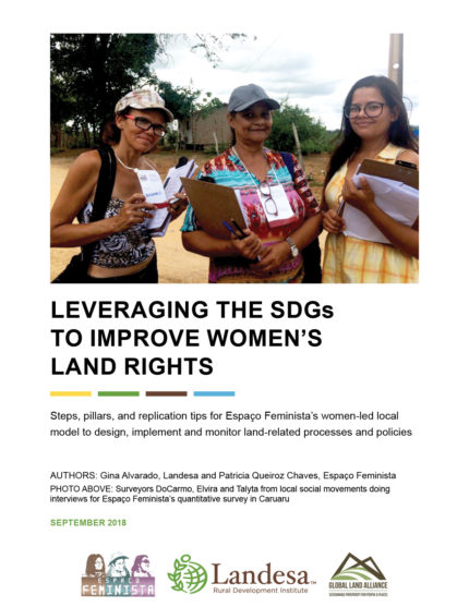
LEVERAGING THE SDGS TO IMPROVE WOMEN’S LAND RIGHTS: MODEL VALIDATION

Reports & Research
Août, 2018
Amériques
Brésil
Global

Steps, pillars, and replication tips for Espaço Feminista’s women-led local model to design, implement and monitor land-related processes and policies.

The Sustainable Development Goals have created an extraordinary window of opportunity to increase the attention to women’s rights and women’s land rights in particular.