Aller au contenu principal

page search

Displaying 13 - 24 of 59

Proclaiming Colonial Urban Heritage: Towards an Inclusive Heritage-interpretation for Colombo’s Past

Journal Articles & Books
Décembre, 2021
Global

Colombo Sri Lankas commercial capital is a forceful creation of European colonialists who occupied the island for over four centuries Its urban structure displays the social fragmentation sought by the rulers Colombo elaborates an extraordinary process of citymaking stratified with its Dutchorigin Britishreshaping and postcolonial adaptation Proclaiming such a contested past as an inheritance requires an inclusive heritage interpretation The recent renovation of monumental buildings for potential market values and demolishing minor architecture do not display such a heritage interpretation

Updating Land Information Systems Created Using Unconventional Approaches

Décembre, 2021
Portugal

Many are the suggestions on how to develop a new land information system or evaluate how successful is the existing system. However, guidance about how the created system can be kept up to date is shallowly mentioned in the literature while it is the key feature for its sustainability.This paper is part of an extensive research done regarding the updating of land information systems that were created using unconventional approaches during systematic land registration. For these systems, huge database are created in a short period during the initial registration.

Map Conflation Using Piecewise Linear Rubber-Sheeting Transformation Between Layout And As-Built Plans In Kumasi Metropolis.

Décembre, 2021
Global

Context and backgroundAccurately integrating different geospatial data sets remain a challenging task because diverse geospatial data may have different accuracy levels and formats. Surveyors may typically create several arbitrary coordinate systems at local scales, which could lead to a variety of coordinate datasets causing such data to remain unconsolidated and in-homogeneous.Methodology:In this study, a piecewise rubber-sheeting conflation or geometric correction approach is used to accomplish transformations between such a pair of data for accurate data integration.

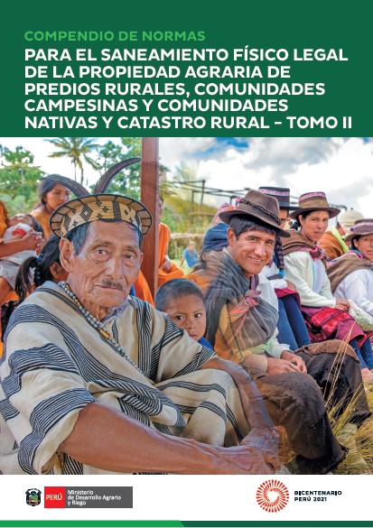
Compendio de Normas para el saneamiento físico legal de la propiedad agraria de los predios rurales, comunidades campesinas y comunidades nativas y catastro rural

Policy Papers & Briefs
Septembre, 2021
South America
Peru

Complementando el Compendio de Normas publicado en 2018, el Tomo II actualiza  las normas relevantes en el marco del sanamiento físico legal de la propiedad agraria de los predios rurales, comunidades campesinas y comunidades nativas y catastro rural.


Para más información sobre el proyecto: Land Titles for Indigenous Communities in Peru | Land Portal.

Lifting a Curse

Août, 2021

Companies in the business of selling farmland to billionaires and pension funds are peddling it as a green;sustainable and socially responsible investment. This propaganda is working. The digital land records and massive quantities of data that big tech companies like Microsoft and Amazon are vacuuming up from farmersfields make it easier for the companies to scour the planet for profitable farmland deals. They can also use satellite technologies and drones to monitor their farms from a distance. But the world’s farmland is finite.

Land Inequality Is a Crisis. Achieving Women’s Land Rights Is How We Respond

Juin, 2021

On 27 April 2021 President Kenyatta launched the National Land Information Management System (NLIMS);the culmination of years of digitisation of chaotic land records. It is expected to ease title transfers and safeguard public land from grabbers. It coincided with the opening of a National Geospatial Data Centre;an online depository that will contain all the land records in the country.

Land tenure systems in the Borgou, Benin

Reports & Research
Mars, 2021
Africa
Western Africa
Benin

Benin introduced new instruments to register customary land rights in the 2013 Land and Domain Law, which was updated in 2017. The BMZ supported “Promotion d’une Politique Foncière Responsable (ProPFR)” project is testing these instruments together with scalable implementation modalities in the Borgou department (Benin). This work is complemented with a rigorous impact evaluation to assess changes in tenure security, agricultural investments and food security. The baseline survey was completed in 2018 and includes 2,968 households in 53 villages in the Borgou.

Land Matters II

Reports & Research
Mars, 2021
Africa
Eastern Africa
Uganda

Improvement of Land Governance in Uganda (ILGU) is a project implemented by the German International Cooperation (GIZ), seeking to increase productivity of small-scale farmers on private Mailo land in Central Uganda, co-financed by the European Union and German Government through the German Federal Ministry for
Economic Cooperation and Development (BMZ).

The role of open data in fighting land corruption

Institutional & promotional materials
Janvier, 2021
Global

This is the presentation of Dr.  Marcello De Maria, Postdoctoral Researcher at the School of Agriculture Policy and Development at the University of Reading during the webinar on the Role of Open Data in the Fight against Land Corruption on January 28th, 2021. 

The analysis revealed overwhelming support for the use of open data as an anticorruption tool in the land sector, but it also found strong evidence for the existence of a high degree of untapped potential.

Spatial aspect of fit-for-purpose land administration for emerging land administration systems: a conceptual framework for evaluation approach

Journal Articles & Books
Peer-reviewed publication
Janvier, 2021
Africa
Americas
Asia
Europe
Oceania
Antarctica

Fit-for-purpose land administration (FFPLA) concept is widely applied in the emerging land administration systems (LASs). This paper aims to contribute to the development of evaluation of the spatial aspect of FFPLA. A review of evaluation models for LASs is made in relation with rationale of FFPLA to identify gaps related to evaluation of a FFPLA and to build up milestones and measurement criteria.

Good Practices in Updating Land Information Systems that Used Unconventional Approaches in Systematic Land Registration

Peer-reviewed publication
Décembre, 2020
Global

To properly govern people-to-land relationships, there is a need to formally recognize land rights, and for this to bring recognizable societal change, the established Land Information System (LIS) has to be updated continuously. Though existing literature suggests different parameters to consider when updating an LIS, little is said on how countries are doing this, especially when unconventional approaches through systematic land registration were initially used. This paper comes up with recommendable good practices where the suggested needs for updating land records were made workable.