administração cadastral related News | Land Portal
Existem 363 itens de conteúdo relacionados a administração cadastral no Land Portal.
Exibindo 1 - 6 de 6
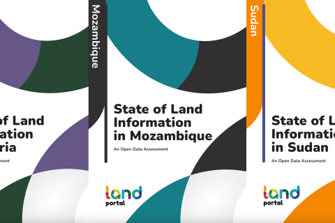
State of Land Information in Liberia, Mozambique, & Sudan
23 Janeiro 2024
Sudão
Moçambique
Libéria

Temos o orgulho de anunciar o lançamento de três relatórios sobre o Estado das Informações Fundiárias, que detalham a situação das informações sobre terras em Moçambique, Libéria e Sudão. Esses relatórios detalhados fornecem uma análise aprofundada dos atuais sistemas de informações sobre terras, estruturas legais e acessibilidade de dados nesses países.

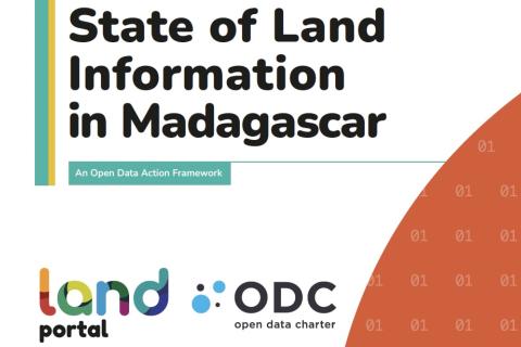
State of Land Information in Madagascar
20 Setembro 2023
Madagáscar

A Fundação Land Portal e a Open Data Charter lançaram o relatório Estado da Informação Fundiária em Madagascar: Uma estrutura de ação de dados abertos para Madagascar, esclarecendo o estado do ecossistema de dados de terras no país. O relatório serve como uma ferramenta de diagnóstico e guia abrangente, com o objetivo de catalisar mudanças e promover conversas sobre transparência de dados e governança de terras em Madagascar.

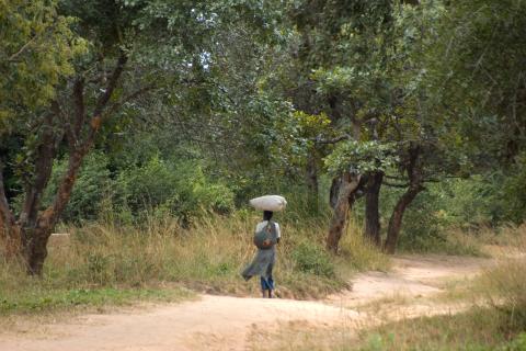
Scenes from Chewe village
4 Julho 2023
Zâmbia
Botswana

Dois relatórios abrangentes sobre o Estado das Informações sobre Terras (SOLI) foram publicados, fornecendo avaliações detalhadas dos ecossistemas de dados e informações sobre terras em Botsuana e Zâmbia. Esses relatórios examinam a disponibilidade de informações sobre terras e avaliam sua adequação aos padrões de dados abertos. As descobertas destacam os pontos fortes e fracos das práticas de gerenciamento de informações sobre terras de cada país e oferecem percepções para intervenções direcionadas.

Land Portal Annual Report 2022
5 Abril 2023
Global

A Fundação Portal da Terra relatou outro ano de sucesso em 2022, fazendo progressos significativos em direção a sua estratégia organizacional e estrutura de monitoramento e avaliação. De acordo com sua pesquisa anual, 87% dos(as) usuários(as) relataram um impacto positivo em seu trabalho, enquanto o site continuou recebendo um alto volume de visitas, com uma média de 74.000 acessos por mês.

27 Julho 2021
África
Sudão
Etiópia
Madagáscar
Moçambique
Ruanda
Somália
Zâmbia
Chade
Namíbia
Burkina Faso
Gâmbia
Gana
Libéria
Mali
América Latina e Caribe
Global
A Land Portal Foundation e a Open Data Charter pretendem implementar o Guia Aberto de Governança Fundiária no período 2021 - 2024. Como parte deste projeto, procuramos desenvolver relatórios de Informação sobre o Estado da Terra (SOLI - sigla em ingles) para 10-12 países da África e da América Latina.
Ilustração: Otávio Nogueira/cc
Brasil

Fonte: Le Monde Diplomatique Brasil

Ilustração: Otávio Nogueira/cc

04 de Abril de 2016

Por: Guilherme C. Delgado


O movimento do mercado de terras


Blogues

Organizações

For the purposes of performing the works for establishment and maintenance of the real estate cadastre, the management of the geodetic-cadastre information system, as well as for establishment, maintenance and public access to the National Spatial Data Infrastructure is established the Agency for Real Estate Cadastre. The Agency for Real Estate Cadastre acts in the capacity of a legal person with its rights, liabilities and responsibilities as stipulated by the Law on Real Estate Cadastre and for its operation reports to the Government of R. Macedonia.

MOTTO

The Dedan Kimathi University of Technology motto is: “Better Life through Technology”.


VISION STATEMENT

To be a Premier Technological University Excelling in Quality Education, Research, and Technology Transfer for National Development.


MISSION STATEMENT

Geo-Informatie Nederland logo

GIN is an interactive meeting place and is an open knowledge network for everyone who is professionally involved with geographic information. GIN organizes activities and encourages and facilitates sharing and transferring knowledge of its members in development of all members and to strengthen the position of the field of geo-information in society.


The subsequent strategic goals are:


Innovations for Successful Societies

ISS chronicles government innovation, especially in low- and middle-income countries. Often the most creative and successful ideas are generated internally, framed by people who have deep knowledge of local conditions. ISS enables practitioners to tell their unique stories and join a knowledge network of reform-minded public servants from around the globe. ISS case studies distill these conversations into a tool for learning, for cross-cutting analysis, and for scholarship.

Mission


To facilitate efficient land administration and management, acess to adequate and affordable housing, social and physical infrastructure for national development


Vision


To be a globally competitive organization in sustainable management of Land and built environment

OUR VISION


Excellent administration and management of land for sustainable development


OUR MISSION


To implement an efficient land administration and management system in order to ensure equity in access to land


CORE VALUES


  • Efficiency
  • Transparency and Accountability
Norwegian Mapping Authority logo

The Norwegian Mapping Authority (NMA) is Norway's national mapping agency, dealing with land surveying, geodesy, hydrographic surveying, cadastre and cartography. Its headquarters are in Hønefoss and it is a public agency under the Ministry of Local Government and Modernisation. NMA was founded in 1773.


Source: Wikipedia (consulted d.d. February 18th, 2020)

Palestine Land Authority logo

The PLA established by presidential Decree No.10 of 2002 as a legal entity with its own budget , subordinate to the Council of Ministers , with the responsibility for both the Survey and Registration Departments.


Mandate:


  • Surveying department responsible for examining maps and plans prepared in connection with land adjudication process, partition, subdivision, first registration and other transaction;

Compartilhe esta página