Passar para o conteúdo principal

page search

Displaying 25 - 36 of 115

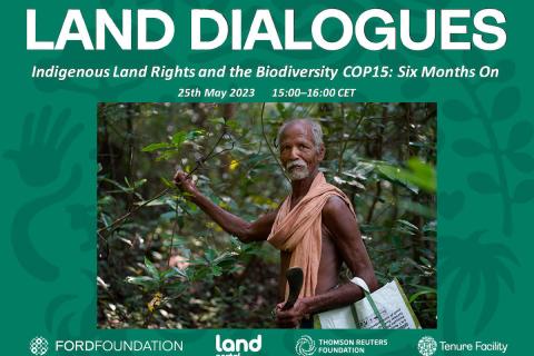
Direitos dos povos indígenas à terra e a COP15 da biodiversidade: seis meses depois

24 Maio 2023

Após duas semanas de negociações tensas, a recente Conferência das Nações Unidas sobre Biodiversidade COP15 terminou com um acordo histórico para orientar a ação global sobre a natureza até 2030. A Estrutura Global de Biodiversidade de Kunming-Montreal (GBF - sigla em inglês) inclui medidas concretas para interromper e reverter a perda da natureza, incluindo a proteção de 30% do planeta e 30% dos ecossistemas degradados até 2030.

Land Portal Foundation
Ford Foundation
Thomson Reuters Foundation
The Tenure Facility

Fundamentals of Machine Learning for Earth Science

19 Abril 2023 - 03 Maio 2023

NASA’s Applied Remote Sensing Training Program (ARSET) has opened a new online introductory webinar series: Fundamentals of Machine Learning for Earth Science. This three-part training, presented in English and Spanish, is open to the public and will provide attendees an overview of machine learning in regards to Earth Science, and how to apply these algorithms and techniques to remote sensing data in a meaningful way. Attendees will also be provided with end-to-end case study examples for generating a simple random forest model for land cover classification from optical remote sensing. We will also present additional case studies to apply the presented workflows using additional NASA data.


O refúgio em disputa: reflexões sobre a proteção internacional e o Novo Pacto sobre Migração e Asilo na UE

19 Março 2023
Portugal

O objetivo desta apresentação é partilhar a análise da erosão da proteção internacional e da figura do refugiado, aprofundando-se nas práticas de controlo da mobilidade e de externalização da responsabilidade de proteger que se vão paulatinamente consolidando na União Europeia (UE).

Crop Mapping using Synthetic Aperture Radar (SAR) and Optical Remote Sensing

03 Abril 2023 - 12 Abril 2023

NASA’s Applied Remote Sensing Training Program (ARSET) has opened a new online advanced webinar series: Crop Mapping using Synthetic Aperture Radar (SAR) and Optical Remote Sensing. This three-part training, presented in English and Spanish, is open to the public and builds on previous ARSET agricultural trainings. Here we present more advanced radar remote sensing techniques using polarimetry and a canopy structure dynamic model to monitor crop growth. The training will also cover methods that use machine learning methods to classify crop type using a time series of Sentinel-1 & Sentinel-2 imagery. This series will include practical exercises using the Sentinel Application Platform (SNAP) and Python code written in Python Jupyter Notebooks, a web-based interactive development environment for scientific computing and machine learning.

Capital versus Vida. Dimensões do debate agroecológico na América Latina

12 Dezembro 2022
Coimbra
Portugal

De acordo com o Relatório da Desigualdade no Mundo 2022 (Chancel, Piketty, Saez, Zucman, et al: 11), elaborado pela equipa interdisciplinar de cientistas que compõem o World Inequality Lab (Laboratório de Pesquisa associado às Escola de Economia de Paris, França, e Universidade de Berkeley, Califórnia, Estados Unidos) a desigualdade é uma escolha política. A nossa política económica global está a levar-nos à fome e à destruição, afirma o Relatório (Ibid.: 95).

LDC 2022 : Les pressions mondiales sur les terres locales : Perspectives du Sud

07 Dezembro 2022 - 09 Dezembro 2022

Le thème de la sixième édition de l'ILDC en 2022 est "Global Pulls on Local Lands : Southern Perspectives". L'objectif est de poursuivre et d'élargir la portée des échanges Sud-Sud autour des conversations et des coopérations sur les terres, qui ont débuté lors du dernier épisode, tandis que l'accent des délibérations continuera d'être mis sur l'Inde.

NRMC

Copernicus Land User Event

17 Novembro 2022 - 18 Novembro 2022
Bedford Hotel & Congress Centre
Rue du Midi 135,1000 Bruxelles
Belgium

Copernicus Land User Event - Register now!

European and global land surface applications

Copernicus Land Monitoring Service