
Questions mount over the Xayaburi Dam’s changes to water and sediment flows as the river swallows farmers’ land.
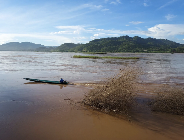
Main photo: A fisherman drives his boat past dead trees that slid into the Mekong River during a riverbank collapse in August in Ban Huai Kho village in Thailand’s northeastern province of Nong Khai. PHOTO: Paritta Wangkiat
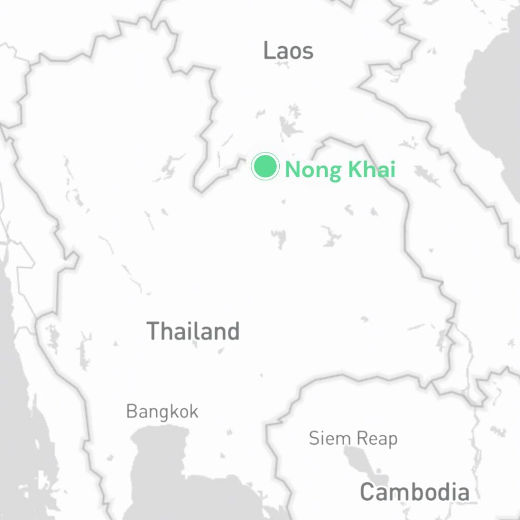
NONG KHAI, THAILAND ― Thai communities living along the Mekong River have watched their land disappear before their eyes as riverbanks collapse. However, what has caused these riverbank collapses is unclear.
Local residents link the riverbank collapses to the irregular water flows that have been seen since the commercial launch of a huge dam on the Mekong in Laos.
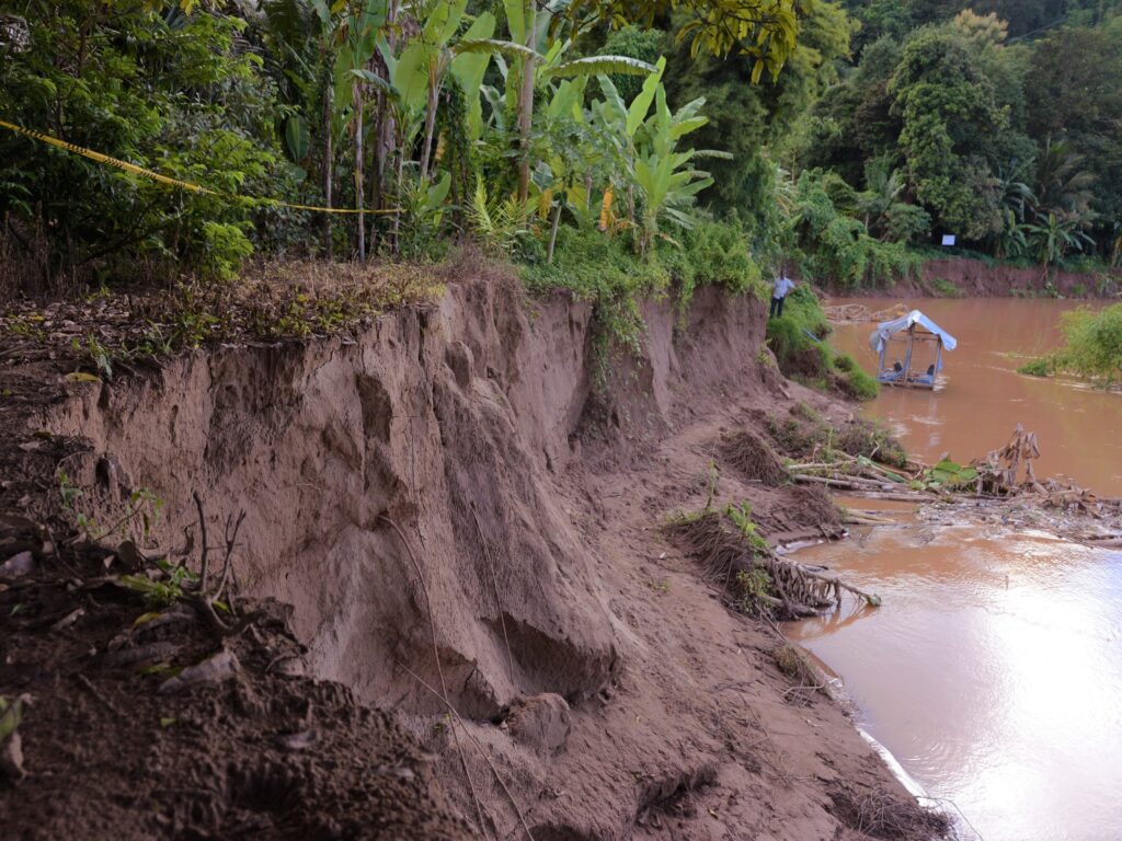
A “DO NOT ENTER” sign has been erected on the bank of the Mekong River in Ban Huai Kho village in Sangkhom district, which is part of Thailand’s northeastern province of Nong Khai.
Behind the sign was a steep cliff, a remnant of the 0.8-hectare fertile land once owned by Sukim Khamkhong and her family. The land was swallowed by the mighty Mekong last August.
“We used this land for farming,” she said, pointing to the land that now only appears on her printed land title.
“We planted vegetables and bananas there and cut the leaves for sale. We have lost income since the land has gone. Part of this income was spent on my grandchild’s school fees.”
The land plots next to hers and beyond also slid into the water. Not far from Sukim’s community, the riverbank at Ban Phu Khao Thong village eroded inland from 20 to 30 meters within a few days in the last rainy season.
Incidents of riverbank collapses have happened for years, gradually eating away at the fortunes of the farming communities living along the Mekong River. Last year was the worst on record for villagers in Nong Khai as excessive rainfall and high tides increased soil saturation, resulting in more erosion along the river’s bank.

A study by the network of Thai communities living along the Mekong River, the Foundation for Ecological Recovery and the Nature Care Foundation, pinpointed multiple factors of riverbank erosion in Thailand’s northeastern provinces, a problem that has become severe in recent years.
The factors include heavy rainfall and irregular water flows caused by the upstream dams. These factors together with the trapping of sediments in the dams, as well as illegal sand dredging, reduces the volume of sediment carried to the downstream countries and causes the scouring of the riverbed that leads to an increased erosion rate.
The same study estimated the economic loss of riverbank collapses in three of Thailand’s northeastern provinces – Nong Khai, Nakhon Phanom and Mukdahan – was the equivalent to 25 million baht in total ($US748,000). This value was estimated from the property loss to erosion, covering 14 hectares in 2011 and 2013.
There is no systematic study about the social and economic impact of the riverbank collapses last year. But in the eyes of the villagers there, erosion will worsen if no action is taken by the national and regional authorities.
Changes are plain for all to see
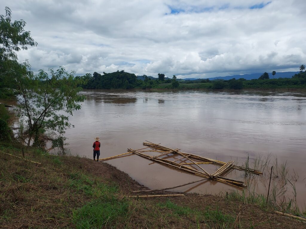
The erosion has changed the nature of the Mekong riverbank. Its slope originally descended gradually to the river, providing people with access to water and fertile farmland.
Fishermen could dock their boats in shallow water. Farmers could farm on the riverbank and earn an income. Local people used the riverbank for leisure and organizing cultural festivals that maintained a tie between humans and the river.
But these relationships were broken when the riverbank was turned into steep cliffs by erosion, reducing the space for local communities to interact with the water.
“The riverbank was very wide in the past,” said On-anong Wongjak, a villager from Ban Huai Kho. “All the important activities of our communities – from farming and fishing to family gatherings – were done on the riverbank. They have all gradually gone year by year.”
A 2021 report on the transboundary impacts of the Mekong mainstream hydropower dams, released by the Office of National Water Resources (ONWS), showed that riverbank collapses were reported in all of Thailand’s 28 districts bordering the Mekong River. Each incident led to land losses ranging from 0.3 to 1,234 hectares.
The erosion was most widespread in the third quarter of 2020, nearly one year after Laos started the commercial operation of the Xayaburi Dam in the mainstream Mekong river. The total erosion area was more than 3,600 hectares in all districts combined.
“For the first time in my life I have witnessed the worst damage by riverbank collapses in my community,” said Kankong Chanlong, the Chairman of the Mekong Conservation Group at Ban Huai Kho in Nong Khai, referring to last year when excessive riverbank erosion happened in his community.
A lifelong fisherman, Kankong is familiar with the nature and the pattern of the water fluctuations in the Mekong River. He knows that the water level gradually rises and falls according to the season – it rises in the wet season and falls in the dry season.
But this pattern has changed since the launch of the Xayaburi dam in Laos, about 400 kilometers north of his village. He has noticed that the water level rises and falls rapidly in a few days, or even a day, regardless of the seasons.
The riverbank collapse in his community last year happened one day after a swift change in the water level – the current became turbulent and heavily eroded the riverbank.
Kankong believes the erosion problem has happened under the radar of policymakers, despite its heavy consequences and costs.
“We have lived along the Mekong riverbank for our whole life. We can see the changes after the operation of dams upstream,” he said. “I’m afraid the erosion will worsen if more dams are built on the Mekong River.”
Finding the root cause
Building embankments is a primary solution by Thai authorities in tackling erosion along the banks of the Mekong River, even though it changes the complex ecology of the riverbank that provides fish habitats and nutrient soils for farming.
More than 400-meter lengths of embankments were or have been built in Nong Khai alone from the fiscal year 2020 to 2023, costing about 43 million baht ($1.3 million), according to a document from Thailand’s Office of Official Information Commission.
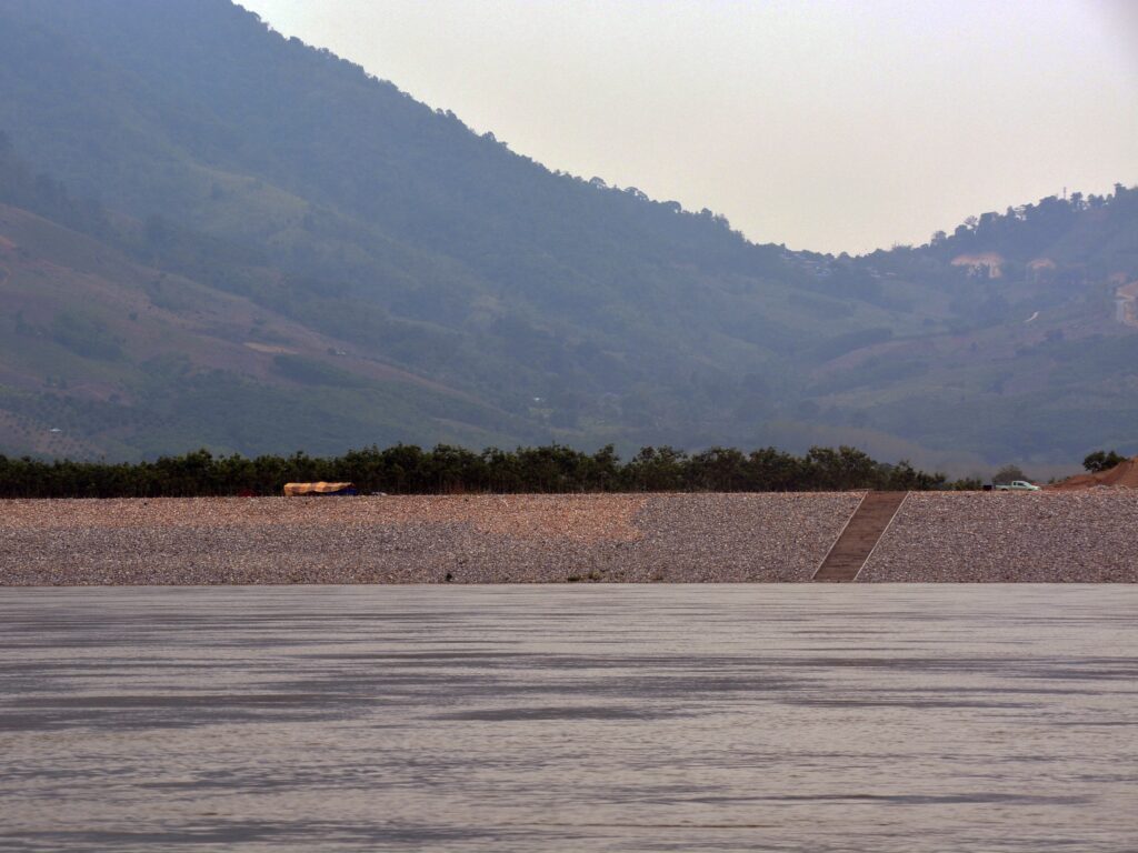
After a series of severe riverbank collapses were reported last year, the Nong Khai governor and local authorities visited the sites to survey the damage and came up with plans to build more embankments.
Similarly, authorities in other provinces bordering the Mekong River have been seeking budgets from the central government to build new embankments. But due to limited budgets, embankments cannot be built in all areas exposed to or already affected by erosion.
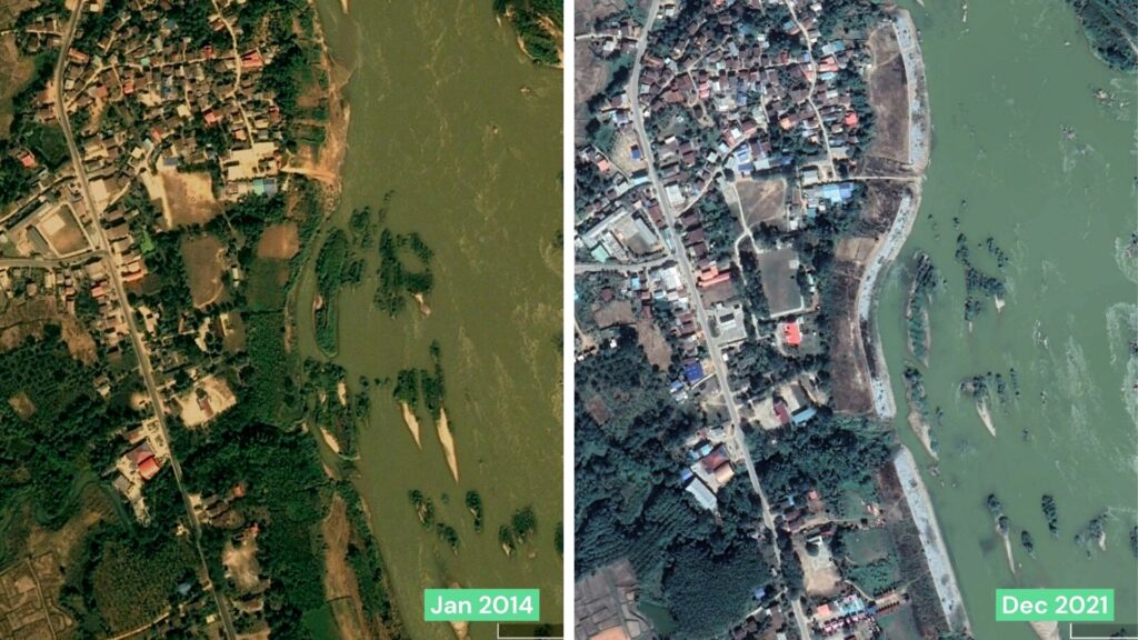
“I haven’t seen authorities initiate any erosion prevention in my community,” said On-anong from Ban Huai Kho village, who lost land and a house to the Mekong River a few years ago. She lives in fear of losing more land in the near future.
Some villagers want Thai authorities to take action beyond building embankments. They want to know the root cause of the riverbank collapses and find ways to stop it.
Saman Kaewphuang, the Chairman of Nong Khai’s Ban Muang Subdistrict Community Organization Council, wants authorities to study the transboundary impacts of Mekong mainstream dams on riverbank erosion.
He names the dams as the prime suspects. Riverbank collapses in his and neighboring communities have become more frequent since the commission of the Xayaburi dam in Laos.
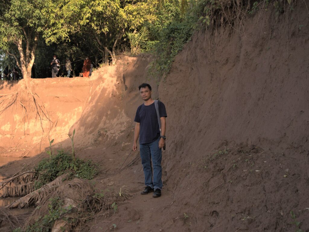
Released in 2018, the Mekong River Commission’s technical study points out that hydropower dams are among the developments that affect substantial changes in sediment – which may affect the stability of riverbanks, from the villagers’ point of view. The other factors include irrigation, agriculture and land-use changes.
“Government officials always avoid talking about dams when we link them to erosion problems. I don’t know why. Perhaps talking about dams will affect diplomatic relations [between Thailand and Laos,]” he said.
“They can’t be silent about this. We’ve seen our land disappear before our eyes. Erosion is really an urgent matter for people living along the Mekong River.”
This story was supported by the Internews’ Earth Journalism Network under the grant for reporting on water governance from gender and social inclusion lens. It was first published in Sarakadee Magazine.
About the writer Thitipan Pattanamongkol
Thitipan Pattanamongkol is a Thai environmental journalist and a former president of Thai Society of Environmental Journalists. More by Thitipan Pattanamongkol
Source
Language of the news reported
Related content:
Copyright © da fonte (mencionado acima). Todos os direitos reservados. O Land Portal distribui materiais sem a permissão do proprietário dos direitos autorais com base na doutrina de “uso justo” dos direitos autorais, o que significa que publicamos artigos de notícias para fins informativos e não comerciais. Se você é o proprietário do artigo ou relatório e gostaria que ele fosse removido, entre em contato conosco pelo endereço hello@landportal.info e removeremos a publicação imediatamente.
Várias notícias relacionadas à governança da terra são publicadas no Land Portal todos os dias pelos nossos usuários, partindo de várias fontes, como organizações de notícias e outras instituições e indivíduos, representando uma diversidade de posições sobre cada tópico. Os direitos autorais estão na origem do artigo; a fundação não tem o direito legal de editar ou corrigir o artigo, nem endossar o seu conteúdo. Para fazer correções ou solicitar permissão para republicar ou outro uso autorizado deste material, entre em contato com o detentor dos direitos autorais.
